History
Like other later Roman settlements on the southwest coast of Sardinia, Nora owes its urban foundations to the establishment of a Phoenician colony at the site; though there was native Sardinian habitation at the site previously. Pausanias also describes a mythological foundation of the city; an Iberian named Norax crossed to Sardinia, conquered the area, and founded the first city on the island; Nora. This story is echoed by Solinus in the 3rd century CE. The Nora Stone (found at Nora and displayed in the archaeological museum in Cagliari) is currently the earliest Punic inscription found on Sardinia, and places the Phoenician conquest of the area to the late 9th century or early 8th century BCE, about the same time as the founding of Carthage. There is some debate over whether part of the inscription refers to a Cypriot-Phoenician god or a Tyrian king, which may differentiate between the expedition originating from a Phoenician city on Cyprus, or from the city of Tyre.
Nora’s position on a promontory allowed the coming and going of ships no matter which direction the wind was blowing, making it an important part of the Phoenician trade network in the area. At about the time Nora comes under the more direct control of Carthage, the fortifications of Nora were rebuilt, indicating the entrance into Carthaginian hegemony might not have been an entirely peaceful process. By the 5th century BCE, Nora had become a critical link in the trade route between Carthage and Caralis.
After the Roman takeover of the island in 238 BCE, Nora may have originally been the administrative center of the island for some time, only later being replaced by Caralis in the early Empire. Even after Nora waned in importance, the city was still relatively prosperous and probably gained municipium in the latter 1st century BCE. It seems to have undergone monumental building improvements through the 2nd century CE, and perhaps as early as the beginning of the 1st century CE. The Vandal invasions starting in the early 5th century CE lead to a decline of the city and by the end of the 7th century CE, it had been largely abandoned.
Getting there: Unlike many of the archaeological areas on Sardinia that aren’t in major urban areas, getting to Nora is actually relatively feasible with public transport. Two ARST buses run from the bus station in Cagliari (at Piazza Matteotti, across from the main train station) to Pula, the town nearest the archaeological site. These buses are bus 129 and 130, the schedules for which can be found at the respective links. That journey takes about 50 minutes. From the Pula town hall, there is a shuttle bus that runs from the town hall to the archaeological area, taking about 10 minutes; the schedule can be found here. Of course, a personal vehicle is also a great option, and there is ample parking in the vicinity of Nora (though the closer parking lots fill up early in the morning during the summer). Some of the closer lots are technically pay lots, but the machine was covered when I visited; be prepared to potentially pay.
In the center of Pula, near where one catches the shuttle to the archaeological site, there is the Civico Museo Archeologico ‘Giovanni Patroni’ at Corso Vittorio Emanuele 67. Unfortunately, the archaeological museum was closed when I visited, and had been for a number of years prior. It is still closed at the time of writing, and when I inquired with the tourist office, there didn’t seem to be any estimate of when it would open. Unfortunately, many sites don’t seem to note that the museum is and has been closed for several years; even reviews on Trip Advisor seem to indicate the museum is still open. In any case, they did appear to actually be actively working on the restoration of the museum when I walked by, so hopefully it will reopen in the near future.
Archaeological Site
The Area Archeologica di Nora is open every day, year round. In the summer (the end of March through the end of September) the site is open from 9:00 to 20:00. From October 1st through the last Saturday in October, it is open from 10:00 to 18:30. Between the last Sunday in October and February 15, the hours are 10:00 to 17:30. Finally, from February 16th through the last Saturday in March, Nora is open between 10:00 and 18:00. Admission is 6 Euros.
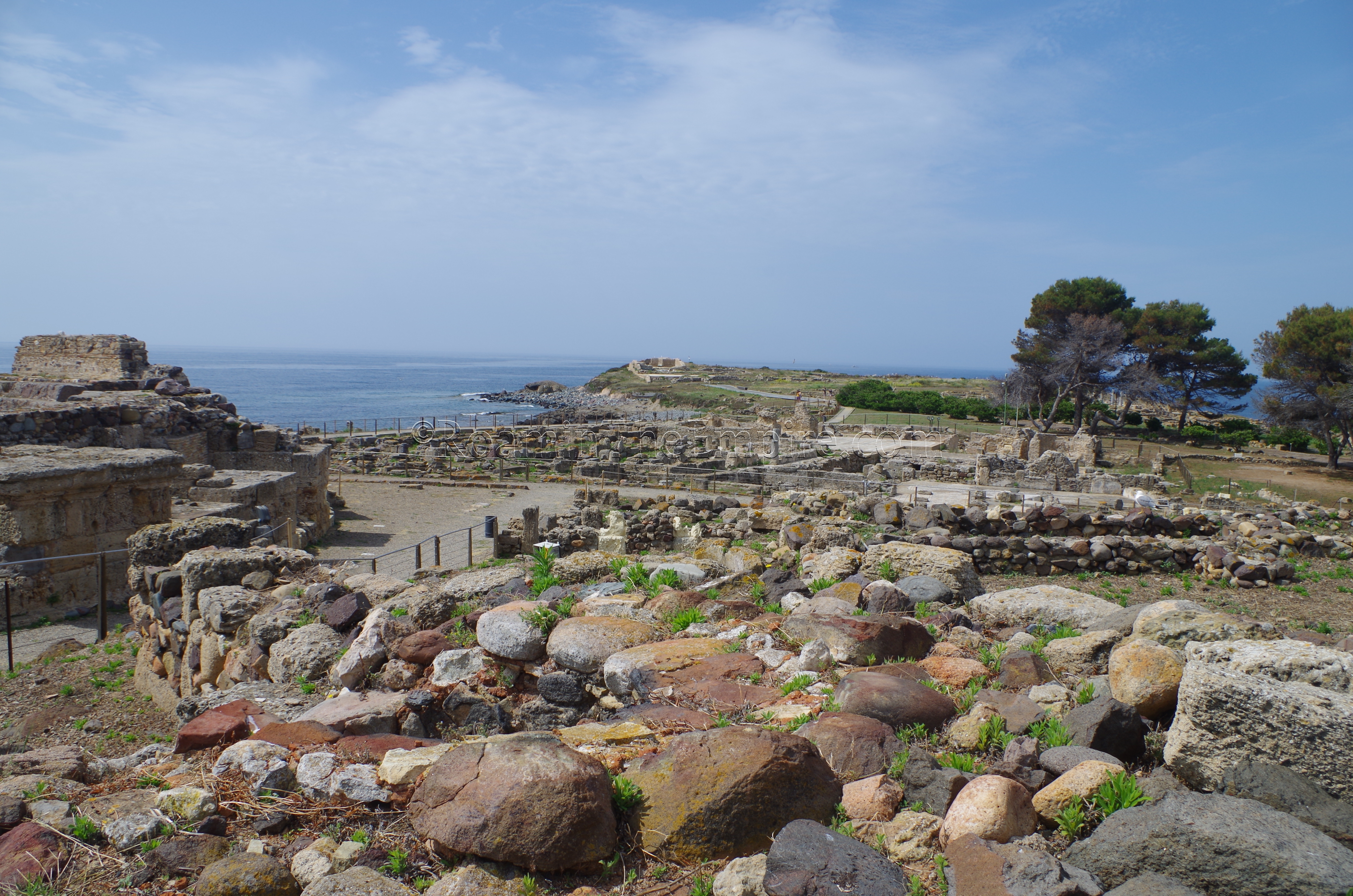
Approaching the site from the parking area, there are some remains that can be seen on the beach one passes. A significant portion of the ancient city is apparently underwater, and at the Spiaggia di Nora, that phenomenon is observable as walls disappear into the bay. Part of this, a robust wall running parallel with the coastline, is the so-called Grecale Wall, which seems to have been a sort of breakwater structure meant to protect the shoreline of the isthmus. Structures closer to the park entrance seem to be associated with the Punic/Phoenician necropolis.
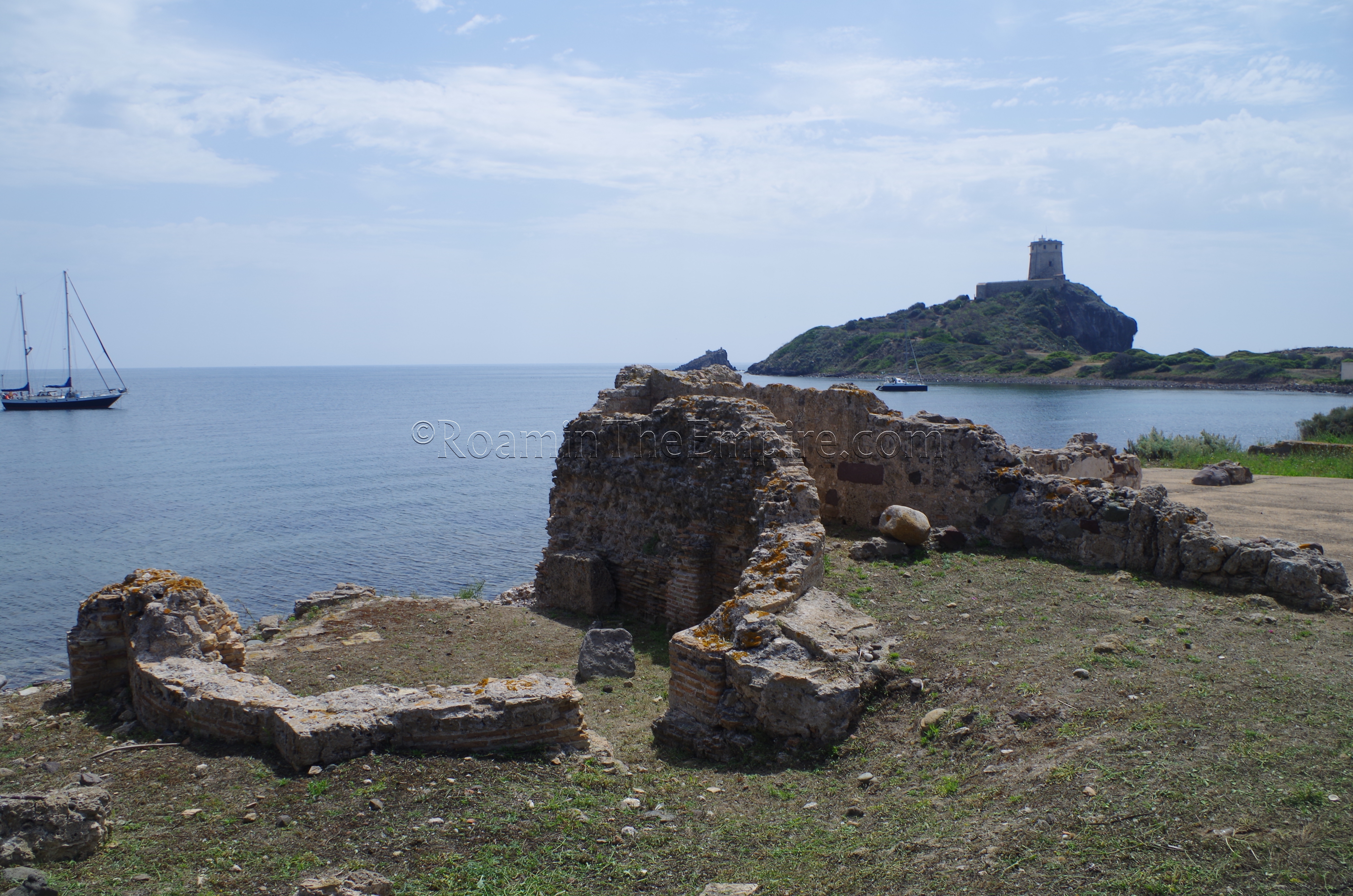
Inside the archaeological area, there isn’t a whole lot of free movement. There are paths that take the visitor around to the different buildings and areas of the excavations, but free movement and closer inspection of many of the areas is limited. Right past the ticket are is a 4th century CE bathing complex, the Terme di Levante. This is a building in which the coastal erosion is easily demonstrated, as the eastern portion of the baths have fallen off into the sea. Not much is clearly discernible, but the apsidal room on the northern side is identified as a caldarium, with the partially extant rooms immediately to the south being the apodyterium and tepidarium.
Continuing south along the main path, which runs over the remains of a Roman era road, one reaches the forum area, with the actual forum located to the south between the path and the coastline. The forum was constructed in the first half of the 1st century BCE upon the remains of a Punic residential area originally dating back to the 6th century BCE, which has been excavated in the central area of the forum. Some of the paving stones of the forum have been preserved near the path. A very fragmentary temple of unknown dedication (built upon an earlier Punic religious area) opens up to the forum on the north side, while a civic basilica lines the east side of square. Along the west side are civic buildings, probably one of which was the curia.
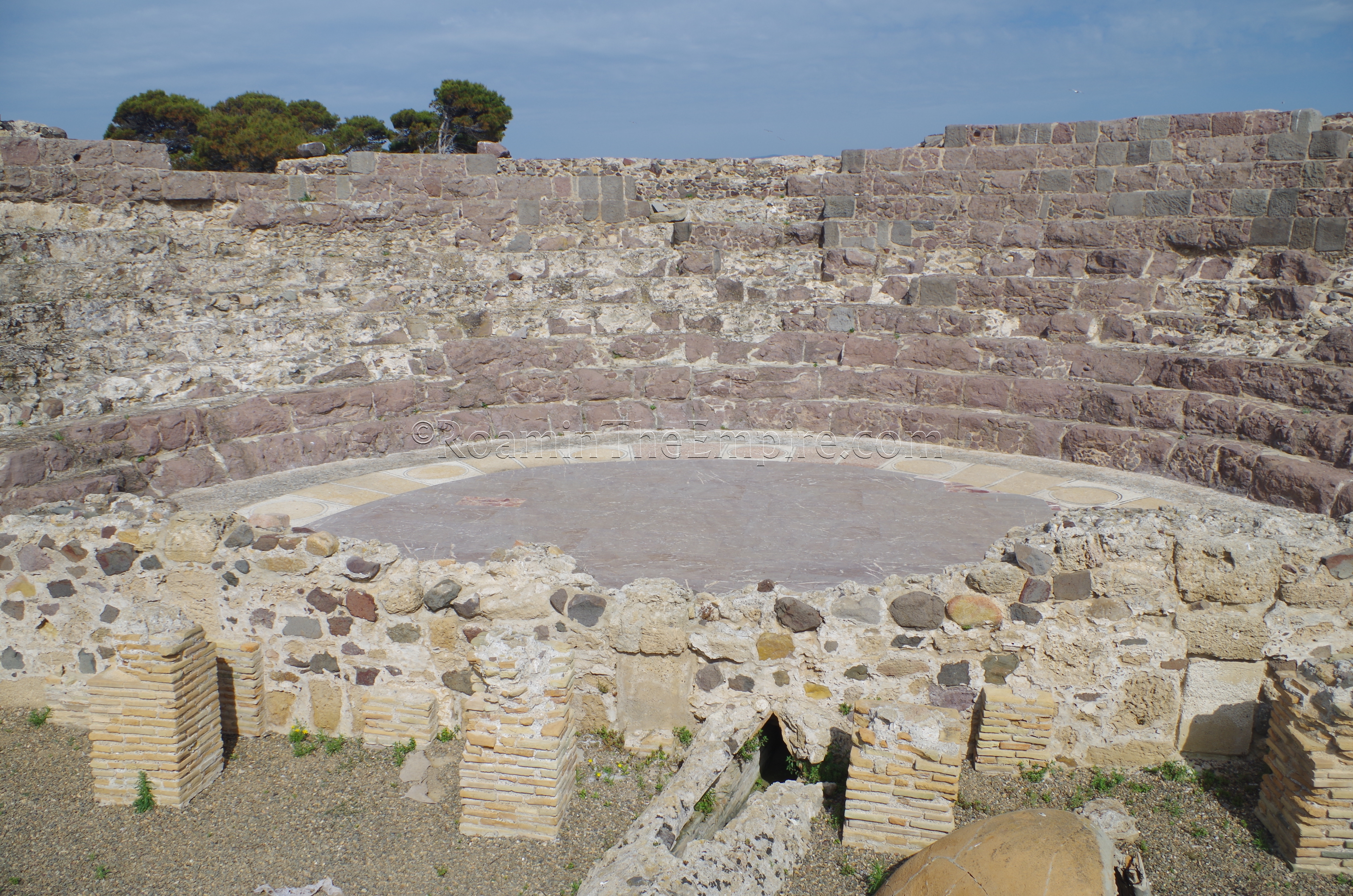
Northwest of the forum is a less fragmentarily preserved Roman temple dated to around 230 AD. Again, the exact dedication of the temple is unknown, but it is suspected to be affiliated with the imperial cult. Adjacent to the temple, to the west, is the theater. The theater, which held between 700 and 1200 spectators, is generally accepted as being built in the mid-2nd century CE, but may be as old as the beginning of the 1st century CE. Like many of the areas, the interior of the theater is not accessible, though the absence of most of the scenae allows for an easy view into the building.
West of the forum and south of the theater, along the coastline, is a building that was at one point thought to be a fullonica, but is now identified as just a private residence. Most of the structures along this southern coastal area, between the path and the sea, appear to be private houses. North of the path as it continues toward the west is a large excavated area, typically referred to as the central neighborhood, that is mostly the remains of a bathing complex, though the southeast quarter of it is late antique housing.
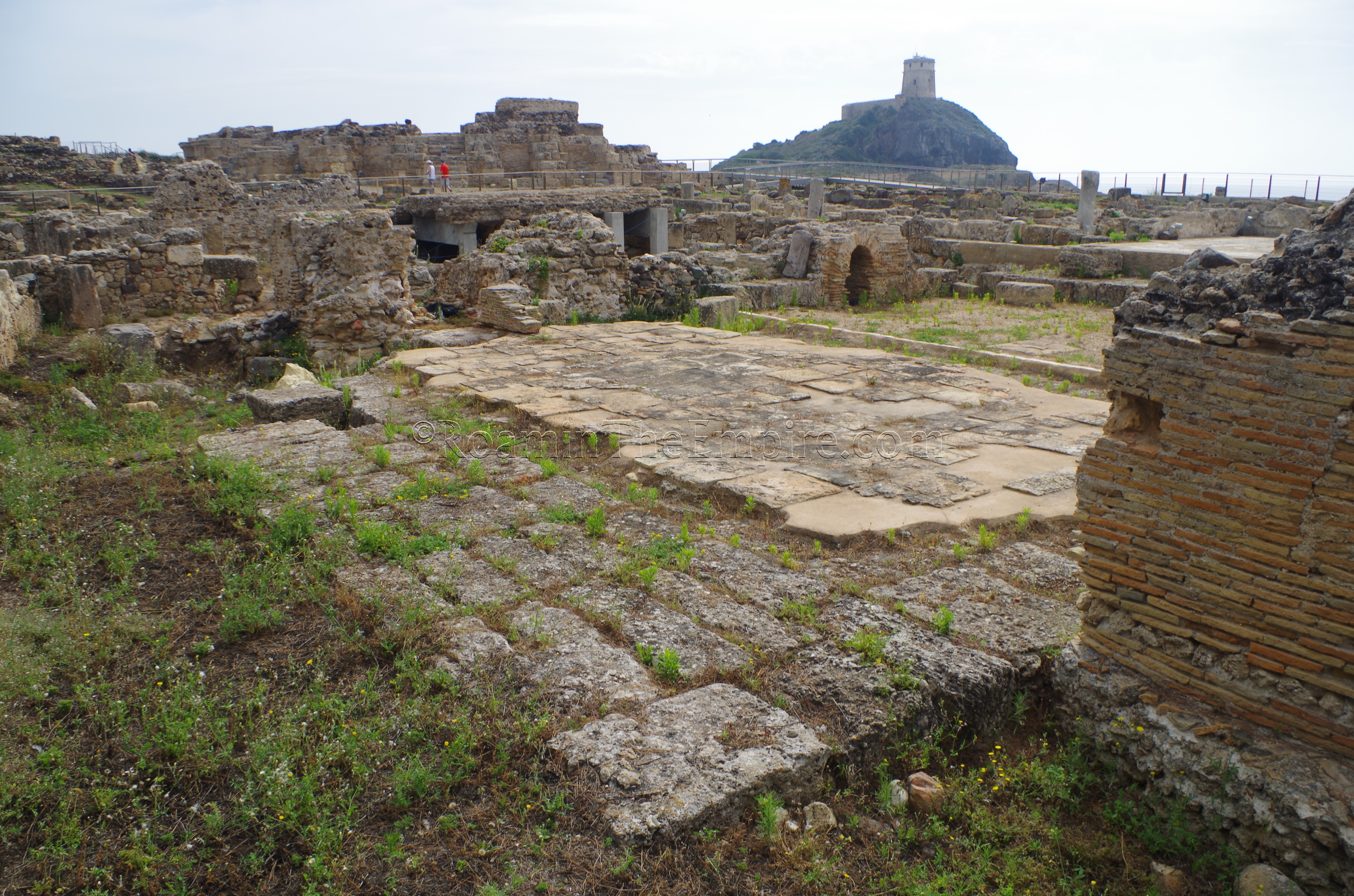
The bathing complex, the Terme Centrali, was constructed in the second half of the 2nd century CE. The baths were preceded by a Republican era residential neighborhood. Once again, there is no direct access to the structure, but a path along the west side allows for a viewing of most of the major rooms of the baths, as well as some visibility of the large and mostly mosaicked frigidarium and the adjacent mosaicked corridor. On the north side of the central neighborhood, there is a mosaicked area that was, at one point, identified as a nymphaeum. Recent studies suggest it may actually be a private residence or perhaps a guild hall, dated to the early 3rd century CE.
Continuing to the southwest, there are more residential buildings to the east along the coastline. Unfortunately, the path toward the tip of the promontory, where a sanctuary to Aesclepius was located, was closed when I visited. It’s unclear whether this is a long term closure, or it was a temporary closure. It seemed to be overrun with seagulls, so perhaps they were nesting. As I learned first-hand a few years ago on Sicily, they can become quite aggressive and territorial if one accidentally stumbles upon their nesting area.
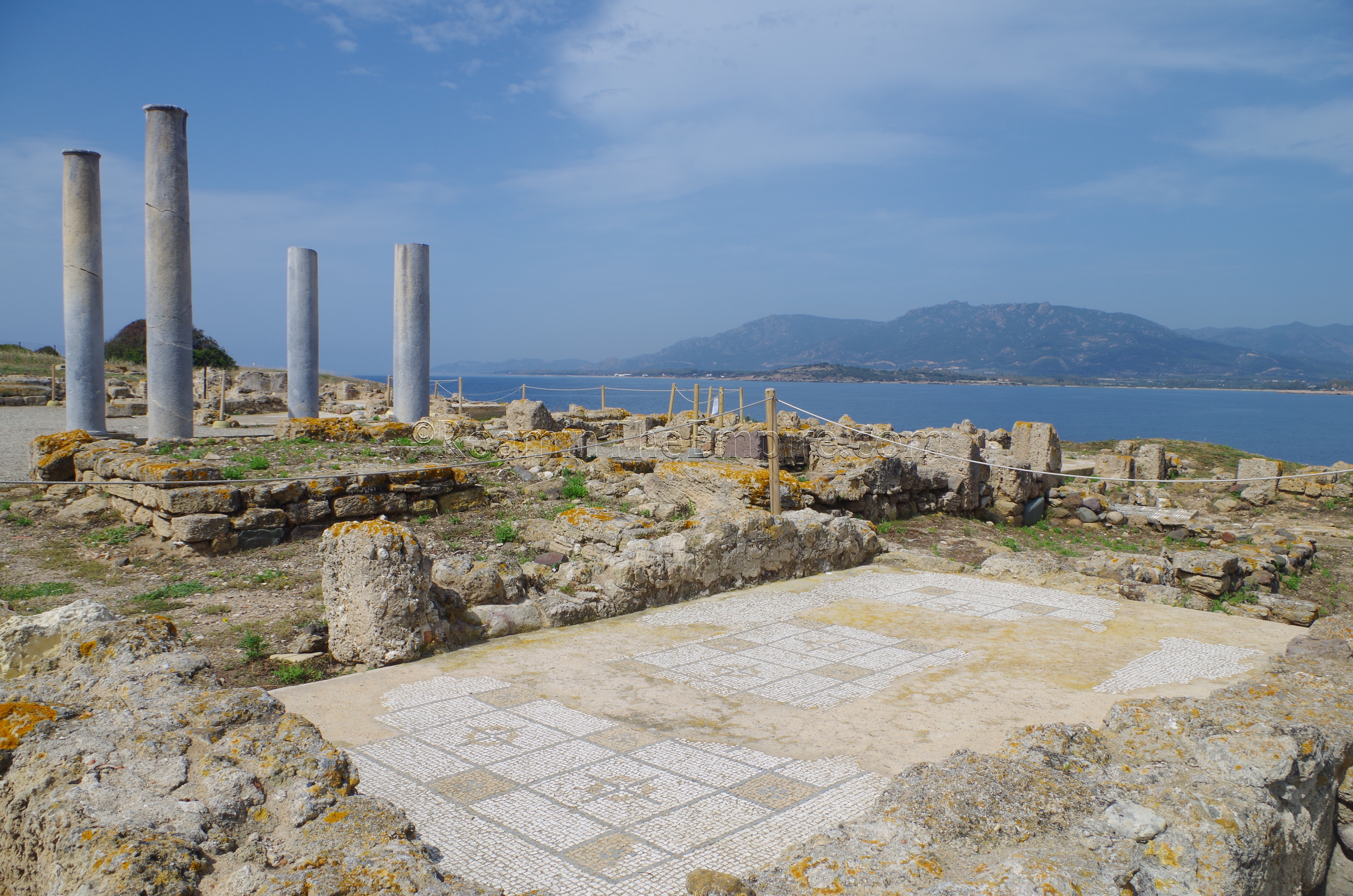
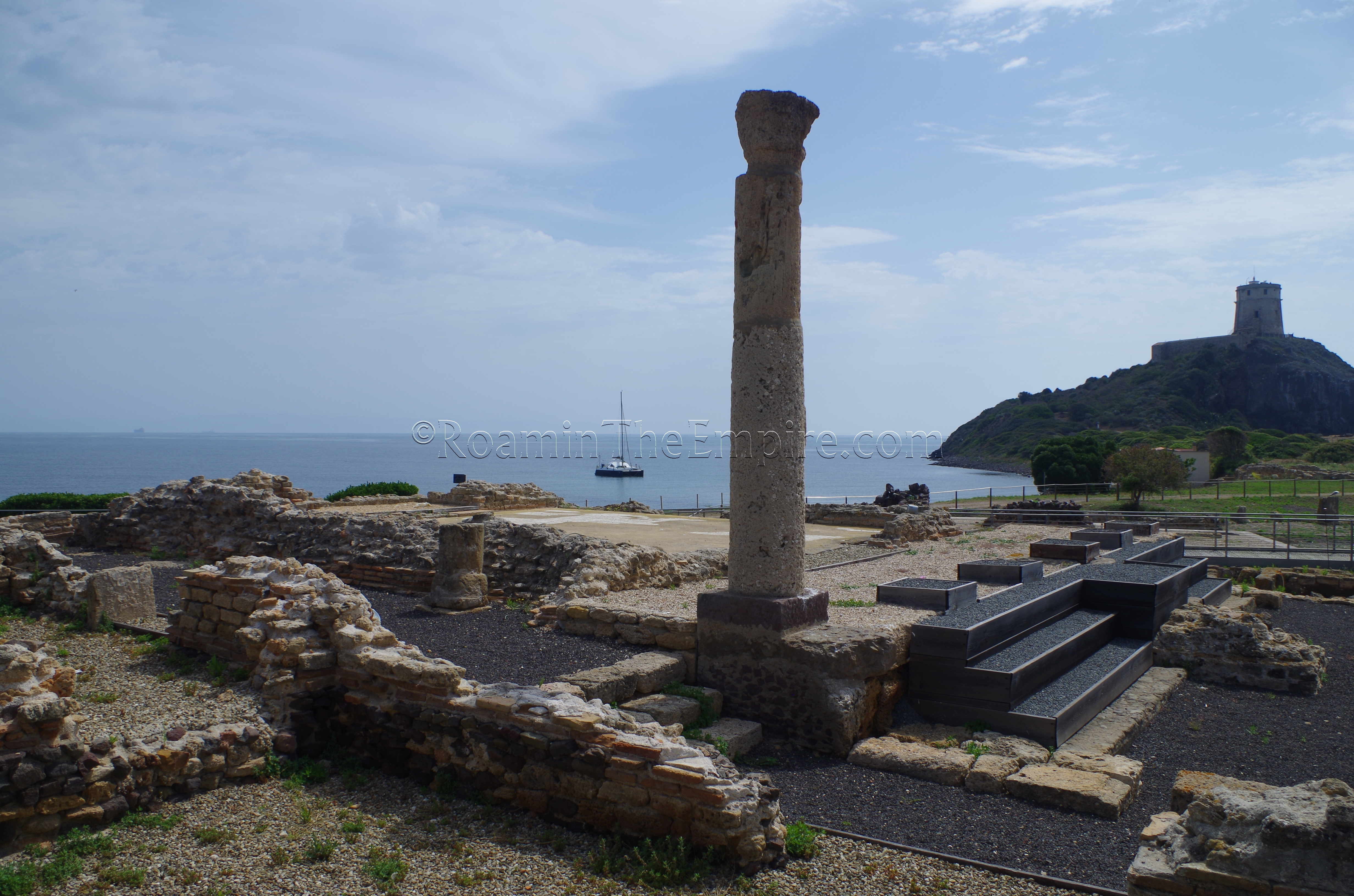
As the path turns back toward the west, there are two large residences. The southernmost of the two is the Casa Dell’Atrio Tetrastilo; the House of the Tetrastyle Atrium. Constructed in the late 2nd or early 3rd century CE, there are a number of well-preserved/conserved in-situ mosaics throughout the house. Most are geometric mosaics, but there is one with a figural central panel depicting a Nereid on the back of a sea animal. The four columns of the eponymous tetrastyle atrium have also been restored to their original locations. This is one of the few buildings at the site to which there is little in the way of access restriction, other than preventing walking on the remaining mosaics. Part of the road that ran on the west side of the property, but is now underwater, is visible with the kerb stones projecting just above the water line.
North of this house is the Casa Del Direttore Tronchetti, the House of Director Tronchetti. Built at the same time as its neighbor, the modern name of the house refers to Carlo Tronchetti, who directed the excavations at Nora from 1977 through the 1990’s. Unlike the Casa Dell’Atrio Tetrastilo, there really is no access to the interior rooms of the Casa Del Direttore Tronchetti, and it is only visible from the visitor path that runs through the west side of the house. On the north side of the house, though, alongside the visitor’s path, there is the opening to a pre-Nuragic well.
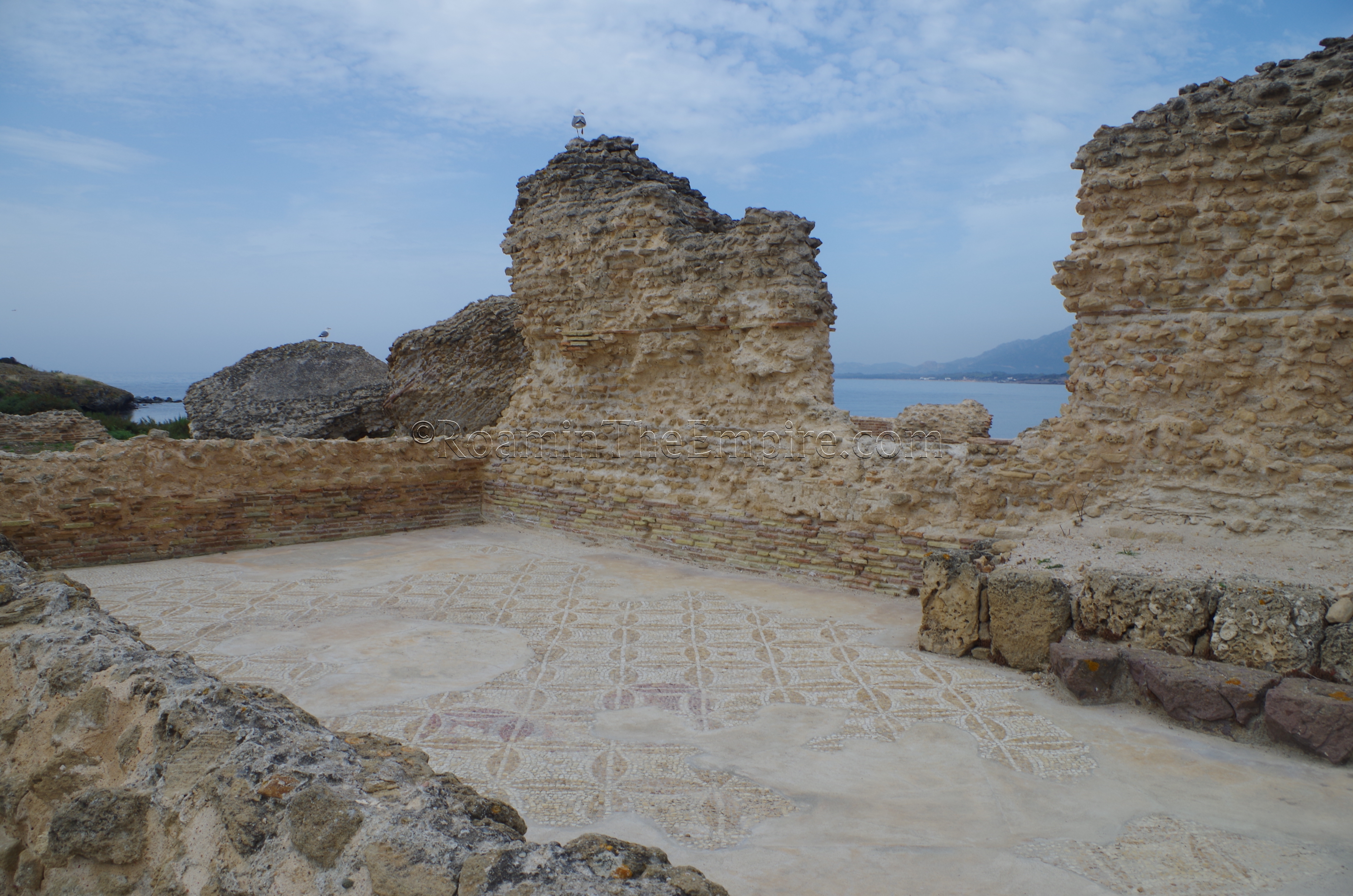
From there, the next structure is the monumental Terme a Mare, with significant portions of the walls preserved in places, as well as large chunks of the vaulted roof collapsed into some of the rooms. Again, the bathing complex here is mostly inaccessible, though one of the atriums with preserved mosaic flooring can be seen from the visitor path, which runs through the east wing of a portico that ran along the north and east side of the complex. All of the major bathing rooms are not visible, though. The Terme a Mare were originally constructed in the early 3rd century CE, with renovations in the first half of the 5th century CE. Some well-preserved sections of Roman road radiate out from the intersection at which the baths are located.
The insula to the north of the Terme a Mare is largely inaccessible, and can only be viewed from the external roads running along the outside. Much of it seems to be commercial in nature. The very northern part contains some houses with shops dating to the 2nd century CE. In the middle, facing the western road, is a small bathing complex with two construction periods in the early 3rd century CE and the 4th century CE. The rest of the insula is composed of a large structure, the exact nature of which is a matter of some debate. It is thought to possibly be a hospitium, macellum, or horreum, but may have a more multi-functional use like the northern part of the neighborhood, as a combined residential and commercial district. Like the baths, there seem to be two major construction periods; the early 3rd century CE and the early 4th century CE.
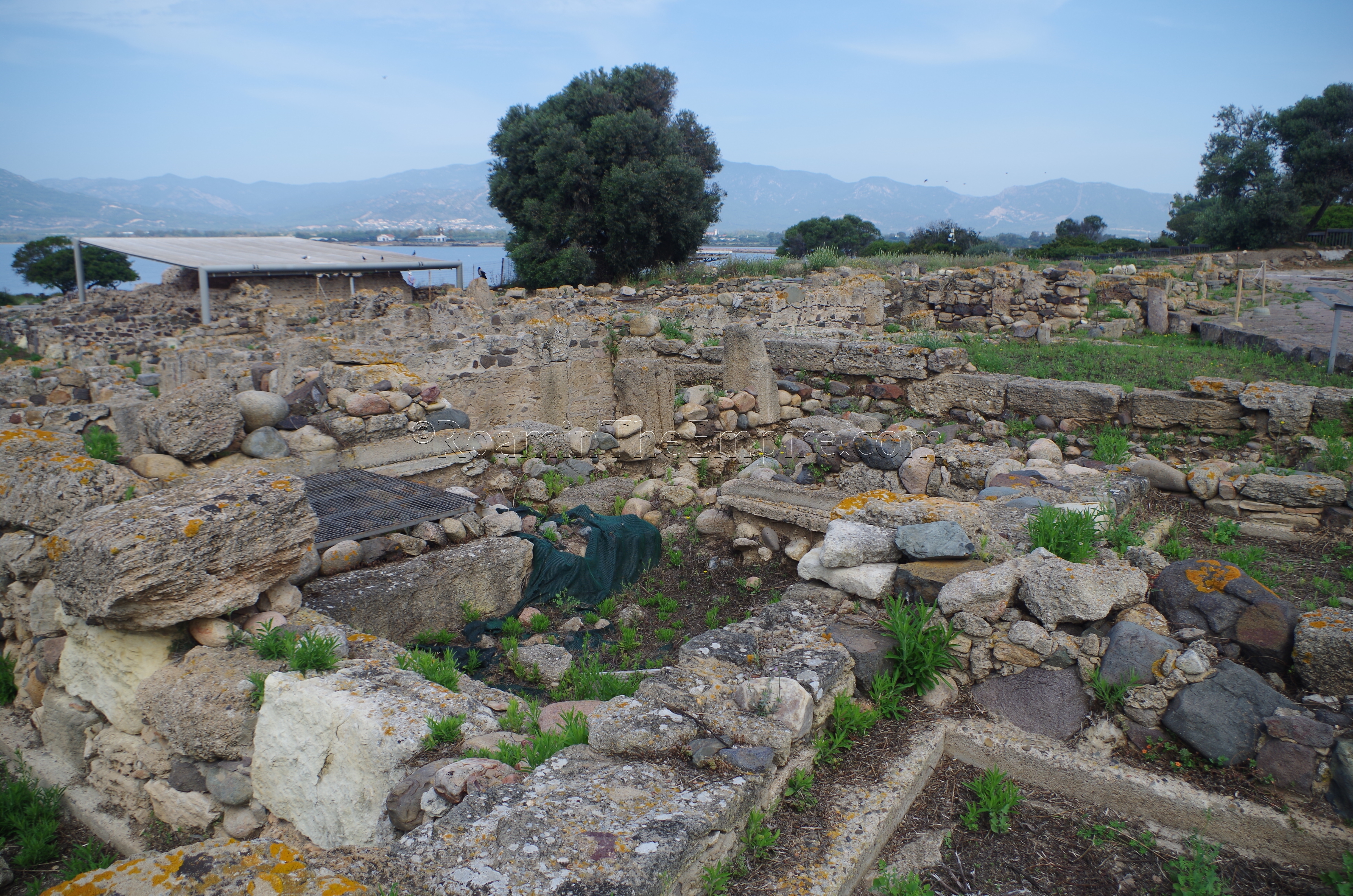
The insula to the east, heading back toward the theater is dubbed the ‘Kasbah’. This area, on the slope of the so-called Tanit Hill, is a residential district and the name comes from the use of Punic construction techniques in some of the houses located here. The construction in the Kasbah dates from many different periods, but the earliest seems to be from the Republican period; perhaps not long after the Roman occupation of the city. One of the most recognizable structures of this area is a fountain a small distance from the road, near the middle of the insula.
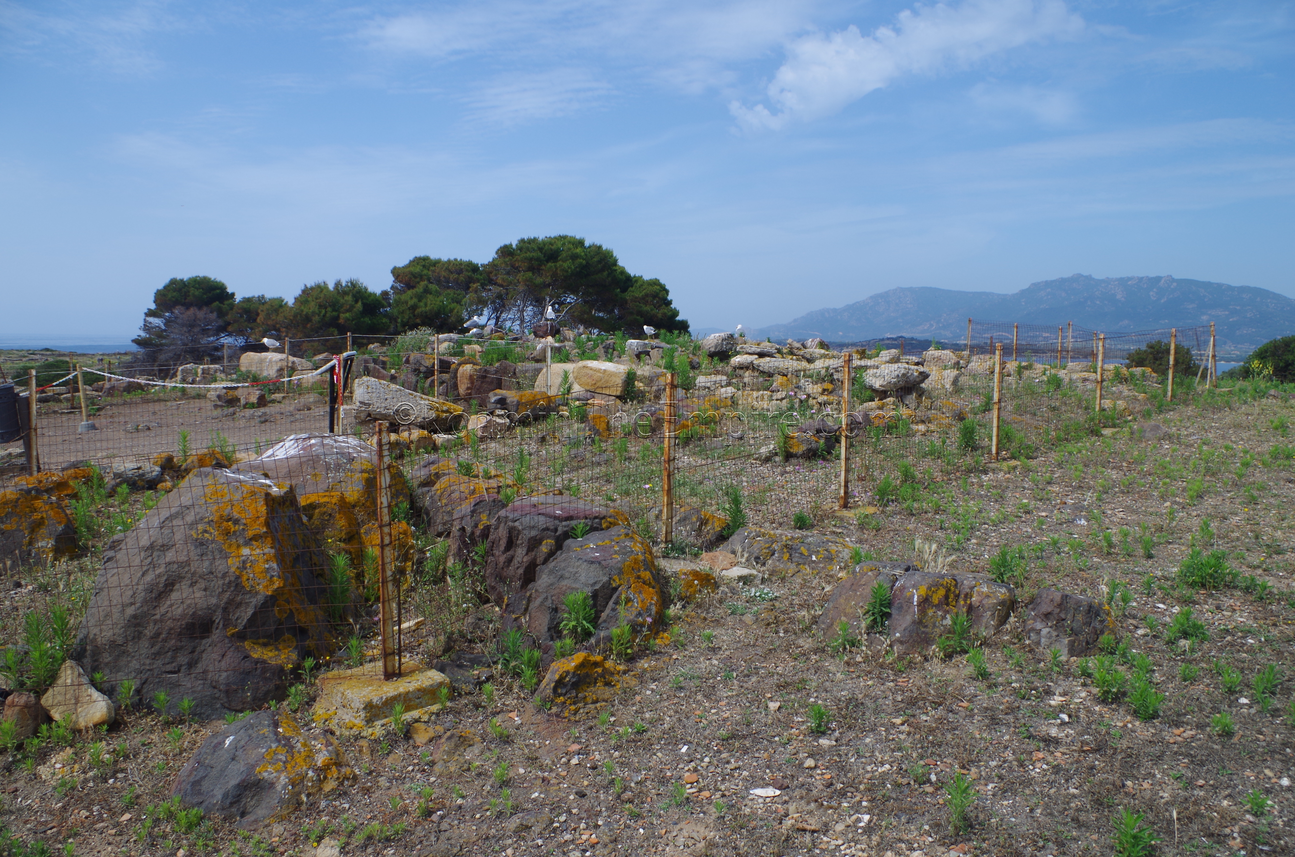
Atop the hill is the final stop on a tour through Nora; the so called Temple of Tanit. Whether this structure was actually dedicated to Tanit is unclear, but it does date to the end of the 6th century or early 5th century BCE and was indeed a religious structure. Not much is left standing of the temple, but it seems to have reused Nuragic era ashlar blocks in its construction. In addition, the highest point in the city, it offers great views over the archaeological area.
Back outside the archaeological area, there is one last Roman vestige that can be visited, the Is Fradis Minoris quarry. Located on the split of land that extends out to the west of the isthmus and encloses the Pesceiera di Nora, the quarry is within the Laguna di Nora park near the Fradis Minoris Ristorante. Unfortunately, the park is not free access and charges an 8 Euro entrance fee. There are other things to do in the park, including a visitor’s center and a sea turtle recovery center, but having other sites I wanted to see, I didn’t feel like I would have enough time to enjoy the other aspects of the park to the point that would justify the cost of the visit, so I skipped it. The park is open 10:00 to 19:00 in the summer months, with reduced (but unclear) hours outside of that.
Nora is among the most completely excavated, largest, most important, and best preserved archaeological sites on the island. The proximity to Cagliari, where almost any visitor to the island will inevitably find themselves, makes it a must-see site for those interested in archaeology who visit Sardinia. I spent about 2 hours on site, so it’s really not a huge investment of time either. Though if there weren’t as many access restrictions, I probably could have easily spent another hour or more there.
Sources:
Dyson, Stephen L. and Robert J. Rowland Jr. Archaeology and History in Sardinia from the Stone Age to the Middle Ages: Shepherds, Sailors, & Conquerors. Philadelphia: University of Pennsylvania Museum of Archaeology and Anthropology, 2007.
Hoyos, Dexter. The Carthaginians. New York: Routledge, 2010.
Miles, Richard. Carthage Must Be Destroyed. New York: Viking, 2011.
Pausanias. Description of Greece, 10.17.5.
Pliny the Elder. Naturalis Historia, 3.7.
Solinus. Polyhistor, 4.1.
Stillwell, Richard, William L. MacDonald, and Marian Holland. McAllister. The Princeton Encyclopedia of Classical Sites. Princeton, NJ: Princeton U Press, 1976.


