Continued From Corinth Part II
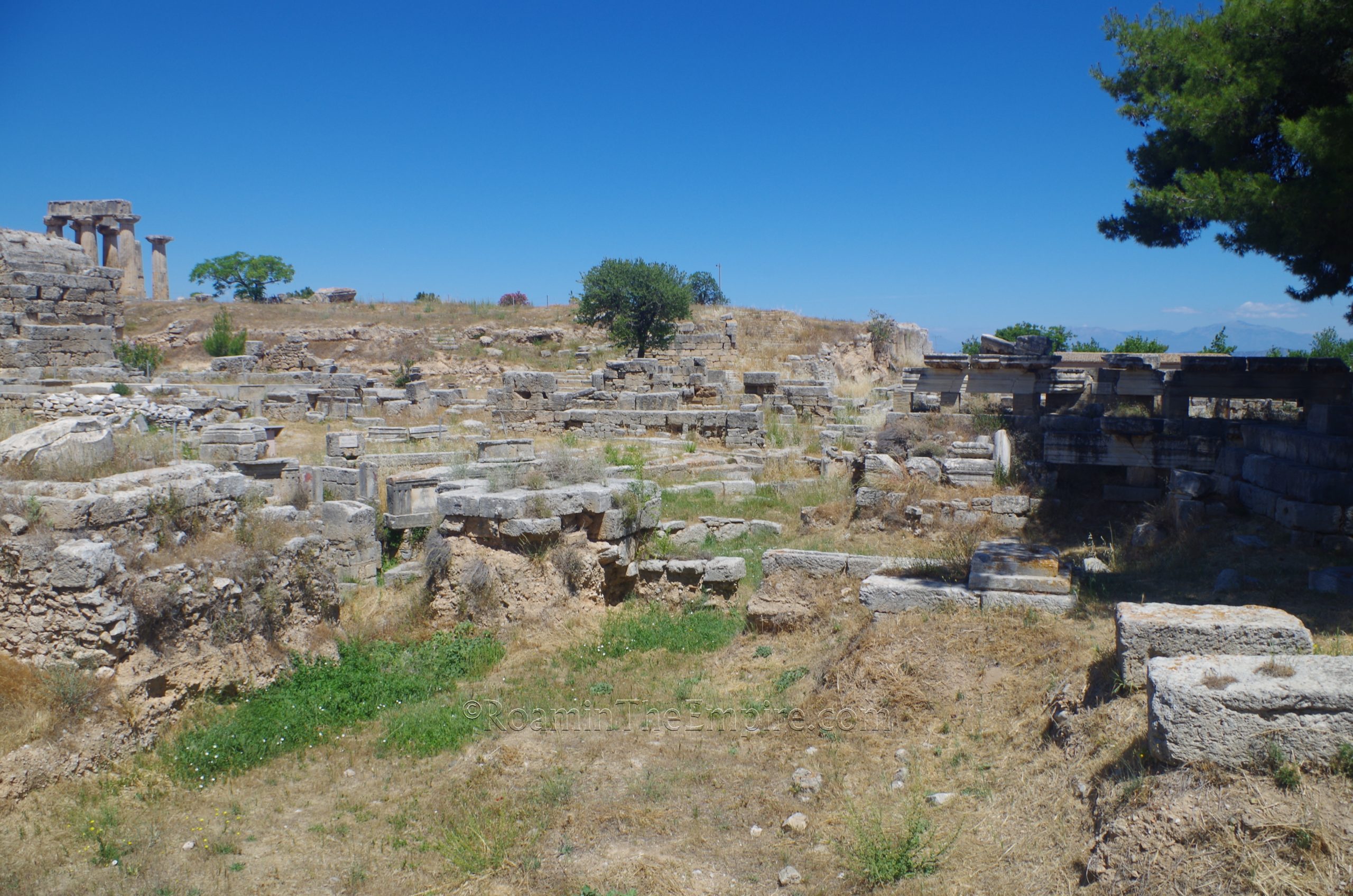
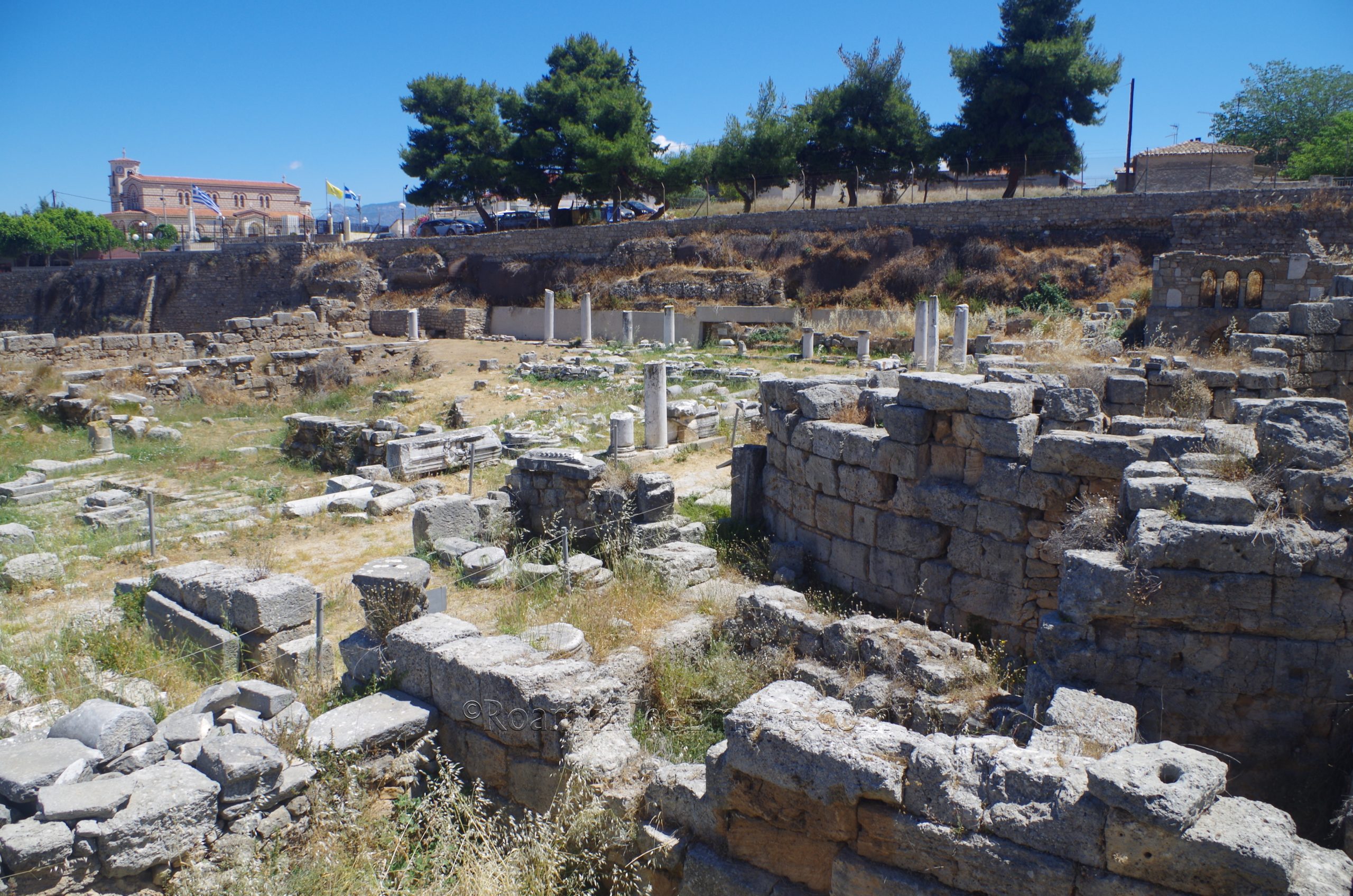
The northeast corner of Corinth’s forum is a bit messier and less orthogonal than the rest of the fairly rectilinear forum. Though during the Roman period it was covered over and the area was largely an open space, presently the remains of some elements of the Sacred Spring are now visible just to the east of the Northwest Shops. The most prominent visible feature is the apsidal building, now among the remains of the eastern most of the Northwest Shops. The architectural elements of the Sacred Spring began to be constructed in the 8th century BCE, with the now visible triglyph and metope wall being constructed later in the 6th century BCE. The original fountain house is not visible. It has been suggested that the proximity to the Temple of Apollo may have indicated some oracular usage in connection with the Sacred Spring; perhaps with the apsidal building functioning as the housing of an oracle. The site remained active until the destruction of Corinth in 146 BCE, and it was then, again, covered over and not visible in the Roman era settlement.
Just to the north of the area that would have been the Sacred Spring in the Greek period, is the south façade of the Lechaion Road Basilica, which, as the name would suggest is a basilica that flanks the Lechaion Road. This south façade is notable, though, as it is the so-called Capitve’s Façade. Originally two stories, this façade faced onto the forum and was notable as the upper story featured six colossal statues of barbarian captives. Two of these statues are now in the museum. It is believed that this decorative scheme commemorated Septimius Severus’ victory over the Parthians in 197 CE. Some other architectural elements have been arranged in what is left of the south wall of the basilica, but not much of the original wall remains.
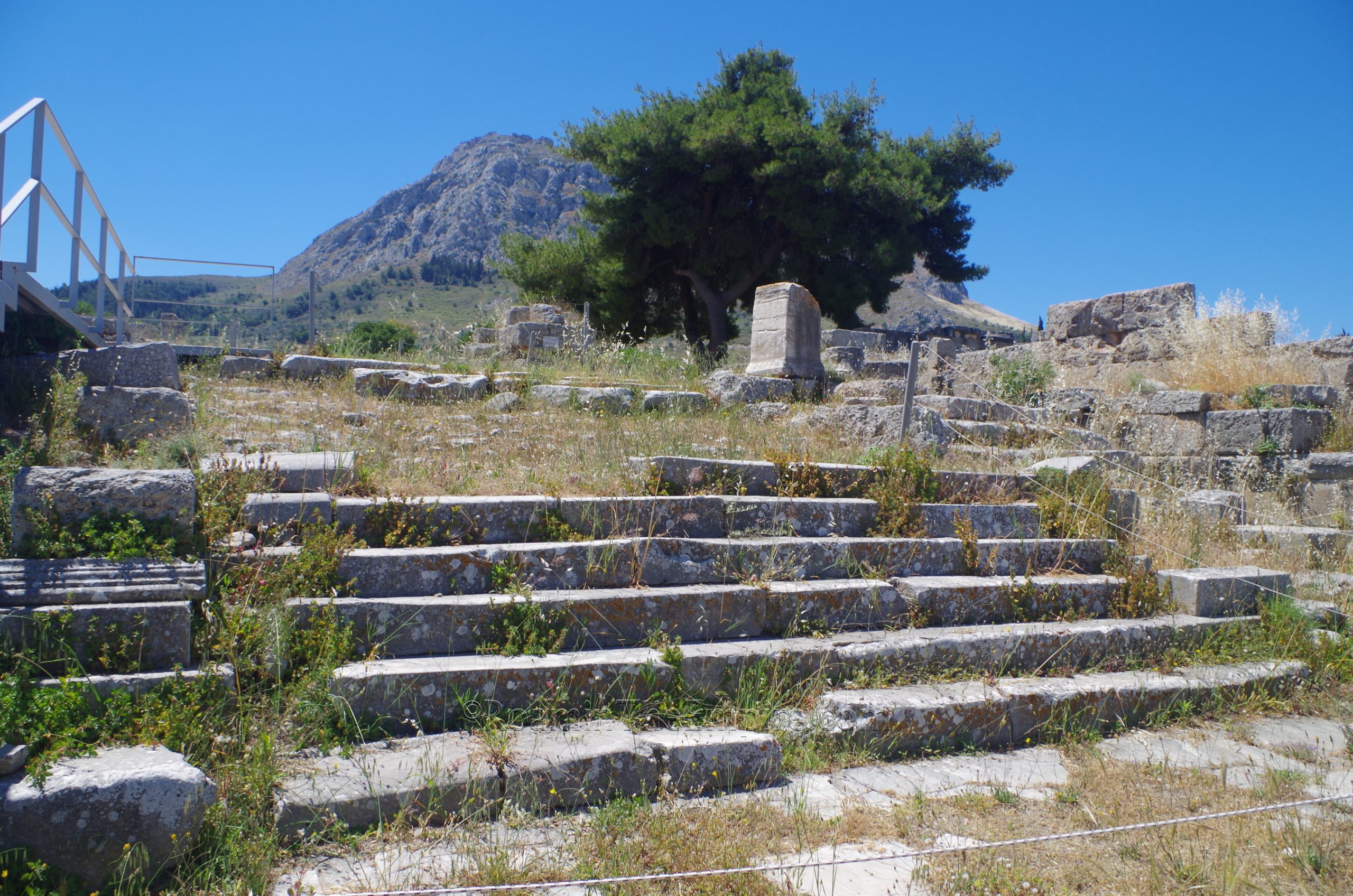
A little bit to the east of the Sacred Spring area is the Propylaia, the monumental entry to the forum from the Lechaion Road. The Propylaia was originally constructed in the early 1st century CE and seems to have consisted of a triple archway; a large gateway arch with two smaller arches flanking it, but relatively little depth. It underwent a significant renovation in the late 1st century CE when the triple archway was consolidated into a single, massive archway with a great deal of depth. Sometime early in the reign of Hadrian, this single archway was embellished with scenes of sacrifice and victory over barbarians. According to Pausanias, there were also gilt bronze statues of Helios and Phaethon in their chariots. The Propylaia was expanded with an additional platform sometime in the late Roman period of occupation. A grand staircase then led down from the gate to the Lechaion Road.
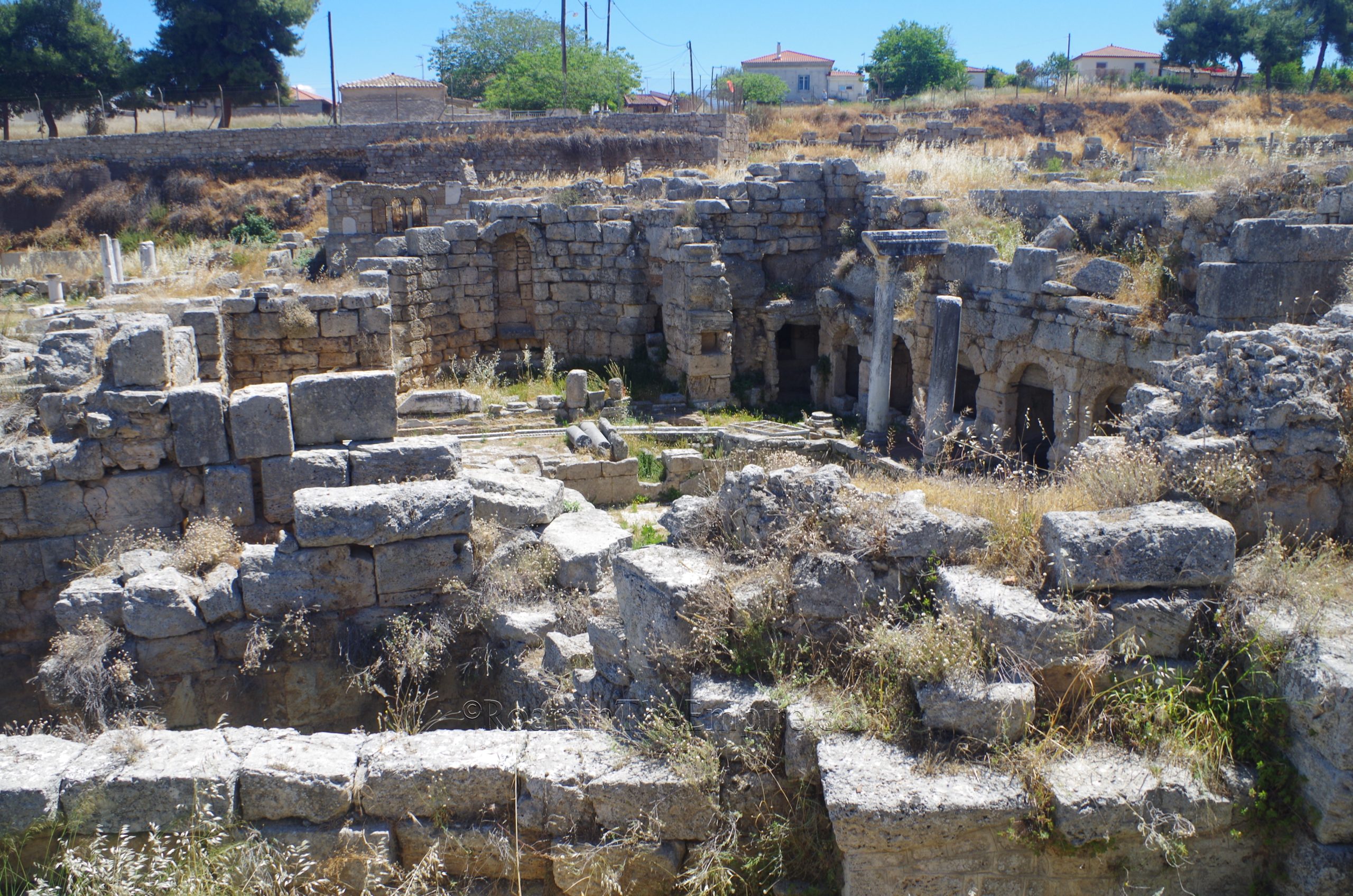
To the east of the Propylaia, and as one descends down the monumental staircase down to the level of the Lechaion Road, is the Fountain of Peirene. There seems to have been some kind of water feature here as early as the Geometric period, but the fountain itself really began to take shape sometime in the Archaic period. Like the Fountain of Glauke, there are some mythological origins attributed to the fountain. The one that gives its name to the fountain, and is recounted by Pausanias in his description, is that of the nymph Peirene. Peirene’s son Kenchrias was accidentally killed by Artemis, and in her tearful grief, was turned literally into the flowing of tears that supplied the water to the fountain. Alternatively, the spring here was said to have been a favorite drinking spot of Pegasus, and when Bellerophon tamed him as he was drinking at the fountain, Pegasus stomped his foot in frustration and shaped the form of the fountain.
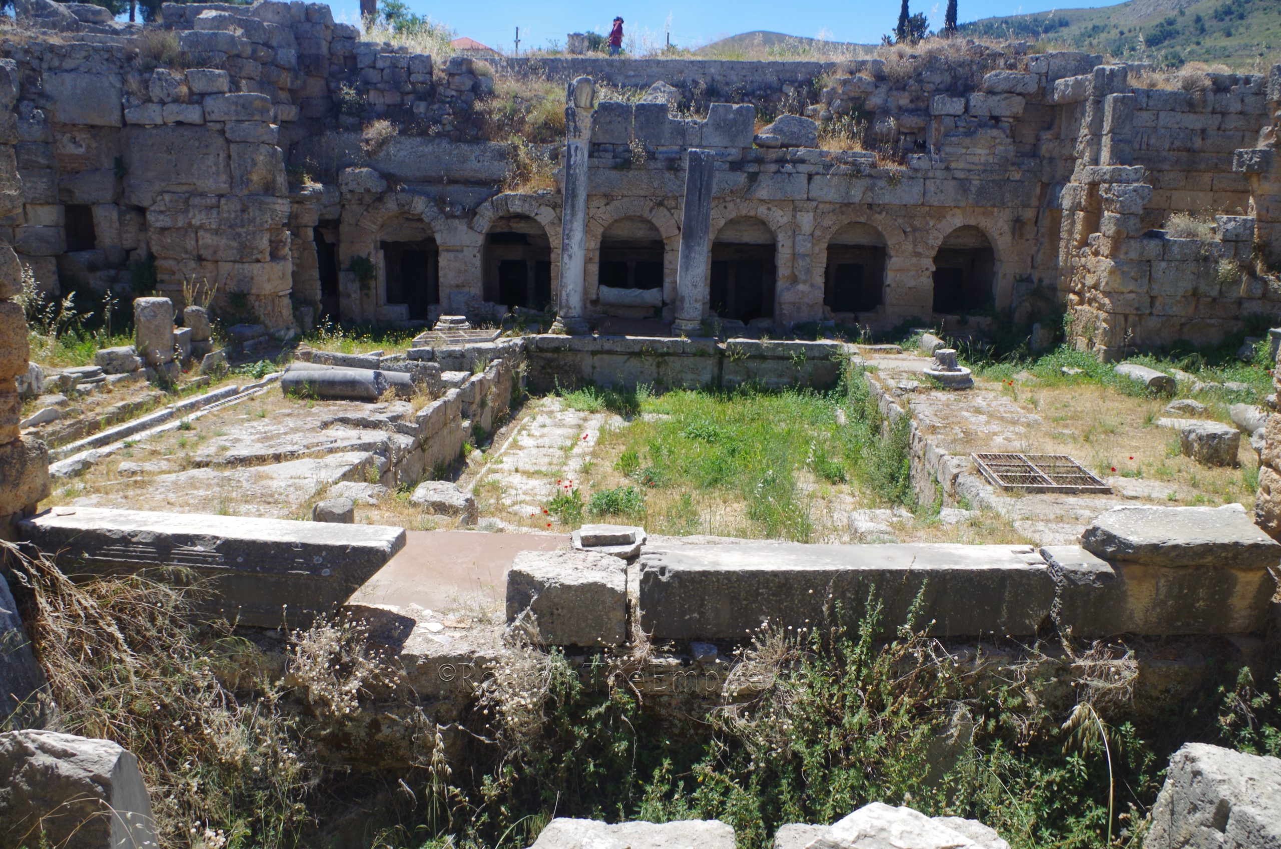
By the time the Romans destroyed Corinth, the fountain had an extensive water supply system that fed into four reservoirs that supplied three basins and six chambers. It doesn’t seem that the fountain suffered much damage during the Roman sack of the city, and the fountain was repaired and renovated very early on after the re-foundation of the city in 44 BCE. Even at this point there appears to have been a second story to the façade of the fountain and the large impluvium-like courtyard that is visible today. The apses were added in the 4th century CE, following some renovations necessitated by an earthquake. Some of the best views of the fountain come from the modern stairway down to the Lechaion Road, though the fountain, despite not being directly accessible, can be seen pretty well from a few positions on the north side of it.
Stretching out from the staircase is the Lechaion Road, the road that heads out toward Lechaion, the Corinthian Gulf harbor of the city. The road itself was in use at least as far back as the Classical Greek occupation of the city. Even under Augustus, though, despite becoming the cardo maximus of Corinth, it remained unpaved. It wasn’t until the latter half of the 1st century CE that it was paved in limestone as it is presently visible. About 75 meters of this paved version of the road is preserved in the archaeological site.
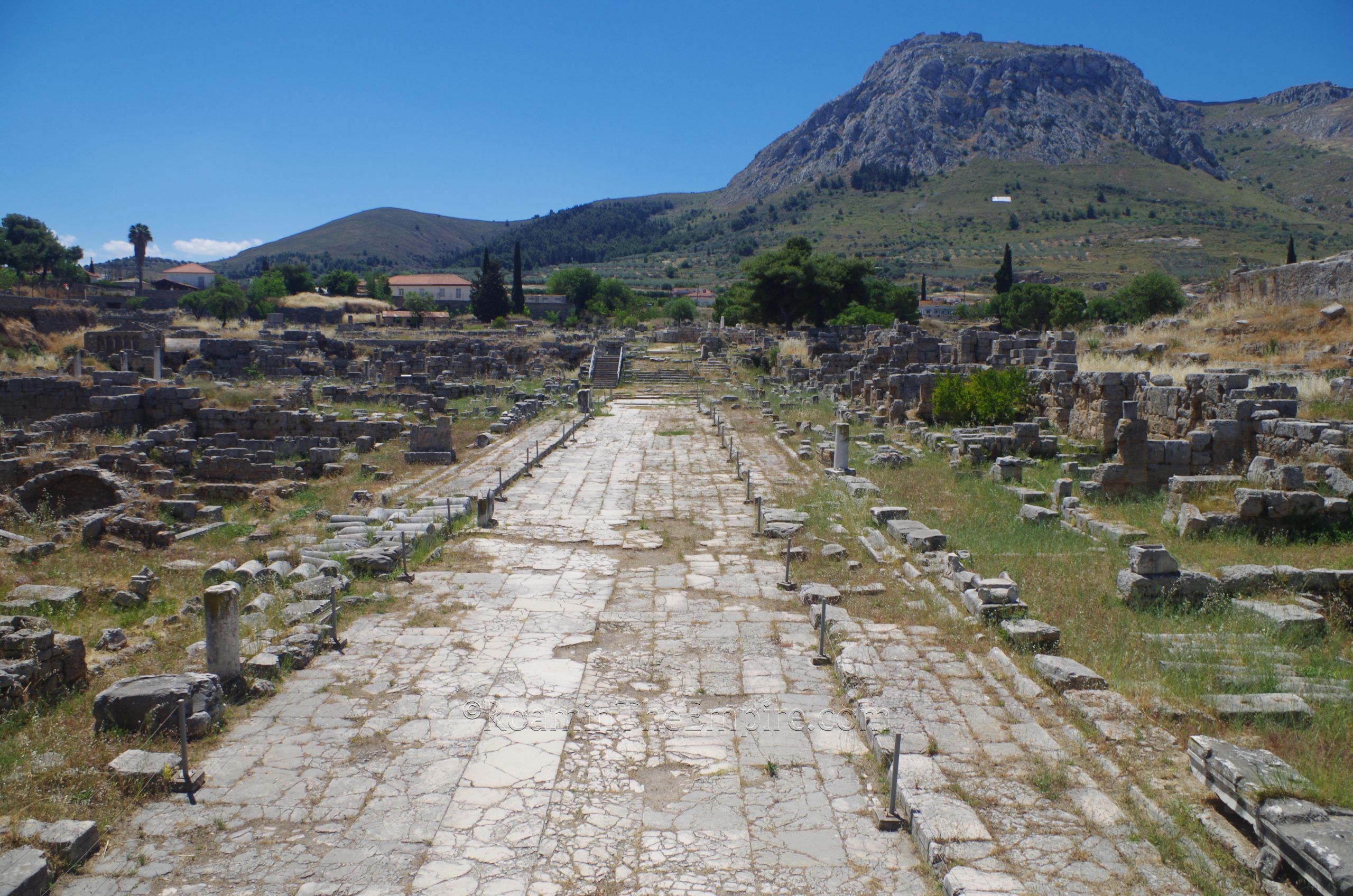
Along most of the western side of the are a series of shop stalls, behind which stands the Lechaion Road Basilica, though the basilica is not really directly visible or accessible. At the northern extent of the west side of the road are the remains of part of a circular construction, long thought to be a macellum due to the circular shape and epigraphic evidence referring to a macellum. More recently, though, it seems as though this area may have housed administrative offices constructed around 70 CE.
On the east side of the road, just north of the Fountain of Peirene, is the Peribolos of Apollo. This large colonnaded courtyard is described by Pausanias as having an image of Apollo present. He also mentions a painted scene of Odysseus expelling the suitors, though it is thought that perhaps this image was actually connected to the Fountain of Peirene, as Peirene is sometimes described as being the aunt of Penelope. The Peribolos of Apollo was originally constructed in the 1st century CE. Mosaic flooring was added in the 3rd century CE. This structure overlays two earlier structures that have been excavated; a mid-6th century dye complex, identified by basins and deposits of murex shells, and Temple A. Though no exact identification has been made, the temple dates to the 4th century BCE and seems to have been dedicated to a chthonic deity or hero.
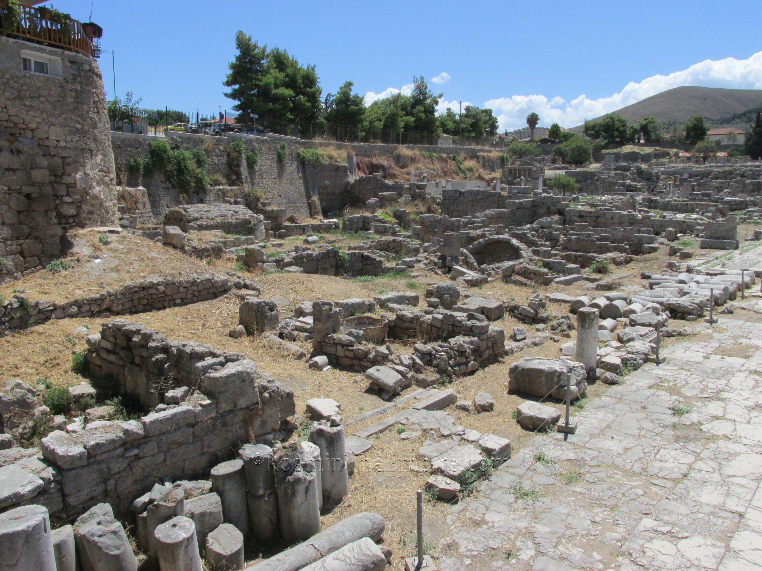
The final structure within the archaeological park, on the northern extent of the east side of the Lechaion Road, is a bathing complex. This is one of the bathing complexes thought to potentially be those described by Pausanias as having been constructed by the Spartan Eurykles, who is sometimes tentatively identified as being Gaius Julius Eurykles, a senator serving under Trajan and Hadrian. These baths in their present form seem to date to the late 1st century CE, probably the result of rebuilding projects following the earthquake of 77 CE. A public latrine is also located near the baths. Unfortunately, the distance that visitors are kept from these features (limited to just the pavement of the road) renders them mostly unable to be seen in very much detail.
There’s quite a bit to see outside the actual archaeological park, including two significant locations that are right next to the archaeological park. Right outside the park, though, just down the street to the southwest, next to the bus stop to/from Corinth, are some unidentified remains exposed. There are no signs or information on-site, and I’ve yet to find any other resources that definitively identify what’s here, so it could be earlier or later than the Roman city. It does roughly correspond to the northwest corner of what would have been the portico surrounding Temple E.
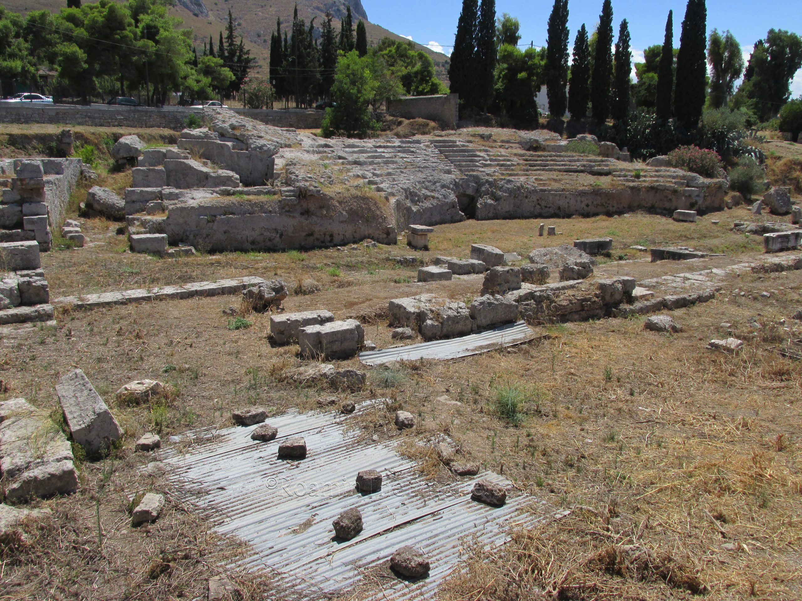
Far more significant and identifiable, however, are the remains located directly across (north) from the entrance to the archaeological site; those of the odeon. Unfortunately, there is no direct access to the odeon, it is fenced off with no entrance allowed. It is, however, visible from the street through fences on the north, east, and south sides. Perhaps the best view is from the north, which looks out over the stage and onto the cavea.
The odeon was constructed sometime in the 1st century CE with a major remodel/renovation project in the middle of the 2nd century CE. It is believed that the prolific Herodes Atticus may have been a patron of the 2nd century CE project. Capacity is estimated to have been about 3,000 spectators at this time. A fire destroyed part of the peristyle and stage of the odeon in the early 3rd century CE, necessitating another renovation and restoration about 225 CE. This renovation included alterations that allowed for gladiatorial games to be conducted in the venue, which saw the damaged stage as well as the first 8 rows of seating removed to achieve this.
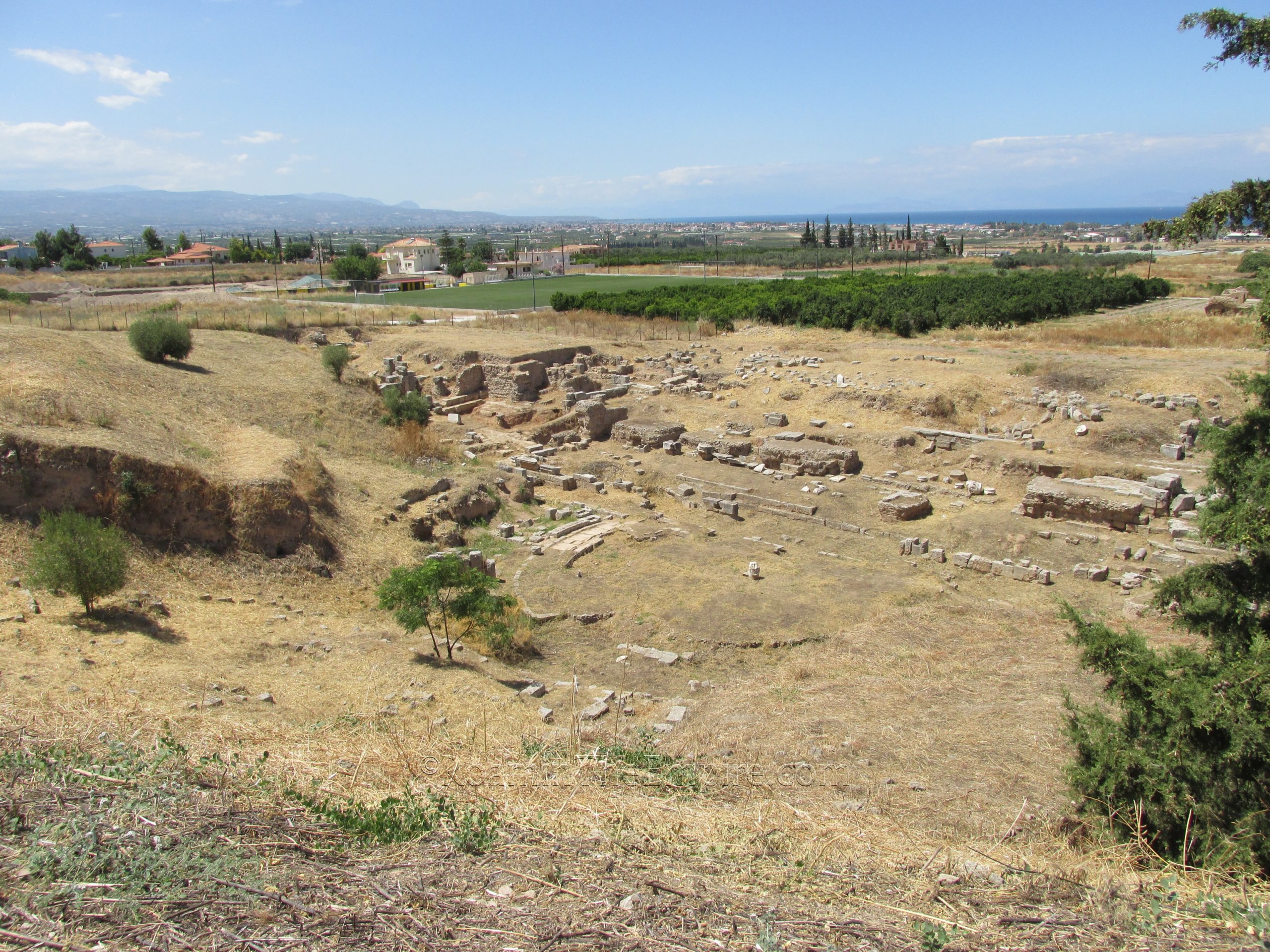
Across the street to the north from the odeon are the significantly less well preserved remains of the theater. Unlike the odeon, though, the theater is directly accessible via a path on the southeast side (northeast corner of the small parking lot in front of the archaeological park). Pretty much the entirety of the theater is accessible (aside from climbing up the cavea) when the area is well-maintained. It was during my first visit, later in the summer, but this past time in May, it was still quite overgrown, which limited access to really the courtyard area on the north side.
The original theater was built in the 5th century CE and featured a wooden stage. In the Hellenistic period, prior to the Roman destruction, a renovation included the addition of a more permanent stage structure. The core of the theater survived the Roman destruction, and sometime during the first years of Augustus’ reign, the theater was rebuilt in the more Roman style. A major renovation occurred early in the 1st century CE in which the slope of the cavea was made steeper and a portico was added in the upper area between the theater and odeon. A significant renovation that included a rebuilding of the stage area occurred in the Hadrianic period. Like the odeon, the theater was eventually altered to accommodate gladiatorial games with the removal of some of the orchestra seating. Waterproof plaster was added in the orchestra at some point as well, indicating the space may have hosted aquatic performances.
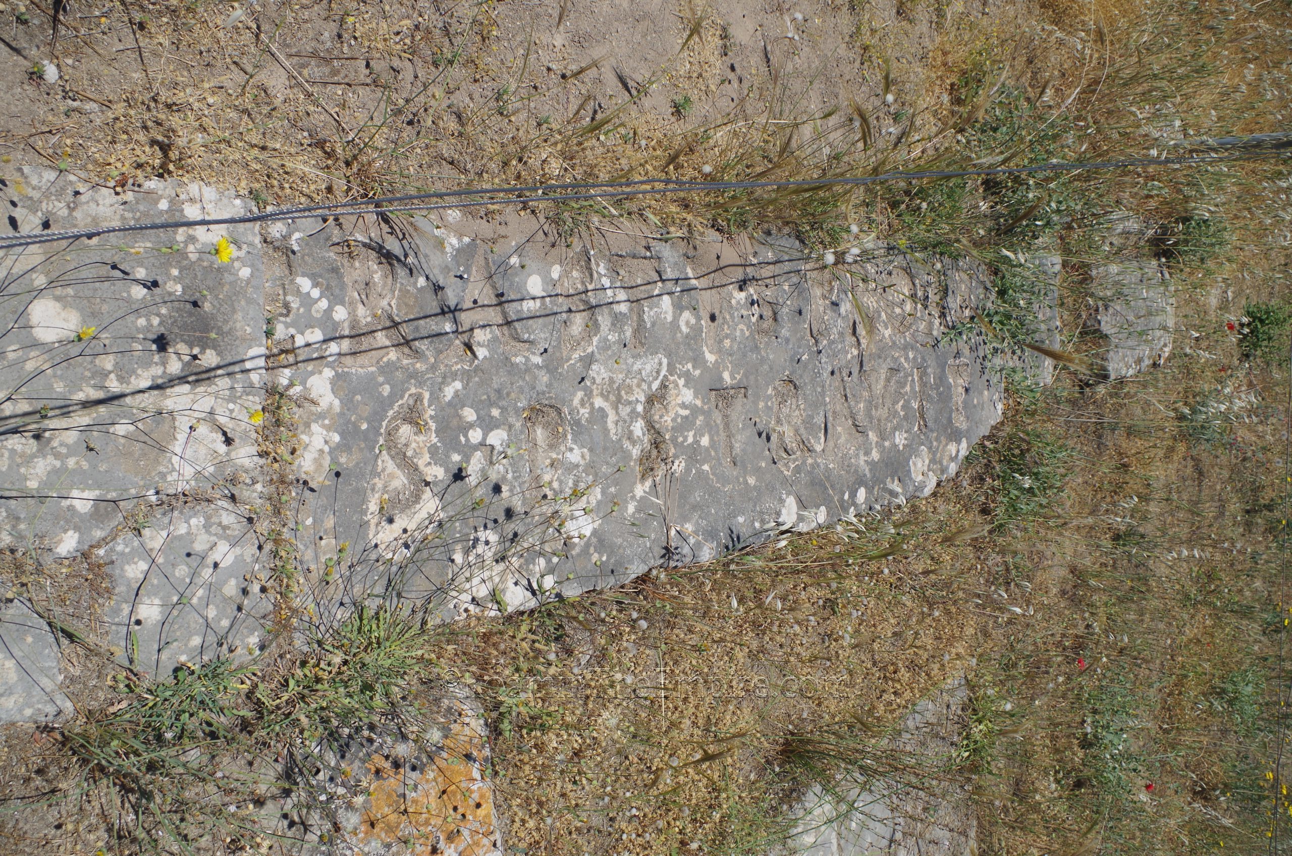
The theater is not in an especially great state of preservation; much of the seating is gone or not excavated. There are some visible remains of the orchestra area and there are large portions of the foundations of the stage elements present. One of the most interesting elements of the theater is the inscription of Erastus. In the courtyard on the northeast, there is an inscription in the pavement, which would have originally been lettered in bronze, noting that the pavement was laid at the expense of one Erastus in return for aedileship. The present location may not be the original location of the inscription, dating to the mid-1st century CE. There’s some debate about whether the Erastus mentioned in the inscription is the same one referred to by the Apostle Paul as being the city treasurer of Corinth in roughly the same period to which the inscription is dated.
Not far, off of Arionos Street, are the remains of some baths. These are visible from the street, but not accessible, and can also be quite overgrown. There are some larger remains of some structures that still stand out amid the overgrowth. These are the other baths that have potentially been associated with Eurykles, as they too would have flanked the Lechaion Road as it left Corinth, as described by Pausanias.
Finishing up with Corinth, there’s a few other sites in the immediate area of Corinth that might be worth checking out, but to which I could not get access. And the lack of access seems mostly to do with the amount of overgrowth. I tried visiting all of these sites on my most recent visit, which was early in the season before a lot of the cutting down of the spring growth had been done, and for each of them, was not able to visit because of overgrowth complicating or impeding access. And not just a little overgrowth, we’re talking above the waist growth, often including thistles and other plants that would make wading through the growth rather unpleasant. Not to mention snakes and other wildlife I wouldn’t be particularly keen on encountering. A visit later in the season might make some of these sites more accessible.
A bit farther north of the theater is the Asklepieon. There is no direct access to the sanctuary, it is fenced, but, there should be a path (when the area is not completely overgrown) which leads to a gate, through which the sanctuary can be seen. It was originally constructed in the 6th century BCE, but was renovated by Marcus Antonius Milesius, the son of a freedman of Marc Antony, not long after the foundation of the Roman city. Just to the southwest, also fenced in and not accessible when the brush has not been cut down, are the remains of a Roman-era gymnasium and possibly some elements from the Roman-era circus. The gymnasium is referred to in Pausanias and seems to have been constructed in the early imperial period.
To the east of the ancient city, along an unnamed road (but marked on the map) are the unexcavated remains of the amphitheater. The shape of the amphitheater is clearly visible on satellite mapping platforms, but, again, the overgrowth in the surrounding field was too dense for me to make my way in to get an actual look. The amphitheater, based on form, seems to date to the 1st century BCE, in the early years of the Roman colony.
The sites of Corinth (as well as Acrocorinth) can be seen in a single day, and perhaps even with an early enough start, as a day trip from Athens. My first trip, I easily saw the archaeological park/museum as well as the theater and odeon as a day trip on public transport from Athens. Unfortunately I didn’t have time for the outlying monuments, which may have been better accessible at that time of year. Adding in Acrocorinth to that day would have been out of the question as well, though with your own vehicle, it’s definitely possible to get it all in.
Sources:
Engles, Donald. Roman Corinth: An Alternative Model for the Classical City. Chicago: The University of Chicago Press, 1990.
Grant, Michael. A Guide to the Ancient World: A Dictionary of Classical Place Names. New York: Barnes & Noble Books, 1997
Livy. Periochae, 52.1-6.
Pausanias. Hellados Periegesis, 2.1-5, 2.8-9.
Polybius. Historiai, 23.9.
Sanders, Guy D. R., et al. Ancient Corinth: Site Guide. Princeton, NJ: American School of Classical Studies, 2018.
Schowalter, Daniel N. and Steven J. Friesen (eds.). Urban Religion in Roman Corinth: Interdisciplinary Approaches. Cambridge: Harvard Theological Studies, 2005.
Shipley, Graham. The Greek World After Alexander: 323-30 BC. London: Routledge, 2000.
Smith, William. Dictionary of Greek and Roman Geography. Walton & Murray, 1870.


