Most Recent Visit: June 2018
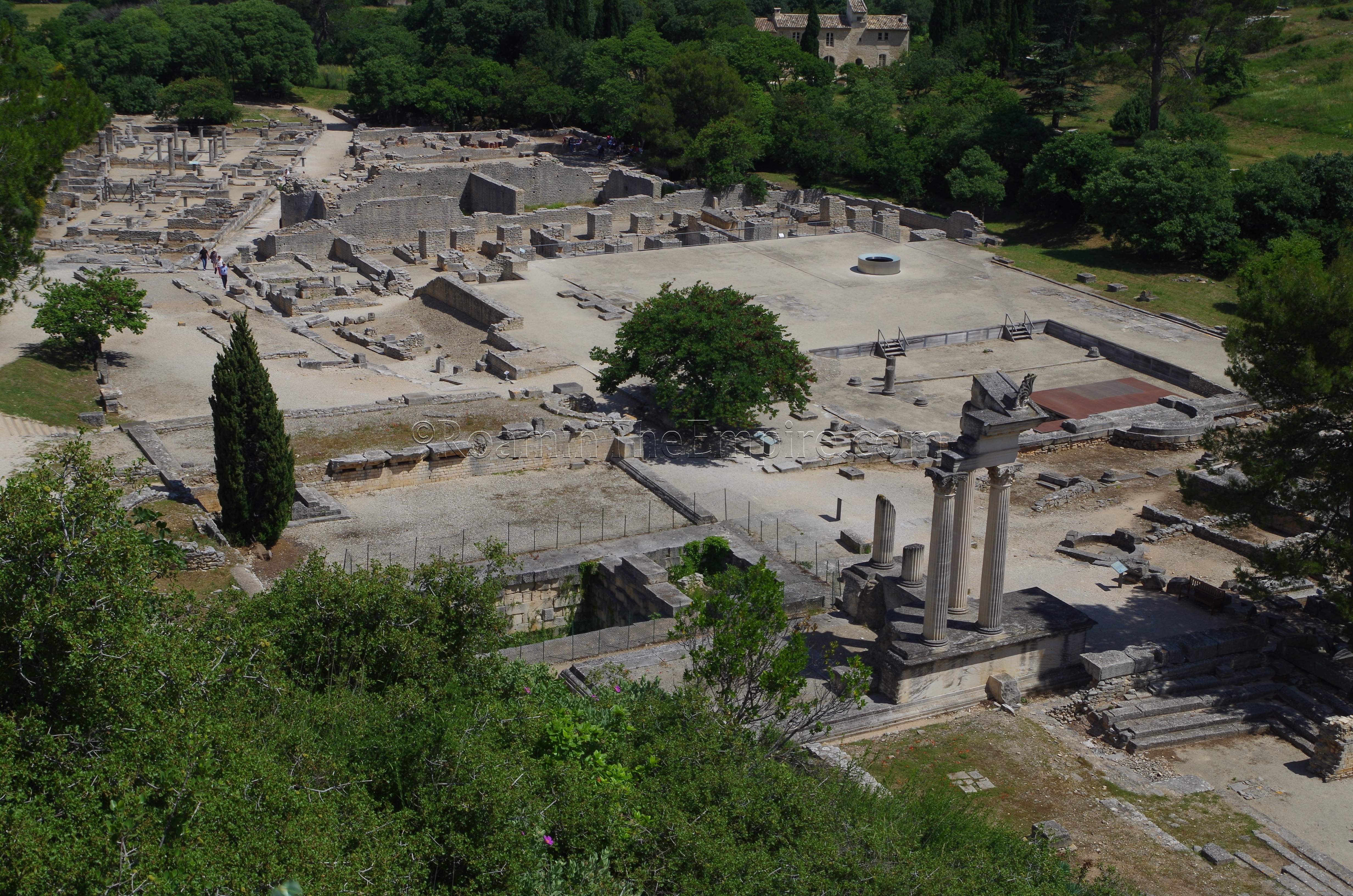
In most cases in Southern France, population centers continue to cluster around settlements that have existed since the Romans occupied the land, and in many cases, even before that. As such, Roman remains can often be found amongst the subsequent periods of occupation in modern cities and towns. Occasionally, though, ancient settlements are abandoned and never reoccupied, leaving them free of the layers of construction in the intervening years. The site of Glanum is an example of this fortuitous course of development. Located about 2 kilometers south of the center of Saint-Rémy-de-Provence, a town perhaps most famous as setting of Vincent van Gogh’s The Starry Night, the archaeological site of Glanum is largely free of the dense modern construction that often hinders large-scale archaeological excavations, and as such, a significant portion of Glanum has been excavated and is available to visit.
Prior to the Roman conquest of the area, the land belonged to the Celto-Ligurian Salluvii tribe (also called the Salyens or Salyi) who seem to have had a permanent settlement at the location of Glanum, which at the time was called Glanon (or ΓΛΑΝΙΚΩΝ in Greek) dating back to at least the 6th century BCE. Among that evidence is pottery produced in Massalia, showing contact and trade between the two sites dating back at least that far, which is important to note because of the heavy Hellenistic influence in the settlement. The impetus for the settlement of the valley seems to be access to a healing spring sacred to the Gallic god Glanis, from which the name of the settlement was derived.
While it remained a town of the Salluvii, by the 2nd century BCE, the town seems to have developed a heavy Hellenistic flavor with the construction of several public and private buildings in a style that would not be out of place in a Greek settlement of the time. Though heavily Hellenized, the town still had some very Gallic elements, as posts and lintels used for the display of trophy heads have been found at the site as well. The Salluviian relationship with Massalia soured considerably in the latter stages of the 2nd century CE, with open conflict between the two eventually pushing Massalia to call in the assistance of Rome in 125 BCE. The Salluvii suffered one defeat at the hands ofof the consul Marcus Fulvius Flaccus that same year, and were definitively defeated by Gaius Sextius Calvinus at their chief city of Entremont (in the northern suburbs of present day Aix-en-Provence) in 123 BCE. The defeat at Entremont brought the territory of the Salluvii under the control of the Romans. Around this time, Glanum seems to have suffered a destruction event in which many of the buildings of the settlement were damaged or destroyed, no doubt related to the conflict between the Salluvii and Romans.
The construction of the Via Domitia about 118 BCE, which passed by Glanum, seems to have positively affected the settlements prospects and lead to a period of prosperity in the waning years of the 2nd century CE. Hellenistic constructions seemed to have flourished during this period. In 90 BCE, the Salluvii rebelled against Roman rule, and the archaeological record again displays evidence of a destruction level coinciding with that general timeframe, and public buildings seem to have been destroyed or heavily damaged at the time, halting the development of the settlement somewhat. In 49 BCE, Masallia was conquered by Caesar after siding with Pompey in the civil war between the two, the absence of the independent, Greek influence of Massalia in the environs of Glanum paved the way for a stronger level of Romanization. Marcus Livius Drusus Libo is supposed to have settled a colony at Glanum about 4 BCE, which is reflected in the name that Pliny the Elder uses for the settlement; Glanum Livii.
Under Augustus, Glanum was given status as an Oppidum Latinum of Narbonensis, which bestowed Latin rights upon the citizens of Glanum. This period during the late 1st century BCE and early 1st century CE saw large-scale, monumental building projects undertaken. Building seems to have continued at a relatively steady pace through the 1st century CE, but by the 2nd century CE, construction appears to have been negligible. Glanum seems to have gone into a period of decline at this time, probably a victim of the prosperity of larger nearby settlements like Avennio, Arelate, and Nemausus (modern Avignon, Areles, and Nîmes, respectively). In 260 CE, Glanum was sacked by the Alamanni and the site was largely abandoned. The inhabitants that stayed in the area instead decided to settle a few kilometers away at a site that would become Saint-Rémy-de-Provence. There was some minor occupation on the site in the 5th century CE, but, for the most part it was abandoned and eventually covered in alluvial sediment and mud.
Getting There:
Saint-Rémy-de-Provence is a relatively small town, and as such, there is no train line that services the town. There is a bus (line 57) that runs from Avignon’s central train station to Saint-Rémy-de-Provence and back pretty regularly. The journey is about 50 minutes and the bus terminates in Saint-Rémy-de-Provence. The schedule for the bus can be found here. There is also a bus from Arles (line 54) that has a similar journey time, but the bus line runs all the way to Cavallion and Saint-Rémy-de-Provence is a stop about two thirds of the way through the route. That bus also only runs a couple times a day, so, taking the bus from Avignon is a much better prospect. The price for the journey is 2 Euros each way. There doesn’t seem to be a bus from Saint-Rémy-de-Provence, but walking from the final bus stop of the Avignon- Saint-Rémy-de-Provence line to Glanum is about a kilometer and a half, or 20-25 minutes walking. When I visited, I had a rental car, and it’s quite a bit easier, as was the case with many of the non-urban sites I visited during the trip. There’s ample parking at the site, though it is paid parking (5 Euros for the entire day).
The Site Archéologique de Glanum is located along the D5 highway, also called the Route des Baux-de-Provence, just to the south of Saint-Rémy-de-Provence, without an actual street address. An alternative address that is also used is Avenue Vincent Van Gogh. The archaeological site is located on the east side of the road, but the parking is on the west side. From October through March, the site is open Tuesday to Sunday from 10:00 to 17:00. During that period, Glanum is closed on Mondays. The rest of the year, from April through September, it is open every day from 9:30 to 18:00. Full price admission to the site is 8 Euros.
Les Antiques
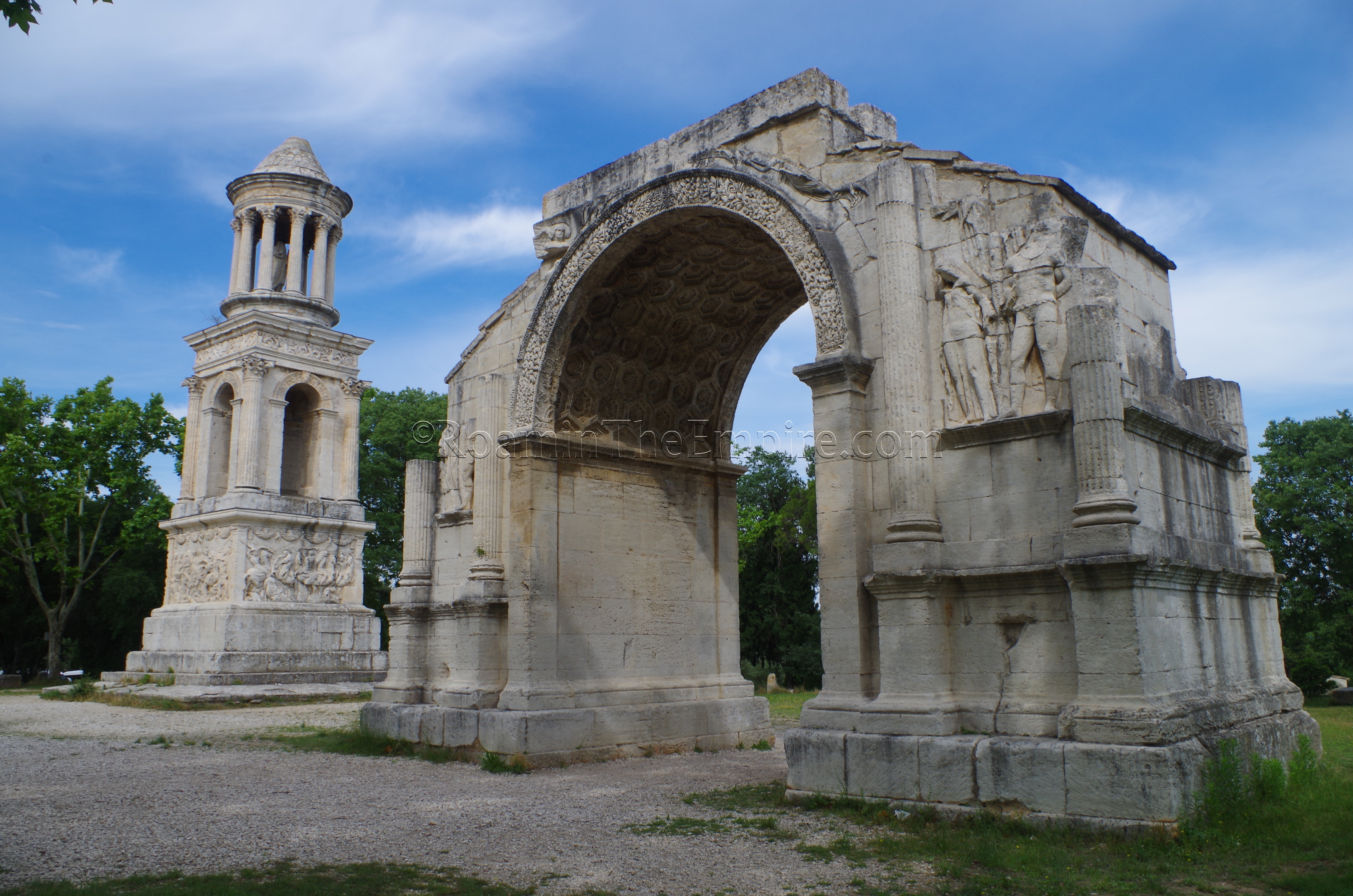
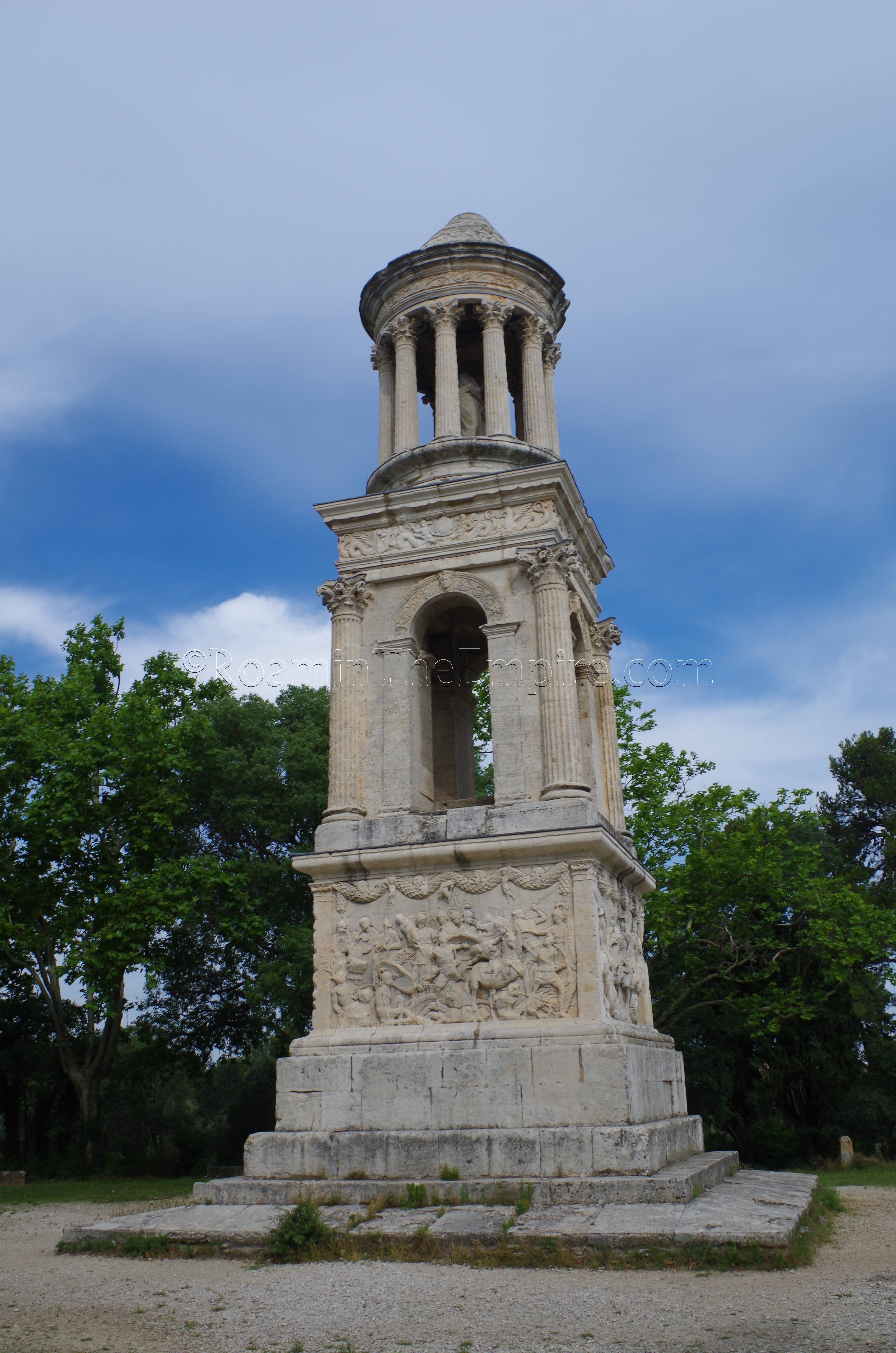
Per the information at the site, when Glanum was restored and renovated in 2007, the attempt was made to preserve the settlement, generally, as it would have been in the 1st century BCE, with occasional ‘windows’ opened up into the earlier Hellenistic stage of the settlement. The most well-known and best preserved portion of Glanum actually isn’t inside the archaeological site, but is rather across the street, adjacent to the parking lot. Two monuments, collectively known as Les Antiques, were visible and known for centuries before the main portion of the settlement was excavated starting in the early 20th century CE. Located here are a triumphal arch and a funerary monument. The funerary monument, with an inscription noting its dedication to brother Sextius, Marcus, and Lucius Julius, was constructed around 40 BCE and was located on the north side of the Via Domitia, which ran nearby. The base of the monument has reliefs of various battle scenes, including one from the Trojan War.
Just to the north of the funerary monument are the remains of a triumphal arch. Most of the arch is pretty well-preserved, but, the upper part of it, which would have included a dedicatory inscription, no longer remains, making the exact nature of the arch less clear. It does seem to have been constructed during the reign of Augustus. The presence of images of Gallic prisoners and trophy iconography suggests it might be related to a victory over Gallic tribes in the region. The Via Domitia would have run under the arch, which would have been located outside the north gate of Glanum.
Across the street, approaching the entrance to the site are the remains of a 4th-5th century CE stone quarry, which would have placed its use after the abandonment of Glanum. There is a small interpretive center on-site. While there are a few artifacts on display, I’d hesitate to call it a museum. Most of what is here is contextual information, primarily in French but also with some things translated in English. The area primarily serves as a gift shop/library, though.
Residential Area
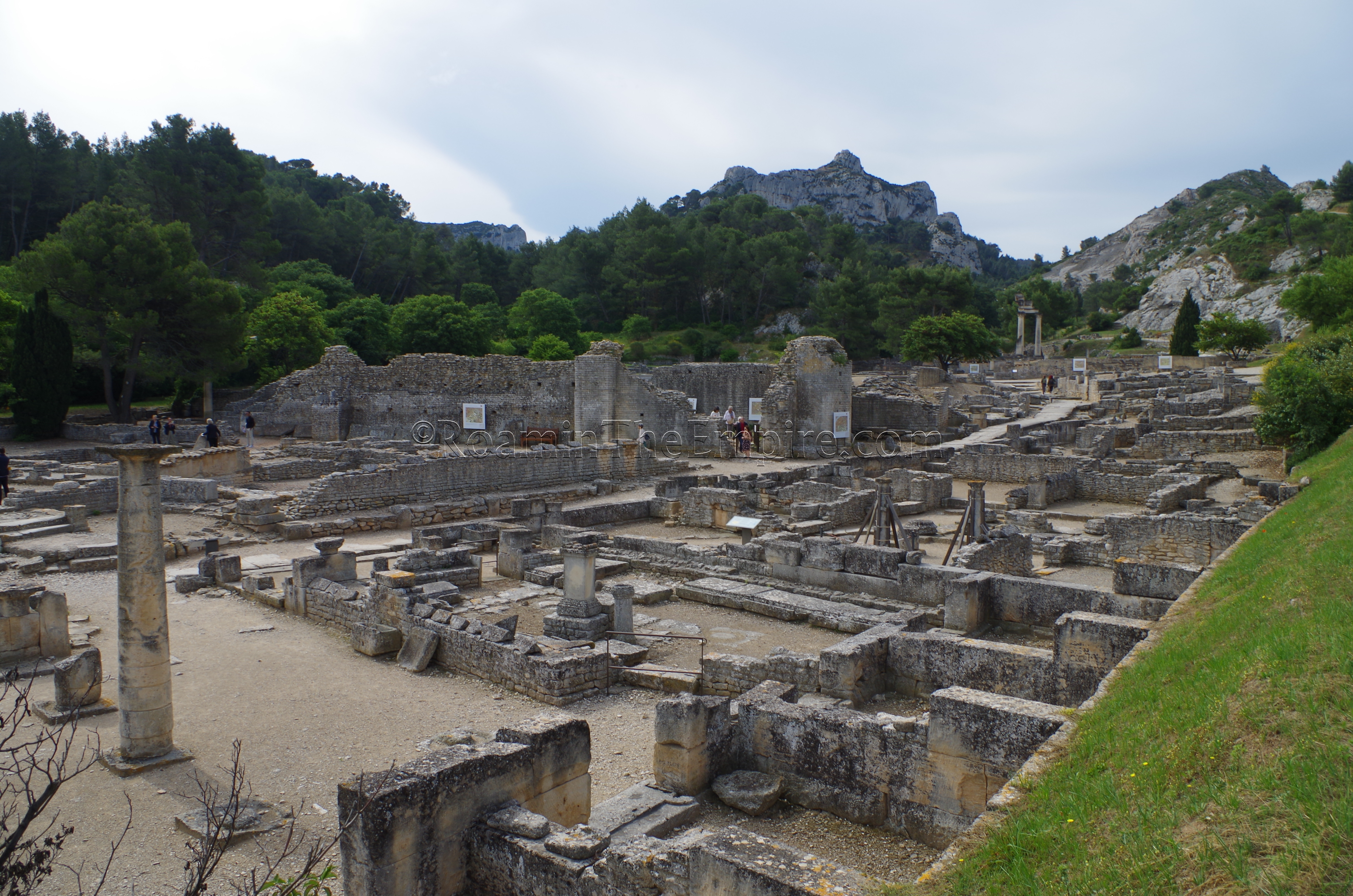
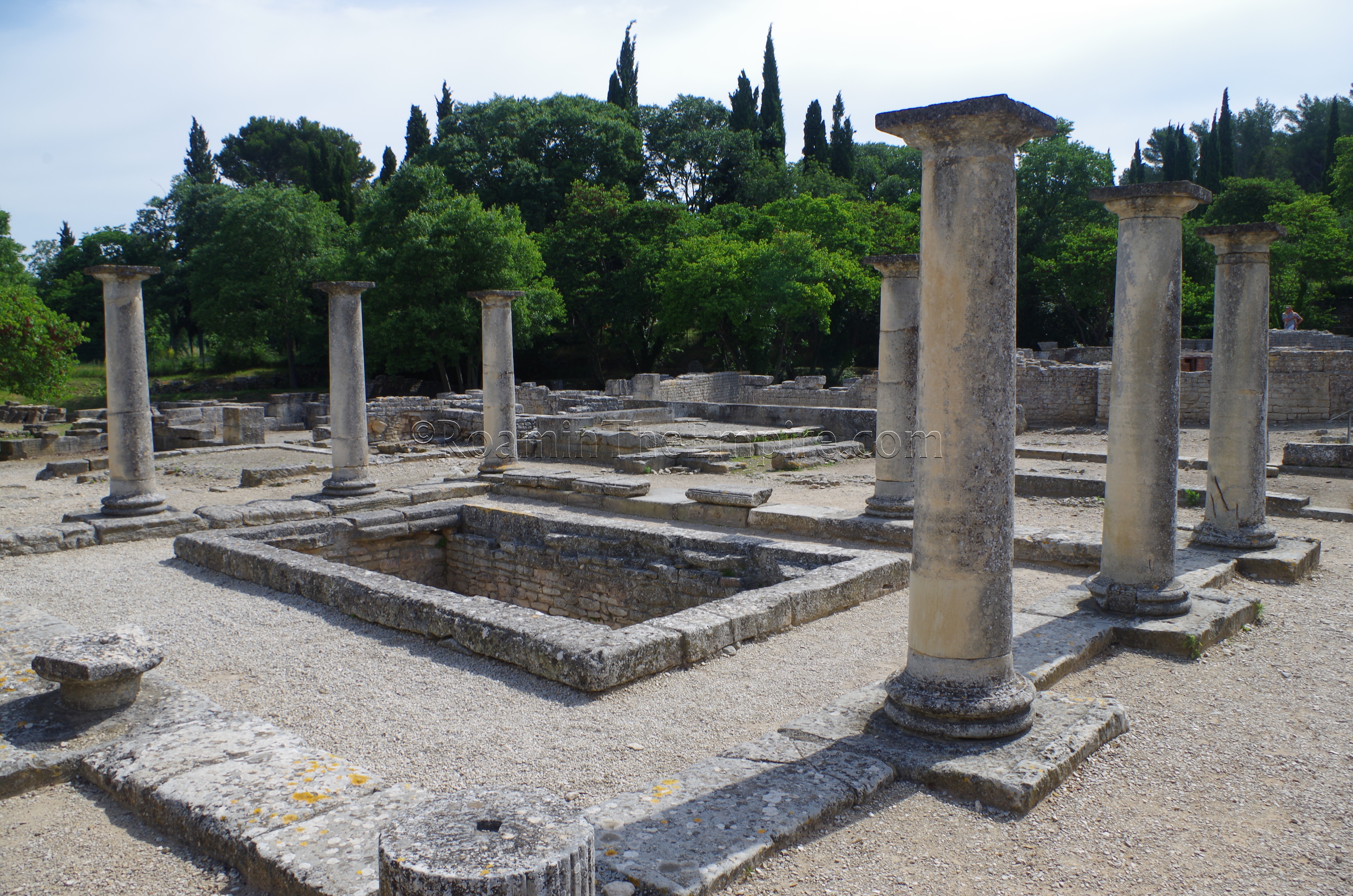
The best place to start when viewing the site is the north side, which is the closest part of the site to the entrance, but also thematically makes the most sense. There are few fragments of unidentified buildings on the slope as one descends down to the valley in which Glanum resides. This first, northern section of the city is referred to as the residential area. The cardo maximus starts here and bisects the site into east and west halves through most of it. The western part of the residential area consists mainly of a two residential buildings, the House of Antes in the north and the House of Atys in the south. There are various other fragments of domestic structures, particularly in the very north of the site, but these two are the most complete domestic structures in the area
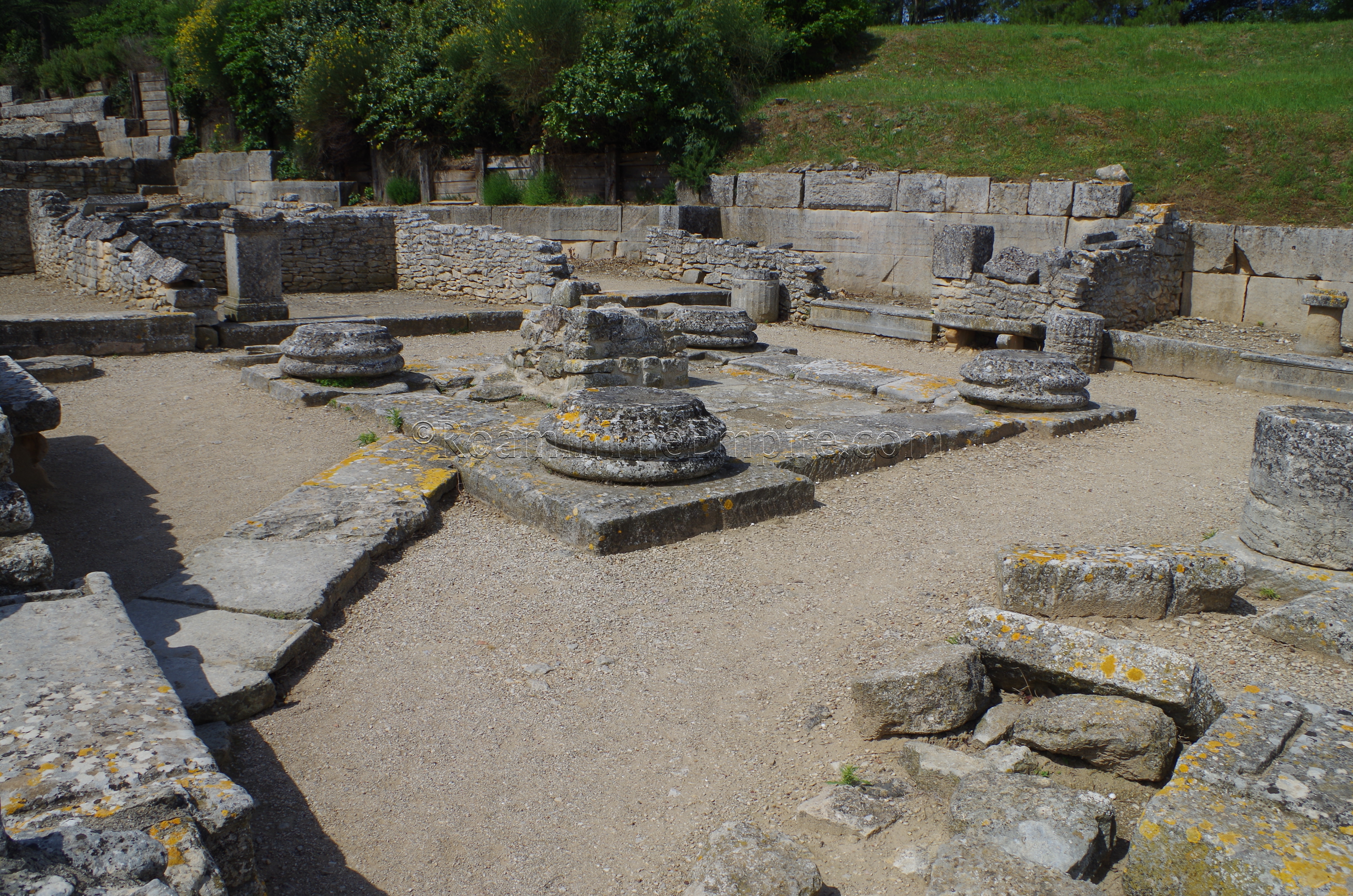
The House of Antes is a typical peristyle house that seems to have had Hellenistic origins, but was in use much later as well, with renovations in at least the Augustan period. Between the House of Antes and the House of Atys is a building that is identified as having been a market during the Gallo-Greek period. After the Roman occupation of the site, the building stopped being used as a market and was essentially divided up between the two houses. The half of the market adjacent to the House of Antes became a courtyard, while the half of the market adjacent to the House of Atys seems to have become a private cultic area. Dedications found there indicate worship of Bona Dea and/or Cybele there, and it is theorized that the House of Atys may have belonged to a priest or priestess associated with the cult of Cybele. The house’s name comes from a relief of Attis that was found there.
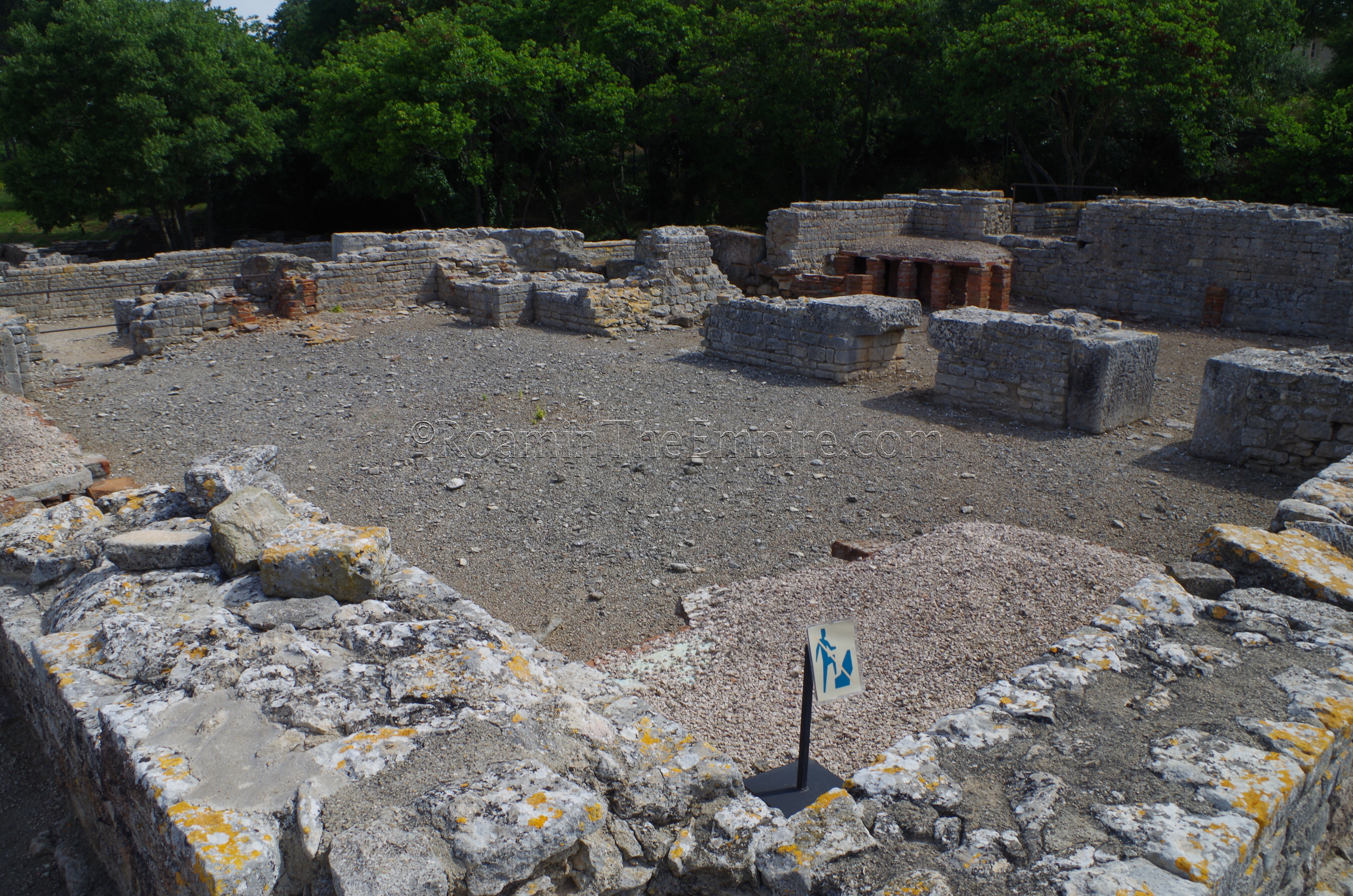
A bathing complex dominates the eastern side of the cardo maximus in the residential area. There are a few fragments of houses visible adjacent to it, though, including the House of Epona, a workshop area where an altar to Epona was found. Originally constructed around 75 BCE, these public baths underwent an extensive renovation in the 1st century CE. Reconstructed hypocaust systems in the corners of a few of the rooms help to identify the tepidarium and caldarium of the baths (the caldarium being closest to the road). Various channels and water features can also be seen within the baths. The natatio on the south side of the bathing complex was part of the original 1st century BCE plan, but was covered over when the palaestra was expanded in the renovation.
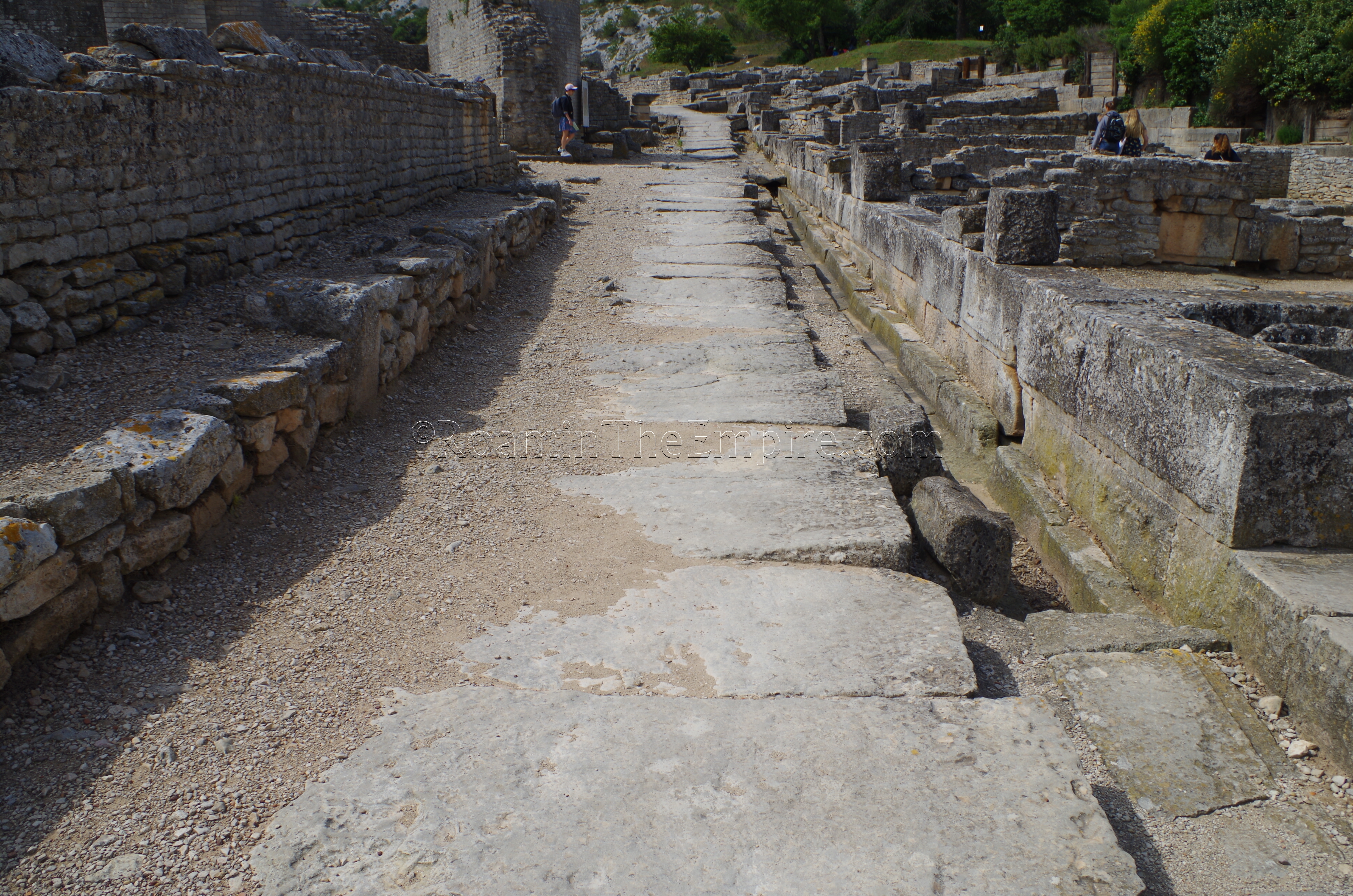
Just to the south of the baths, adjacent to the road, are the remains of a Hellenistic period house; the House of the Capricorn. So named because of a mosaic with an image of a Capricorn, most of the house was built over by the bathing complex and the curia, but a small section remains outside the footprint of both buildings, and has been excavated. The drainage system along the west side of the cardo maximus is best on display through the residential quarter, particularly opposite the bathing complex.
Sources:
Bromwich, James. The Roman Remains of Southern France: A Guidebook. London: Routledge, 1996.
King, Anthony. Roman Gaul and Germany. University of California Press, 1990.
Livy, Ab Urbe Condita, 5.34-35.
Pliny, Naturalis Historia, 3.5.
Smith, William. Dictionary of Greek and Roman Geography. Walton & Murray, 1870.
Stillwell, Richard, William L. MacDonald, and Marian Holland. McAllister. The Princeton Encyclopedia of Classical Sites. Princeton, NJ: Princeton U Press, 1976.


