Today’s post is another in the series that explores some of the smaller archaeological sites around Sardinia. This post focuses on an area generally defined as south-central Sardinia; essentially site in the modern provinces Medio Campidano, northern Cagliari, and southern Oristano. Many of the sites are fairly rural, so a car is absolutely essential in seeing most of them. Since they are relatively minor, for the most part, investing a heavy amount of time trying to visit by public transport (and likely a hefty amount of walking), isn’t exceptionally useful.
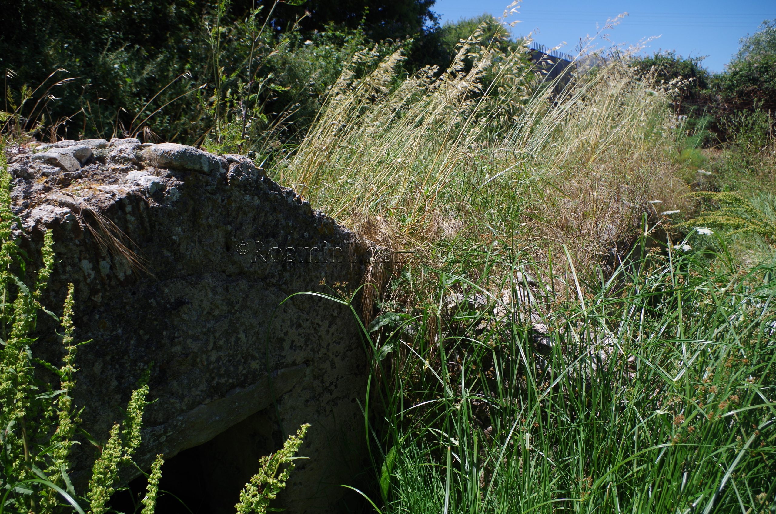
The first stop is near the town of Guspini, on a small side road off the SS126 between Guspini and Località Pip. Along this small road is the Mitza is Allinus, the source of the Allinus spring, or sometimes also called Sa Mitza de S’Abiu, the Source of the Alder, named after the alders present around it. The At the source of this spring, there are 3rd century Roman constructions built to harness the water source. The Mitza is Allinus infrastructure was used well into the medieval period. Unfortunately, when I visited in early June, the site had not been cleared of brush (an issue I frequently run into in Italy in early June), so it was quite difficult to see much of what was there. But there is a housing for the spring, which is still running, as well as a constructed channel leading north away from the fountain into a channel alongside the road.
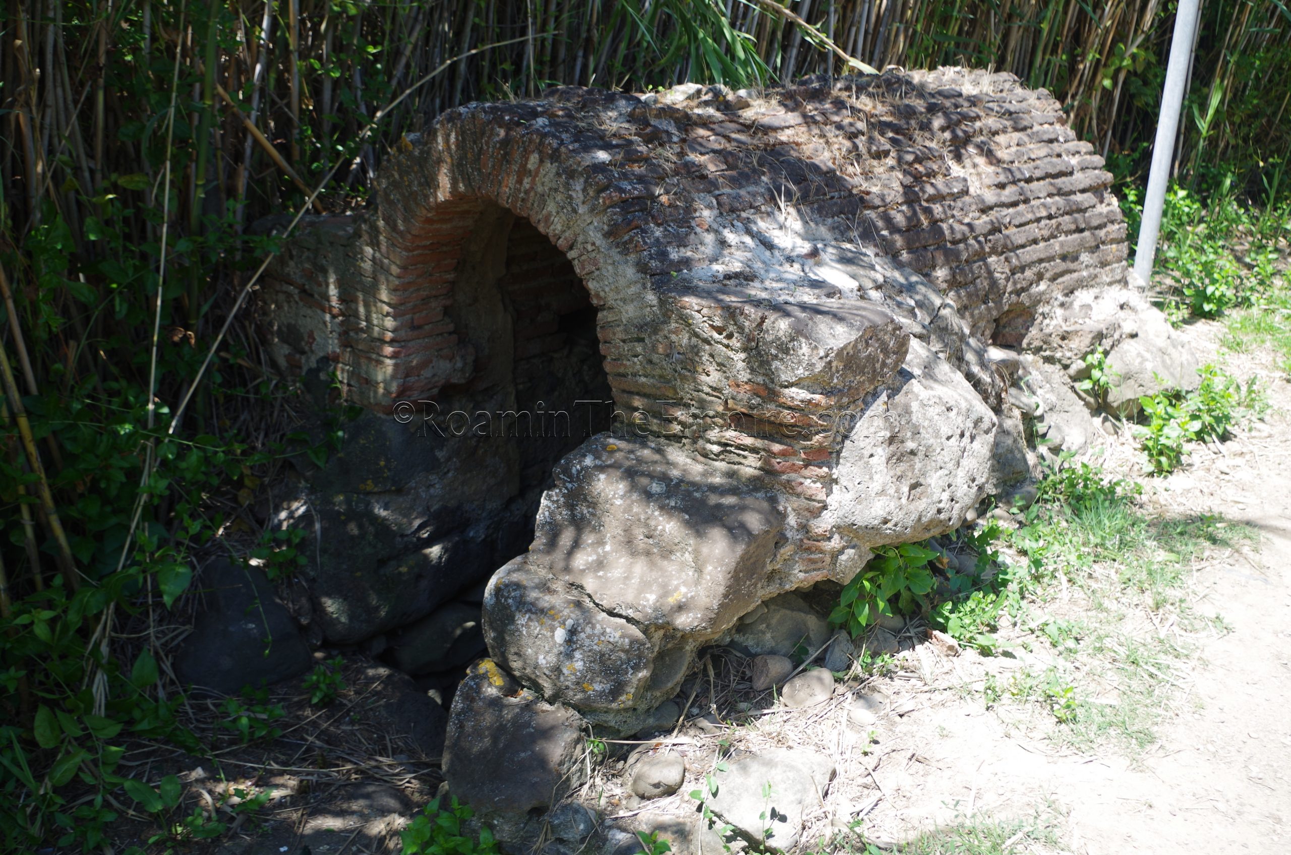
Only about 10 minutes up the road, in the town of Pabillonis, sit the remains of another Roman fountain/source; the Fonte Romana Sa Mitza. Unlike the Mitza is Allinus, which at least had a sign at the site, there isn’t much to distinguish the Sa Mitza site if one doesn’t know what they are looking at. All that is present at this location is the housing for the spring, which is no longer running. The spring seems to have been in use since the Nuragic period, though the housing is Roman in origin, of an indeterminate time period. Like the Mitza is Allinus, this is out in the open without any kind of access restrictions.
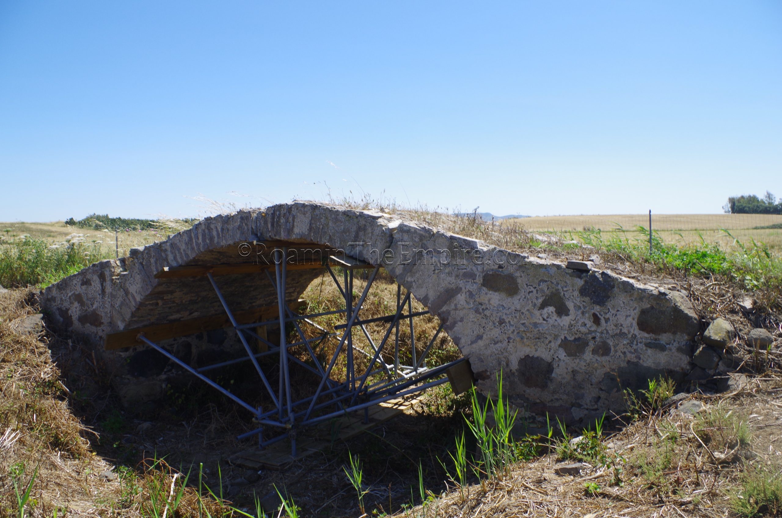
About 5 kilometers to the northwest of Pabillonis is the next site, the Sa Baronessa Roman bridge. This one is a bit difficult to get to as it requires travel on a dirt road that isn’t of the best quality. The easiest way to get to it is from the SP98. Coming from the north, there is a road on the left (Strada Consorile, heading south) just before the bridge over the Flumini Mannu. The bridge is located about 1.2 kilometers down this road. There were the remnants of a fence surrounding the bridge, but there was an improvised opening to allow access. The small, single arch bridge dates to the 2nd or 3rd century CE. The area around the bridge was fairly well cleared of brush, and a support structure was added to the arch in 2017 to prevent collapse.
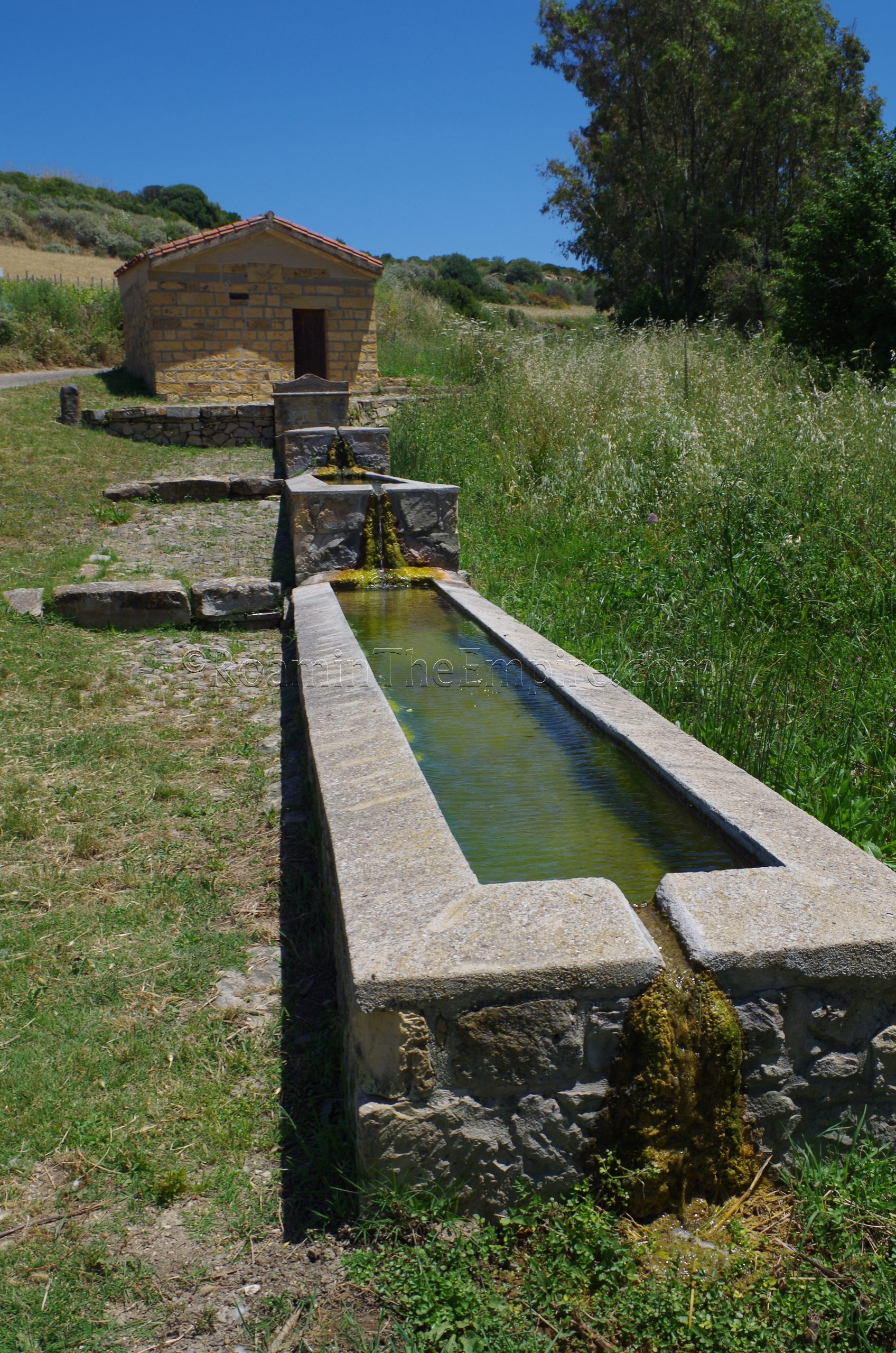
A short drive to the east, near the town of Collinas, are the Terme Romane Su Angiu. This site was apparently some sort of Roman baths built on the site of a sacred well, though all that really remains is a basin that is connected to the spring. Unfortunately, the basin and spring are housed in a building to which there is no access. The spring is still active, and all that can really be seen is a long channel with several rectangular pools that carries the spring water out of the building. From what I can tell, there is no way to gain access to the building; there’s no hours or contact information posted anywhere.
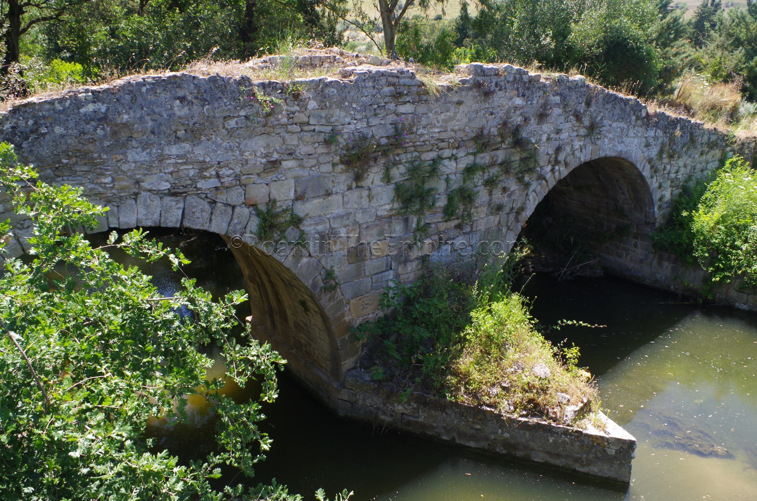
The next stop is a bit farther away, about 25 kilometers or roughly a half an hour of driving, near the town of Barumini. Outside of town to the southeast, along the aptly named Via Ponti, is a still functioning ancient bridge. The ancient bridge runs parallel, to the south, of the modern road and bridge over the stream. The bridge is called the Ponte Romano, but, there is some doubt as to whether the iteration standing today actually dates to the Roman period, or whether it is a medieval bridge constructed of Roman materials from an earlier Roman bridge. It is still structurally sound and can be used to traverse the river on foot. The Ponte Romano is constructed of two arches with a sharp breakwater facing north.
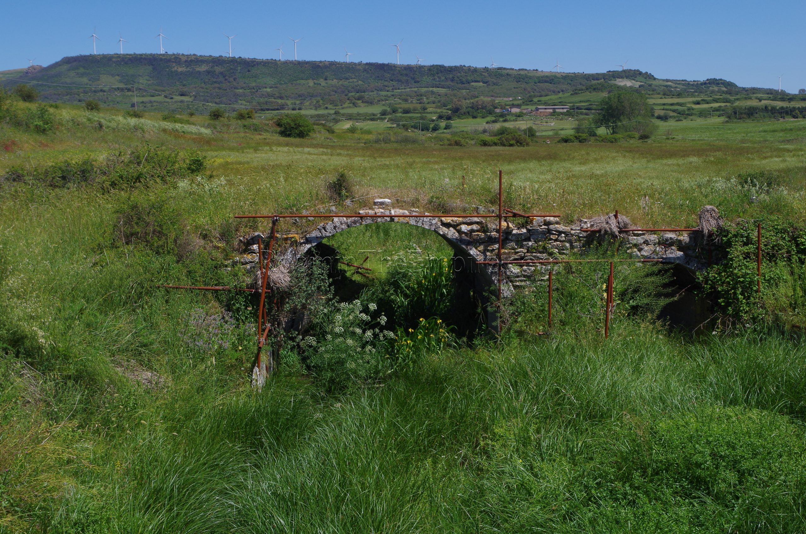
Another 20 kilometers from the Barumini bridge, is the Ponte Brabaciera near the town of Isili. East of Isili, in an agricultural area, the imperial era bridge spans a small stream. The bridge can be seen (to the east) from the road that passes by it, and there is a small dirt area to pull off the road, just north of the modern bridge over the stream. The state of preservation of the bridge is pretty poor. It has two arches of unequal size, but not much of the bridge remains above the larger of the two arches. Some scaffolding has been added in recent years to prevent the arches from collapsing. It was quite overgrown when I visited as well, though a sort of path had been clipped in the tall grass near the bridge. Some remains of the northeast-facing breakwater are also somewhat visible, though it had to be enclosed to prevent further damage.
A supposedly Roman bridge is noted a bit further to the east, near the town of Villanova Tulo. The remains of a bridge crossing the northern finger of the Lago Basso del Flumendosa is referred to as the Ponte Roman di Villanovatulo. Upon visiting the remains of this bridge (which requires scurrying under some railroad tracks to get to) I can state pretty conclusively that this is not, in fact, a bridge of Roman origin. The construction techniques are significantly more modern, and the sharp curve the bridge would have had (judging by the remains on each side of the river) is not consistent with Roman designs. I’m not sure how it would have gotten called a Roman bridge, as it does seem even more modern than medieval, which often get misnamed as being Roman. It’s an interesting bridge and area, but, it is definitely not Roman.
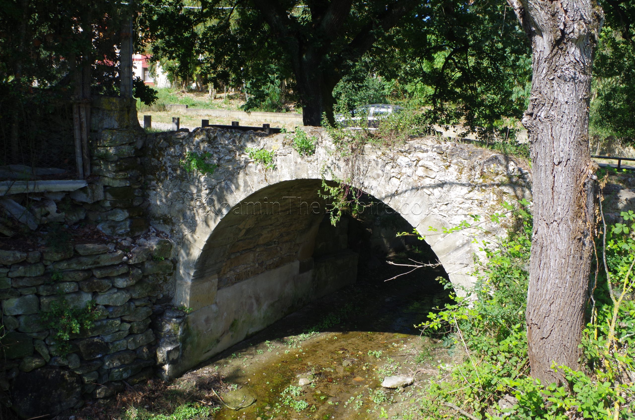
From Isili, the next site is back to the northwest, in the town of Usellus. On the northern outskirts of town, on a small road off the SP35, is the small, single arch Roman bridge over the Riu Spironcia/Su Forraxi River. In antiquity, Usellis was Colonia Julia Augusta Uselis, and this bridge carried the road between Uselis and Forum Traiani (modern Fordongianus) over the river. A pretty significant portion of the road (about 20 meters) remains south of the bridge. The paving stones survive on the road surface of the bridge as well. The external elements of the bridge arch have been reconstructed since antiquity, but the interior vaulting of the arch seems to be original Roman construction.
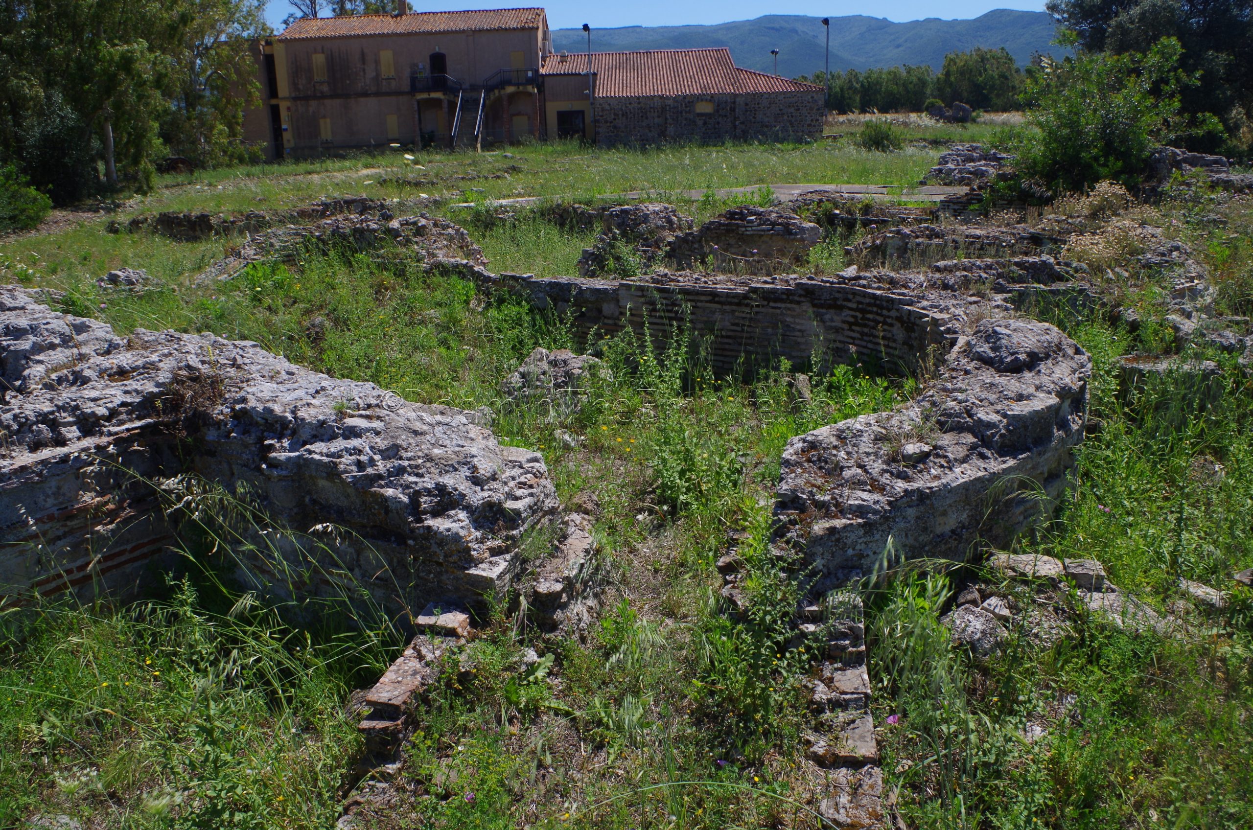
About half an hour to the west, in the small locality of Is Bangius is the Scavi Praetorium Muru De Bangiu. This set of remains is supposedly open by appointment on Saturday and Sunday between 15:00 and 18:00 according to a sign on site (347-109-1585), but the site itself and adjacent museum building looked pretty neglected, and wouldn’t be entirely surprised if that was no longer the case. The site is otherwise closed off and inaccessible, but can be viewed somewhat through the fence surrounding the site. Though the site is called a ‘praetorium’ (owing to an inscription found here with that term) it doesn’t seem to have functioned in the traditional usage of the word, but rather may have just been a generalized administrative center. Located along the road branching off the main Caralis–Turris Libysonis road to Forum Traiani, the remains consist primarily of a bathing complex, with the primary rooms located closest to Strada Consortile, the road that runs along the west side of the site.
The itinerary runs in roughly a circular route, ending up about 30 kilometers from the starting point. The total route is about 150 kilometers, or about 3 hours of drive time. Since many of the sites are pretty quick stops, the route could easily be done in a day, or perhaps even half a day with an early enough start.


