


Today located in the fertile region of modern Campania (but was in antiquity part of the region of Lucania), the city of Paestum was founded by Greek colonists as Poseidonia sometime in the middle to late 7th century BCE. Strabo claims that the colonists were Achaean settlers from Sybaris, a Greek colony on the toe of Italy. Conversely, Paestum may have been founded by Doric settlers from Sybaris, which had been founded by both Achaeans and the Doric Troezenians. Aristotle notes that the Troezenians were later expelled from Sybaris, which may have resulted in that group founding Poseidonia. The Roman writer Gaius Julius Solinus refers to Paestum as a city of Doric origin in the 3rd century CE. Repeated occupations and expulsions of the population in Sybaris by Kroton between 510 BCE and 440 BCE probably resulted in additional waves of migration to Poseidonia from Sybaris. In a turn, it may have been Poseidonia as the mother city that eventually founded a new Sybaris after the original location was given up.
Etruscan expansion into southern Italy extended to just a few kilometers from Poseidonia by the end of the end of the 6th century BCE, stopping at the Salarius (the modern Sele River). The city prospered through the 5th century BCE, in large part to the fertile agricultural hinterland of the city. It was conquered by the Lucanians at the end of the 5th century BCE and renamed Paiston or Paistos, from which Paestum would be derived. The Greeks and Lucanians lived together in relative harmony until 332 BCE, when at the behest of some of the Greek colonies of Magna Graecia, Alexander I of Epirus crossed to Italy to aid the Greeks against the Italic tribes, particularly the Lucanians and Samnites. A major battle was fought near Paestum that same year, resulting in a victory for Alexander I and a treaty with Rome. It also resulted in a brief period of independence for Paestum before Alexander I was killed in battle in 330 BCE and Paestum once again fell to Lucanian control.
Continued friction between the Greeks and the Italic tribes eventually brought the attention of the Romans, who became more involved in the conflicts of Magna Graecia. This in turn caused the Greeks to call on Pyrrhus of Epirus to aid them against the Roman interventions in 280 BCE. Paestum sided with Pyrrhus against the Romans, and as a consequence, came under direct Roman control following the end of the conflict. A Latin colony was established at Paestum in 273 BCE.
Paestum prospered under Rome. Apparently the roses of Paestum were especially famous and sought after even in Rome. Violets too, according to Martial. During the Second Punic War, the city refused to defect to Hannibal and was rewarded with being granted the right to mint its own coinage. Paestum received a colony of veterans of the fleet at Misenum around 71 CE, at which point the city had already achieved the status of Roman colony. The silting of the Salarius in the 1st century CE led to increasing outbreaks of malaria and a steady decline through the 4th century CE until its abandonment sometime after the 7th century CE.
Getting There: The modern town of Paestum is about a kilometer away from the archaeological site, but the train station for Paestum is located very conveniently next to the archaeological site, less than a 10 minute walk. Trains run pretty regularly between Naples and Paestum, typically about once an hour (you can check the schedules here). It’s about an hour to an hour and twenty minute ride, usually costing about 6.50 Euro each way. The return trip is a bit less regular, can include changes, and sometimes takes a bit longer. Some of the trains from Paestum to Naples are also coming from further south, and during the summer can be absolutely jam packed; literally shoulder to shoulder all the way from Paestum to Naples. Alternatively, there is some parking near the site if coming by vehicle, but it is all pay parking.
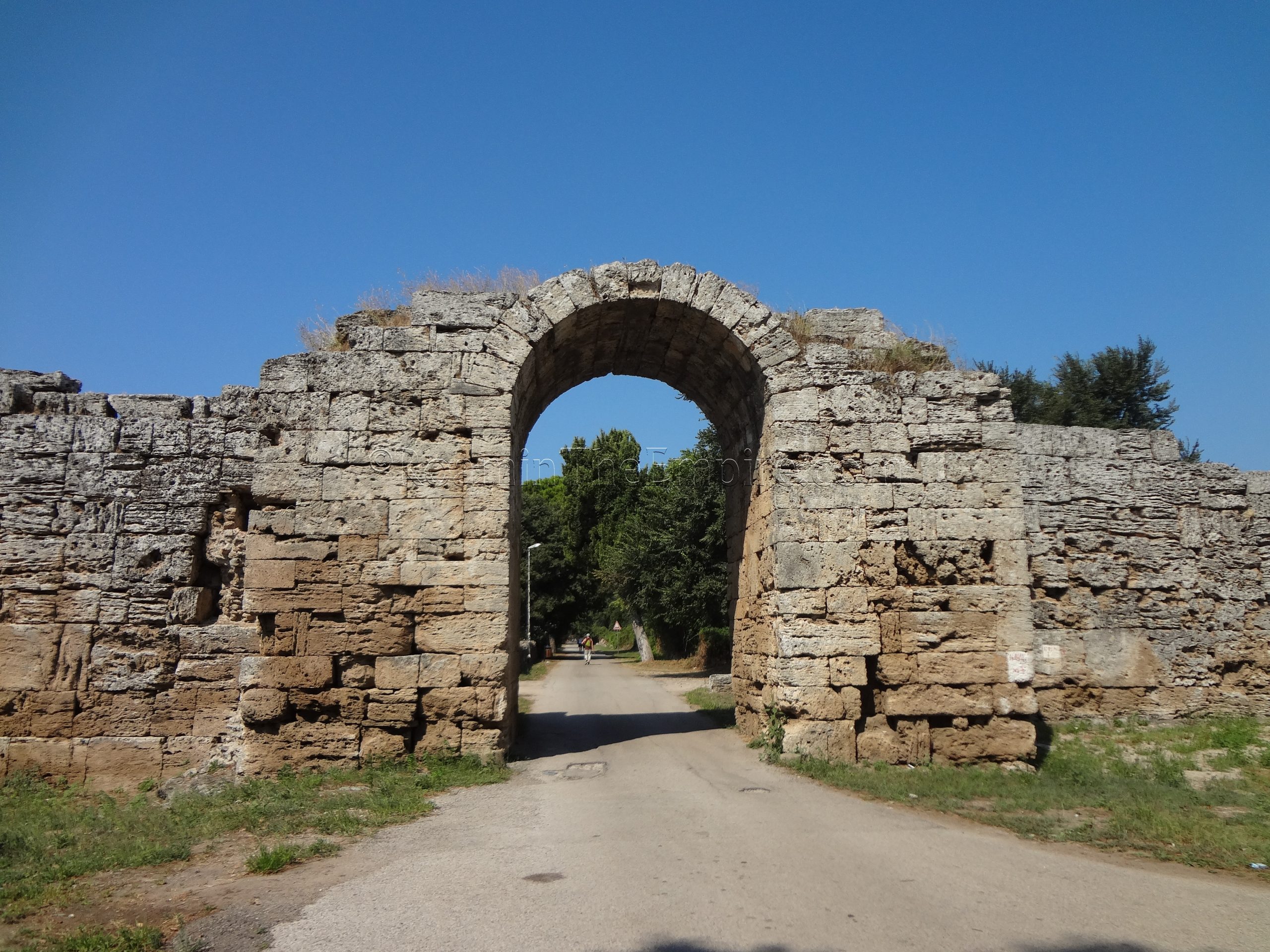
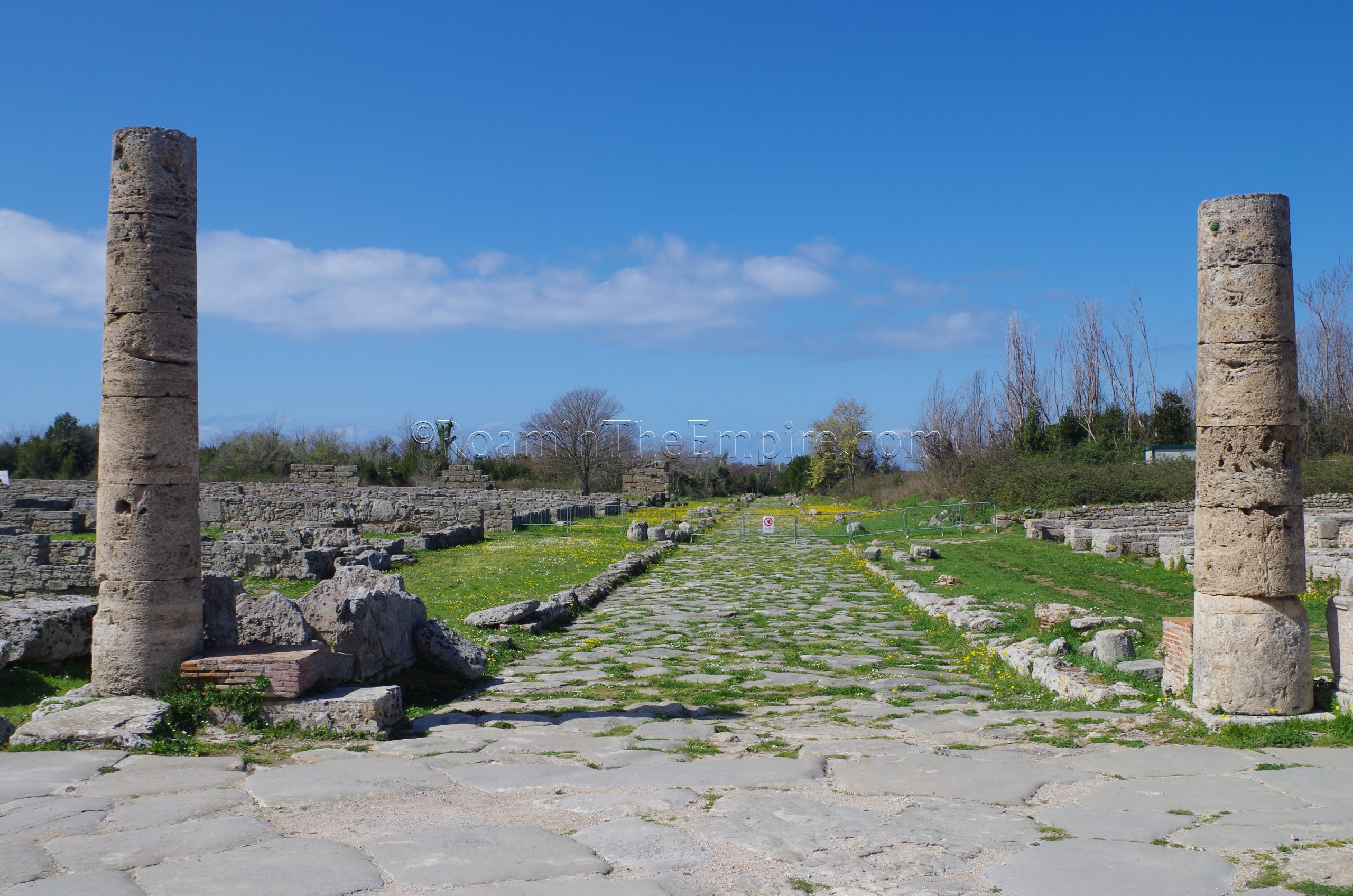
If coming by train, the Porta Sirena, one of the gates of Paestum, is less than 100 meters away from the train station, and must be passed through to get to the site. From there, a series of roads ring the nearly 5 kilometer circuit of the city walls, which are preserved to some degree for nearly the entire course. Additional towers can be seen at some intervals, as well as the remains of the additional gates located at the cardinal points of the encompassing walls. The Porta Marina, at the western extent of Paestum’s walls, is particularly well preserved and accessible. The walls seem to date to the Lucanian or Roman period.
Aside from the walls of the ancient city, nearly all the uncovered remains of Paestum are contained within the archaeological park. The Parco Archeologico di Paestum, located at Via Magna Graecia 917 (officially; the tickets must be bought at the museum located at this address, but the actual park entrance is about 75 meters north), is open every day from 8:30 to 19:30. The adjacent museum, included in admission, is open the same hours, but is closed on Mondays. The combined admission for the site and museum is 6 Euros. A cumulative ticket that includes entrance to the archaeological site of Velia, about 45 kilometers south, is 8 Euros. Admission to just the park when the museum is closed is 5 Euros, and in the event of the site closing for some reason, the museum only ticket is 4 Euros.
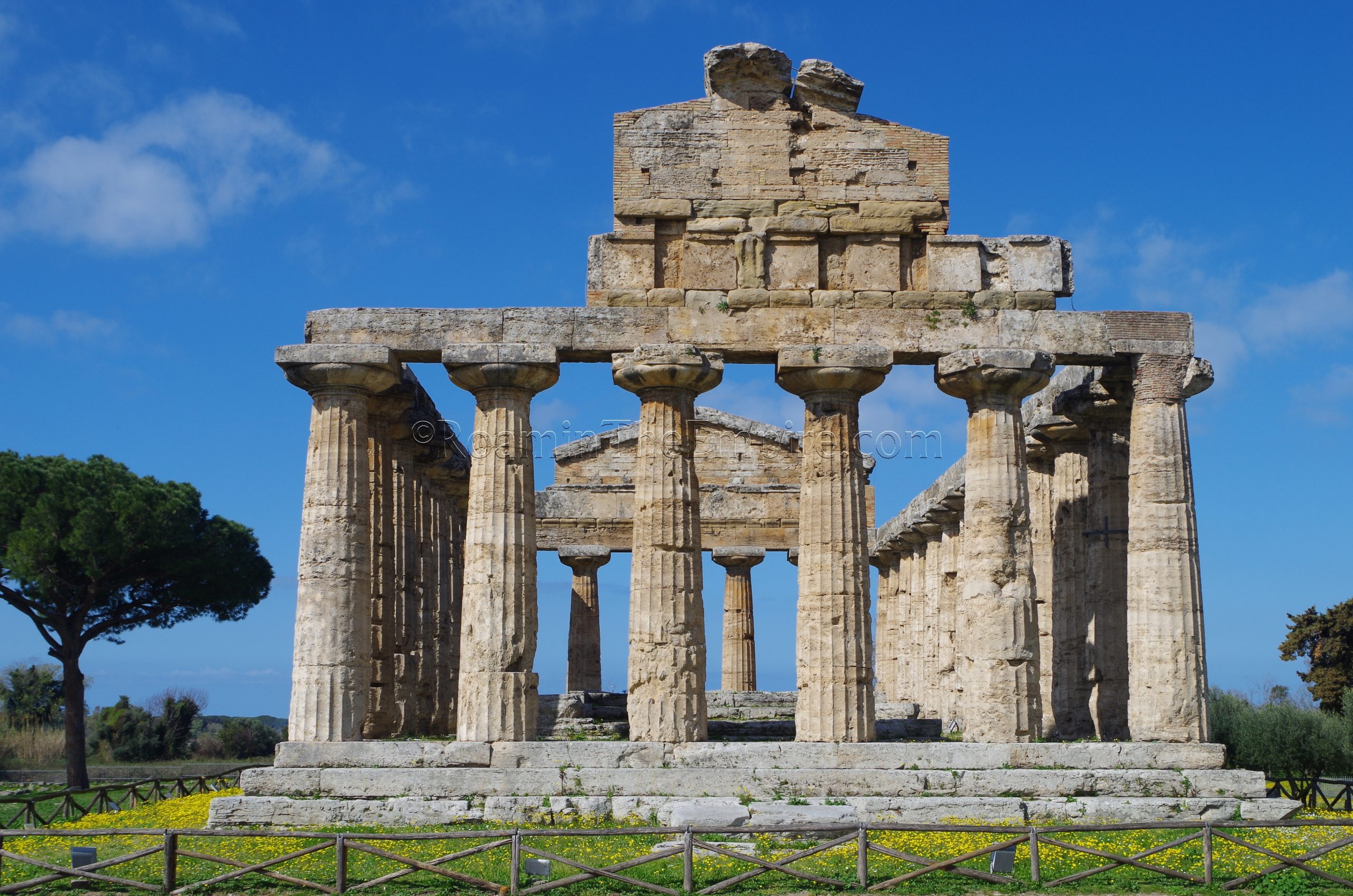
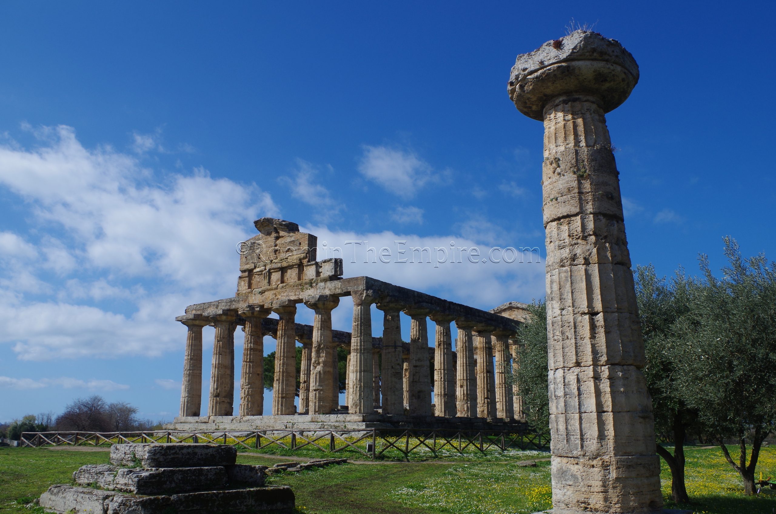
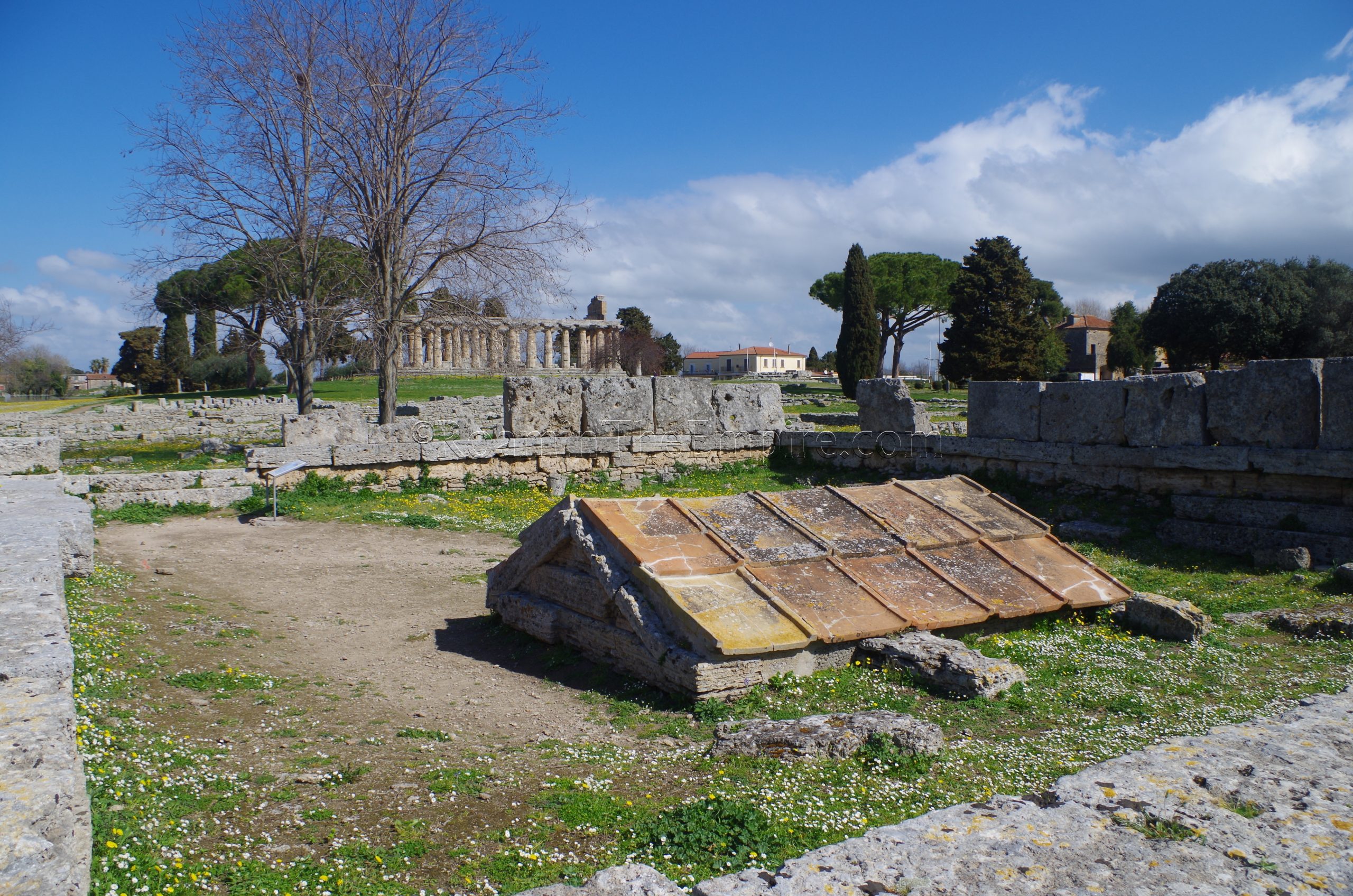
Temple of Athena
From the entrance, I generally take a counter-clockwise approach to seeing the site, which starts with northern sanctuary area and the Temple of Athena just past the ticket counter on the far north side of the site. Constructed around 500 BCE, the temple was originally thought to have been dedicated to Ceres and carried that name for some time before archaeological finds changed the theorized attribution to Athena (and Minerva in the Roman period). All the columns and part of the pediments are preserved, though the cella was almost completely removed when the temple was repurposed as a church in the 6th or 7th century CE.
In the vicinity of the Temple of Athena, just to the south, are the scant remains of the previous version of the temple, with some of the remains found here dating to about 580 BCE. Directly west of the Temple of Athena are remains of the temple’s altar, dated to the same period as the temple. North of the altar are a grouping of remains that are identified as two small temples or shrines, as well as some column bases associated with those. The dedication of these structures seems to be unknown.
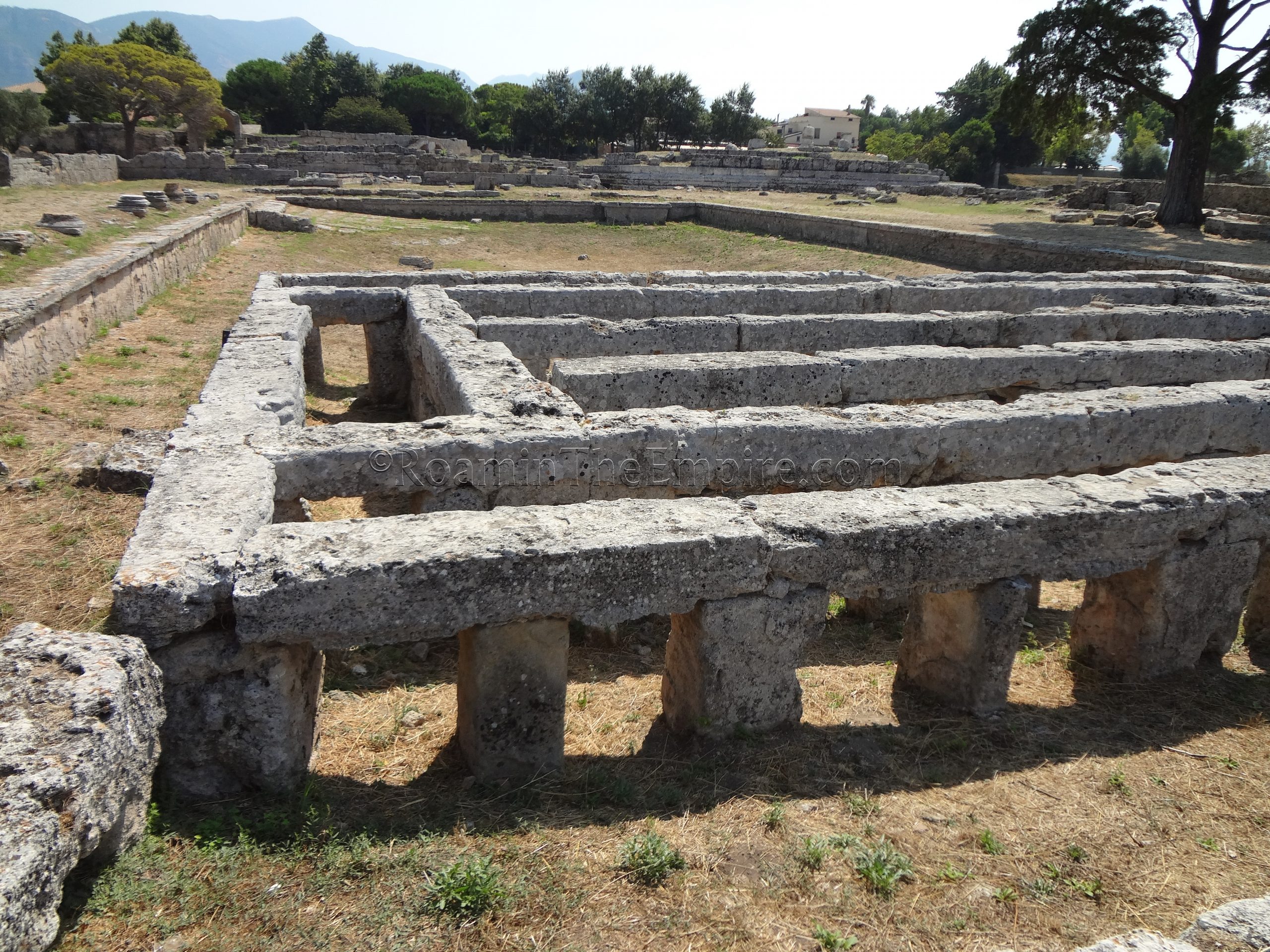
East of the Temple of Athena are some non-descript residential structures, and heading down the southeast path from the temple takes one into an area of more of these residential structures flanking a Roman-era road. This stretch of road, part of the Via Sacra (also the cardo maximus), seems to have been constructed at the establishment of the Latin colony in 273 BCE, and that there was no Greek road preceding it. The area east of the Via Sacra made up the northern part of the Greek city’s agora, which was built up into a residential area after the Romans took control of the city and the forum was established further south.
Among these residential structures immediately east of the Via Sacra, is one vestige of the Greek agora, the Heroon. Constructed sometime between 520 BCE to 510 BCE, the Heroon was a cultic shrine/symbolic tomb dedicated to a hero, probably the founder of Poseidonia in this case. Following the Roman acquisition, the shrine was buried and walled in. Though it was no longer in use, the Romans seemed to have respected the sanctity shrine for the most part, not building over it as was the case for most of the rest of the area.
The northern stretch of the Via Sacra takes an abrupt turn to the west as it reaches the southern part of the agora and the area of the Roman forum. Residential structures, some of them large Roman-style houses, dominate nearly everything east of the Via Sacra for the remainder of its course through the archaeological area. One of the great things about Paestum, is that many of these residential buildings are fully accessible. Some particularly large atrium houses line the western side of the north part of the forum area.
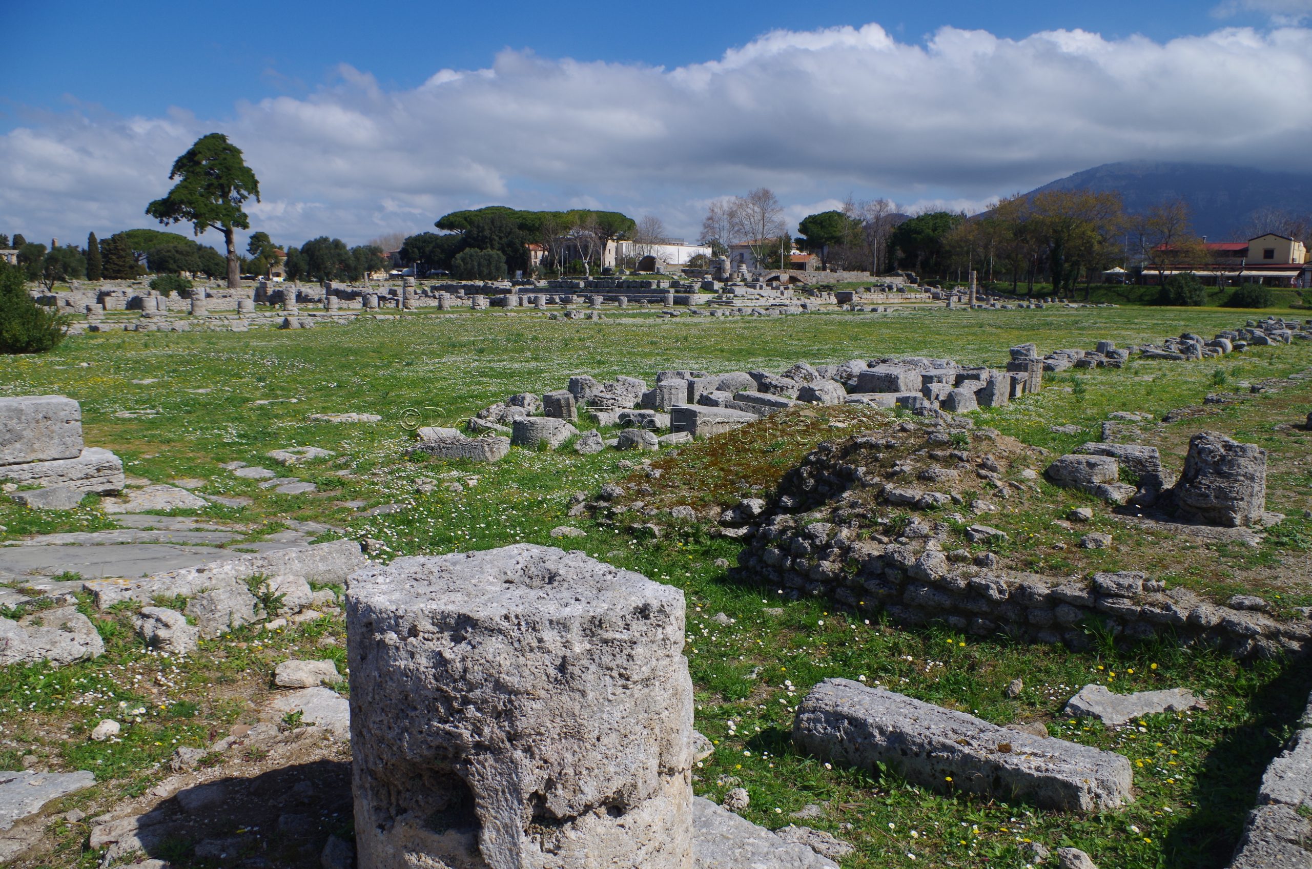
Forum
The very northern extent of the forum seems largely bereft of visible remains. Some scant traces of a portico that lined the northern side of the forum area are visible. This portico essentially stretched along the entirety of the northern border, from where the Via Sacra enters the forum all the way east to the amphitheater. South of that was a temple that was probably dedicated to the imperial cult, though, it can be difficult to make out from ground level.
The first major set of remains encountered in the northwest part of the forum is the so-called gymnasium, also referred to as the Piscina di Venere. The interesting looking structure seems to have been the central element of a sanctuary to Fortuna Virilis during the Republican period. The structure is what it looks like, a pool with a wide sloping ramp at the east end. The support beam structures on the west end apparently were used to prop up wooden planks on which a cult statue of Venus would have been placed. During the Veneralia, a festival to both Venus and Fortuna Virilis, women would bath in the pool as part of a fertility ritual. The pool was built over during the imperial period and the site was used as part of the complex for the imperial cult the previously mentioned temple was connected to.
South of the imperial cult area are a series of tabernae that opened out onto the portico that surrounded the actual open area of the forum. The larger structure with an apsidal northern wall, at the western end of this row of tabernae is identified as the seat of the collegia of the Augustales. Adjacent to that structure, on the west end of the forum, is the shrine of the lares publici. This structure was built in the late 2nd century CE, replacing an existing taberna. The raised area of the forum directly in front of these building also seems to be associated with it. Flanking the shrine are buildings that probably served as governmental offices.
Directly behind the lararium and these offices is one of the more noteworthy residences, the House of the Marble Impluvium. As the name suggests, the defining feature is the intact marble impluvium in the atrium of the house. Built during the imperial period, the house has the typical atrium layout, as does its neighbor to the west, though that house doesn’t have quite as lavish an impluvium and is a bit smaller.
Continuing along the west end of the forum toward the south, another row of tabernae flanks this southern extent of the actual forum. At the east end of the row of tabernae is the curia, sometimes also described as being a basilica. The curia seems to have been constructed in the early imperial period, perhaps in the early 1st century CE.
At the southwestern corner of the forum, the paved portion of the Via Sacra picks back up. Running west from the forum is the similarly paved decumanus maximus. The southwestern quadrant of this intersection for the remainder of the archaeological park, is taken up mostly by Hellenistic and Roman residential buildings. These are certainly worth exploring, as there are more interesting examples of domestic structures. The so-called Hellenistic Swimming Pool and a house with a large peristyle (which is right next to the Via Sacra) are also among these structures. The farthest western housing block had been closed off on my most recent visit, so it may not be possible to see some of these.
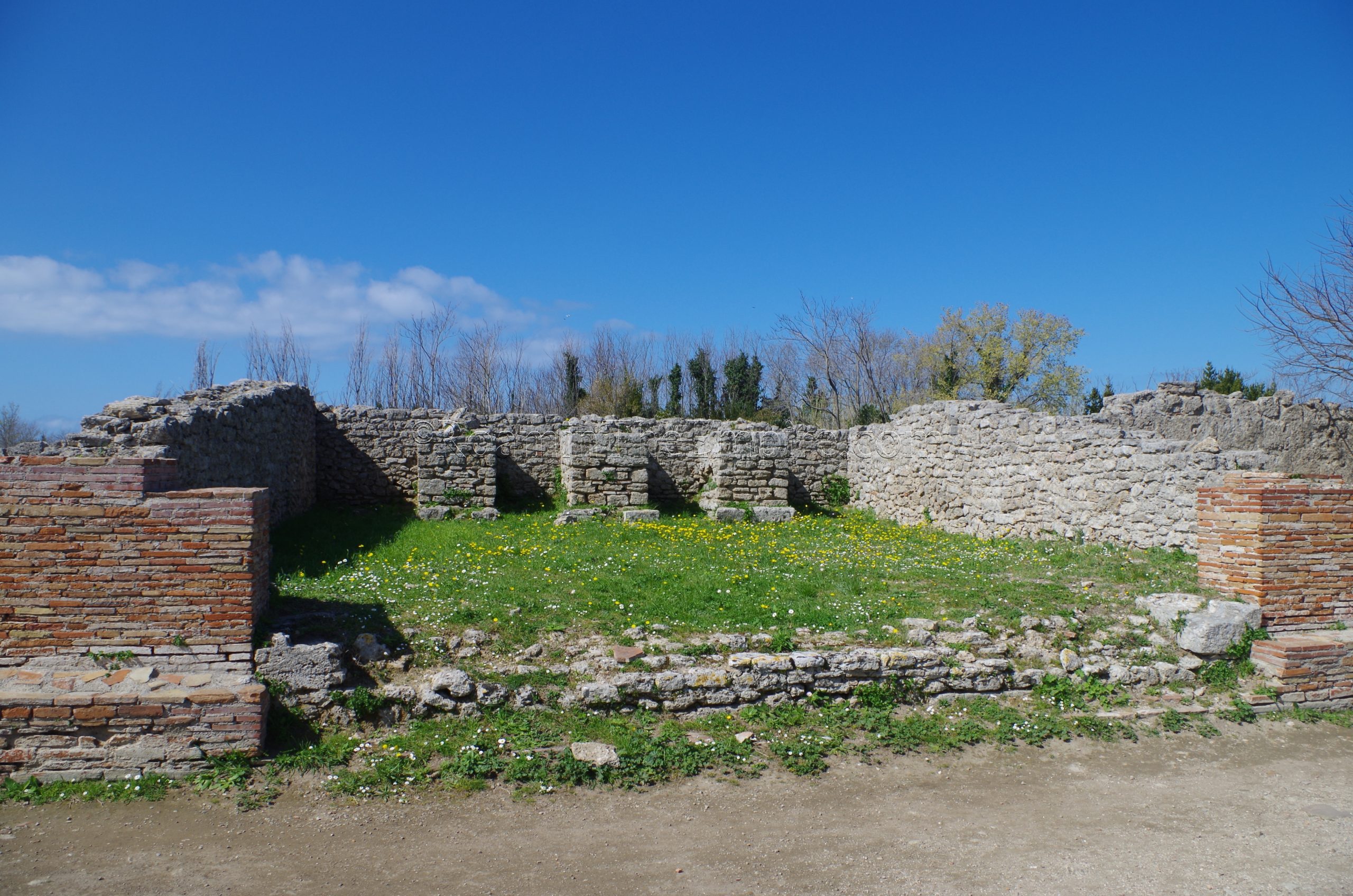
On the east side of the Via Sacra, south of the forum and behind the tabernae, is a bathing complex. There are some robust walls visible, but, there is not much in the way of discernible features of the baths. Portions of it seem to be only barely excavated as well. As such, there’s not even much to denote what’s actually here, despite the fact that baths are typically big draws at sites.
Immediately south of the baths are a series of three small temples at the northern part of the southern sanctuary. Two of these temples are oriented east-west, while the third and southernmost is oriented in a north-south direction. The northern most of these temples is the Temple of Magna Mater. South of that is the Temple of Victory. Finally, the southernmost of the three temples is the Temple of Demeter. The Temple of Demeter seems to date to the 5th or 4th centuries BCE, while the other two date to the Roman period.


Sources:
Aristotle. Politics, 5.1303a
Grant, Michael. A Guide to the Ancient World: A Dictioniary of Classical Place Names. New York: Barnes & Noble Books, 1997.
Halloway, R. Ross. “The Tomb of the Diver.” American Journal of Archaeology, vol. 110, no. 3, 2006, pp. 365-388.
Livy. Ab Urbe Condita, 8.17.8.
Martial. Epigrams, 9.26.
Mello, Mario. “Paestum: A City, a Civilization, a Heritage.” The Journal of Aesthetic Education, vol. 19, no. 1, 1985, pp. 9–22.
Ovid. Metamorphoses, 15.680.
Scullard, H. H. A History of the Roman World 753 to 146 BC. London: Routledge, 1991.
Solinus, Gaius Julius. De Mirabilibus Mundi, II.
Stillwell, Richard, William L. MacDonald, and Marian Holland. McAllister. The Princeton Encyclopedia of Classical Sites. Princeton, NJ: Princeton U Press, 1976.
Strabo. Geographica, 5.4.13.
Vergil. Georgics, 4.116.
Welch, Katherine E. The Roman Amphitheatre: From Its Origins to the Colosseum. Cambridge University Press, 2007.