Most Recent Visit: June 2023
The area of the Roman settlement of Aquincum was inhabited prior to Roman conquest by Eravisci (also referred to as the Aravisci), a Celtic people. The Celtic cultural influence is evident in archaeological remains, though Tacitus claims that they are related to the Osii, a group he labels as Germanic that lived on the opposite bank of the Danubius (modern Danube) and to the north. The Eravisci had a settlement on the site of Aquincum that seems to have been called Akink, or abundant waters in their Celtic dialect; perhaps a reference to nearby thermal springs. Though the exact timing is not clear, the territory of the Eravisci seems to have been brought under Roman control by 12 BCE.
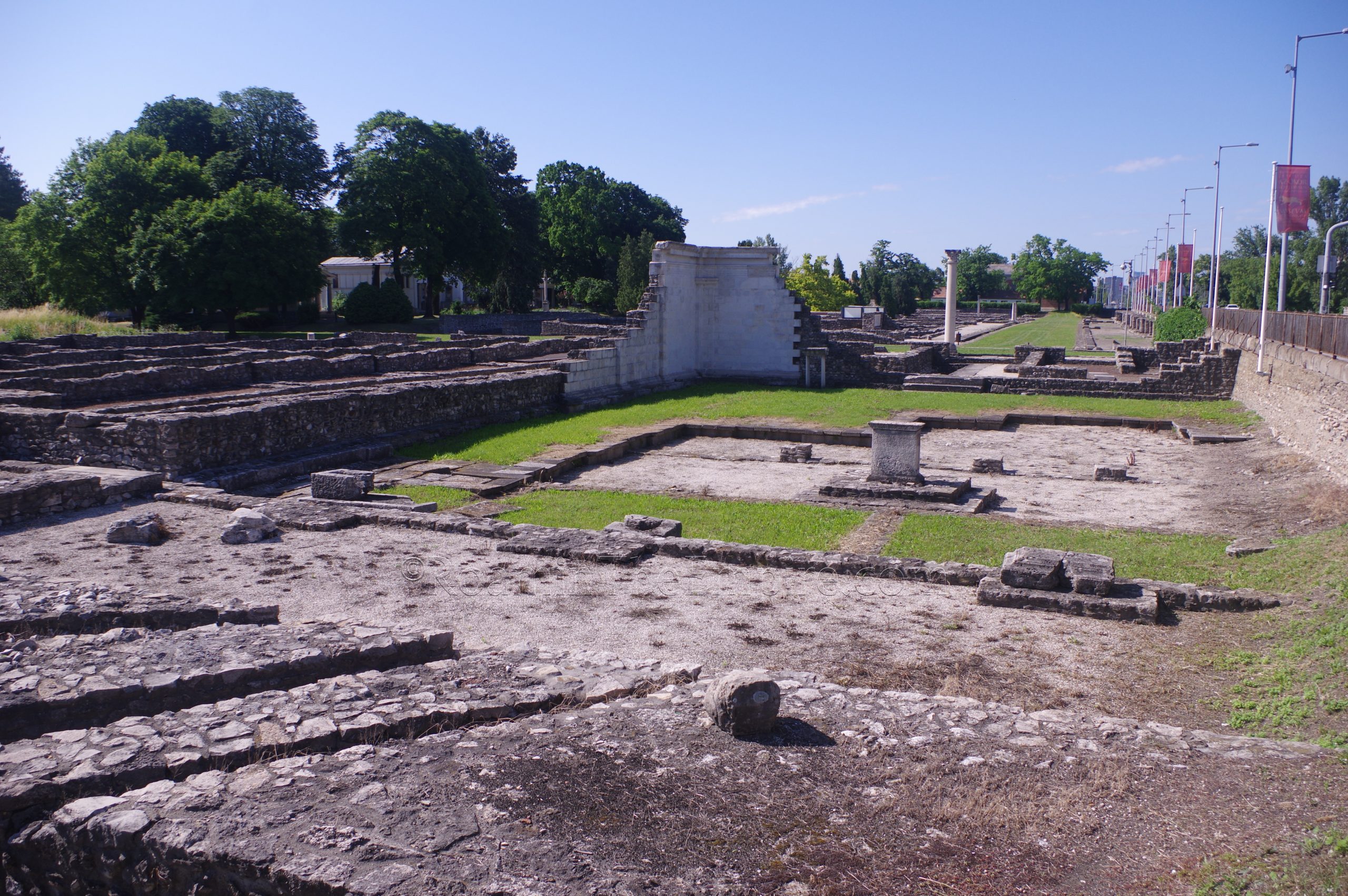
An important crossing point of the Danubius, and thus an important point along the Danubian Limes, there was military presence in the form of an ala camp by the time of Tiberius. Under Domitian, a permanent legionary castrum was constructed about 2 kilometers south of the civilian settlement of Aquincum, in the modern neighborhood of Óbuda. A canabae would have started developing around the castrum, and it was probably after this point, in the late 1st century CE that the civilian settlement really started to take shape and grow. The province of Pannonia, established in 20 CE, was subdivided into Pannonia Superior and Pannonia Inferior in 106 CE, with Aquincum becoming the capital of the latter following the split. In 124 CE, during the reign of Hadrian, who had previously become the first governor of Pannonia Inferior from 106 to 108 CE, the civilian settlement of Aquincum was given municipium. Around this time, following their participation in the Dacian Wars, Legio II Adiutrix was stationed at the castrum of Aquincum. In 194 CE, following the Marcommanic Wars, the city was elevated to colonia.
Around the time of the civilian city’s elevation to colonia, two military forts were constructed on the eastern bank of the Danubius; one across from the legionary castrum, called Transaquincum, and another about 5 kilometers farther south called Contra-Aquincum. This was located roughly at the location of the present-day Erzsébet Bridge in the central part of modern Budapest.
Sometime around 260 CE, the city seemed to have suffered some significant damage in a raid, but was able to largely recover. Throughout the 4th century, however, Aquincum came under almost constant threat from the Sarmatians. By that point, the capital of Pannonia Inferior had been moved to Sirmium. In the final years of the 4th century CE, the legionary garrison at Aquincum was moved to Gaul and the city was effectively abandoned by the Roman state; while the population continued living there, it was no longer under the administration of the Roman Empire. Germanic and Hunnic groups took control of the area in the early years of the 5th century CE.
Getting There: Aquincum is located in the suburbs of Budapest, or more accurately, the suburbs of the Buda part of Budapest. Both the civilian and military settlements are located right along the H5 commuter rail line that runs along the west bank of the Danube River. The easiest place to pick this up from central Budapest is at the Margit Bridge, which is well connected by bus and tram (and a metro line not far off) from elsewhere in the city. From there most things are walkable. I walked between the civilian settlement and the remains of the military camp, as there are a few things along the way and it’s only a couple of kilometers.
I first visited Budapest and Aquincum in the summer of 2012, but only saw the main archaeological area and museum of Aquincum. It was my second summer traveling in Europe and I was still a few years off from the intense, detail oriented visits that I would come to develop when going to see a city with this kind of archaeological heritage. And after I got that mindset, I always looked at some of my earlier destinations with a bit of a view toward some unfinished business. While I had already visited, I felt like I had missed quite a bit and it would definitely necessitate another visit in the future. As such, I was able to have a much more thorough stop in Budapest over a decade later in 2023.
The most logical way to see the remains of Aquincum, which actually stretch over quite a distance from the civilian settlement to the remains of the Contra-Aquincum fort, is to just kind of start on one end. I used my usual strategy of starting at the farthest point, which would have been the northernmost point, the civilian settlement of Aquincum, and then working my way back. The itinerary works just as well in reverse, though.
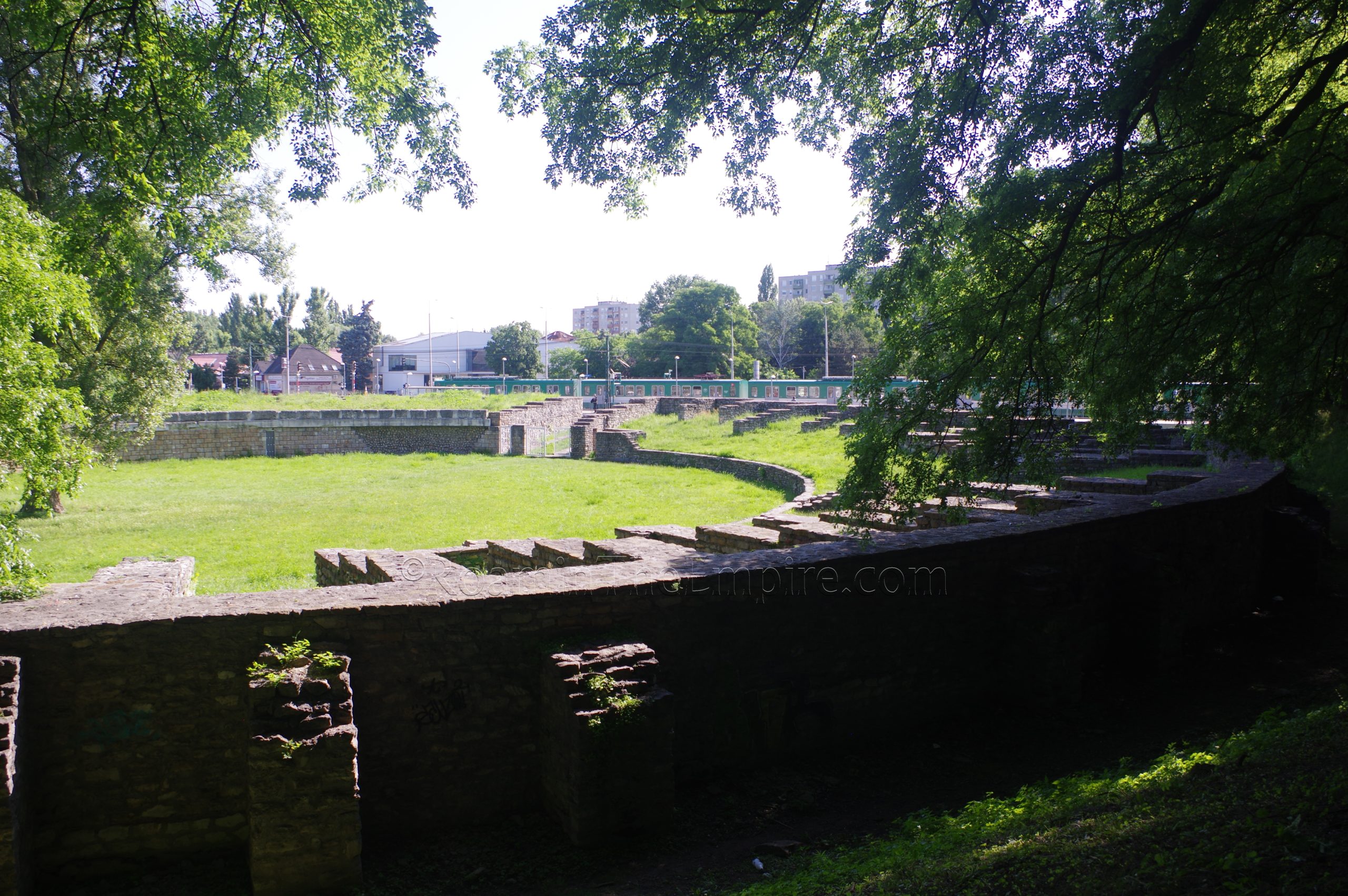
The first spot to start off is essentially the archaeological park, though there are a few things adjacent to the park to the north worth seeing, right near the commuter rail stop of Aquincum. Just to the west of the stop, and on the west side of the thoroughfare that runs through there, Szentendrei út, is the civilian town’s amphitheater, one of two in the area. This is the smaller of the two with dimensions of about 86.5 meters by 75.5 meters. Initially constructed in the mid-2nd century CE, it was built using a method of earth filled in between stone walls to achieve the primary walls of the structure. Throughout the 3rd century CE, the amphitheater underwent several renovations. A shrine to Nemesis has been identified on the south side of the western entrance. It is estimated to have held between 6,000 and 7,000 spectators.
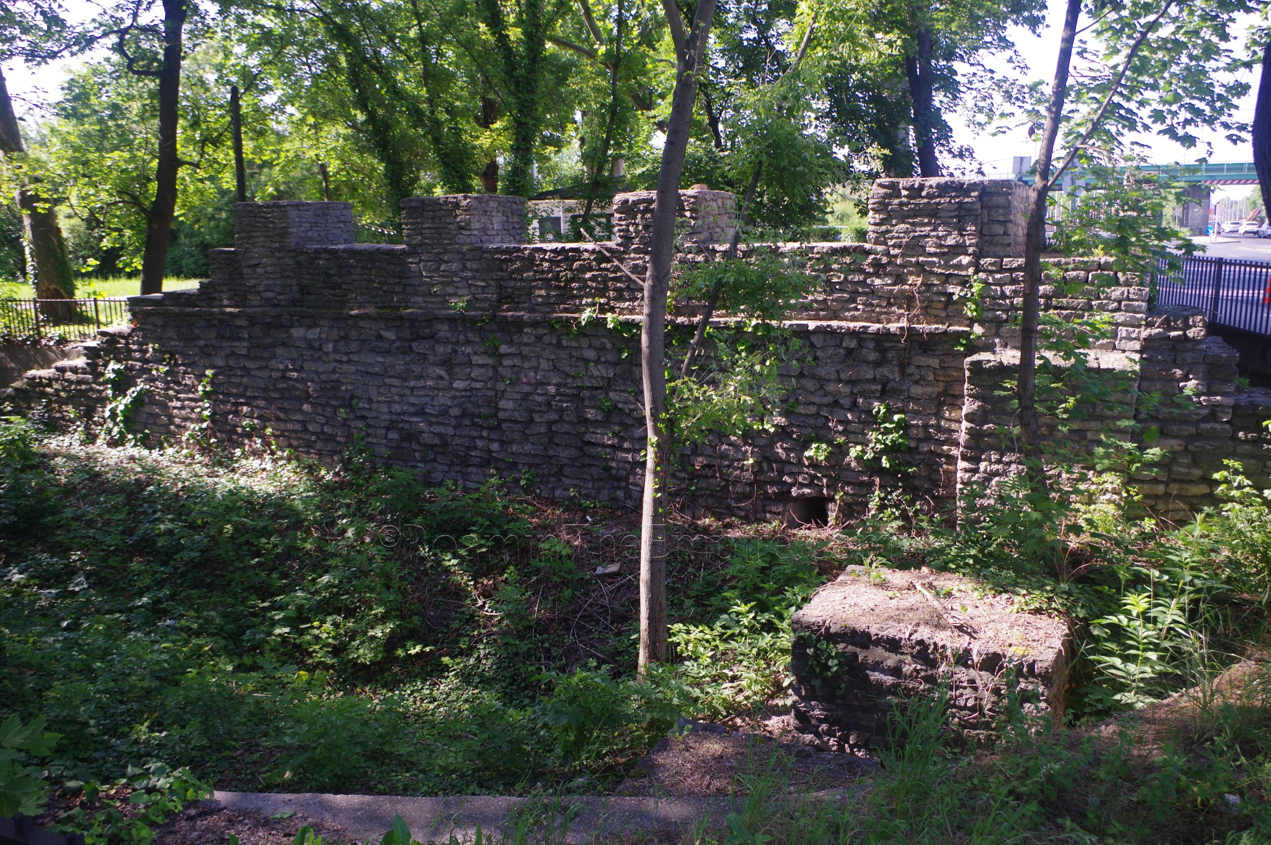
Heading across the street to the east is the Ókori Rom, the remains of where an aqueduct leading into Aquincum passed over the northern circuit of the city walls. A small portion of the actual walls are preserved with the channel of the aqueduct traversing it at the corner of Szentendrei út and Pók u. The aqueduct of Aquincum was a total of about 5 kilometers in length. It started at the source, a series of springs located about a kilometer north of this point, and ran through the civilian town and south to the military fortress where it terminated. It was likely constructed during the reign of Trajan.
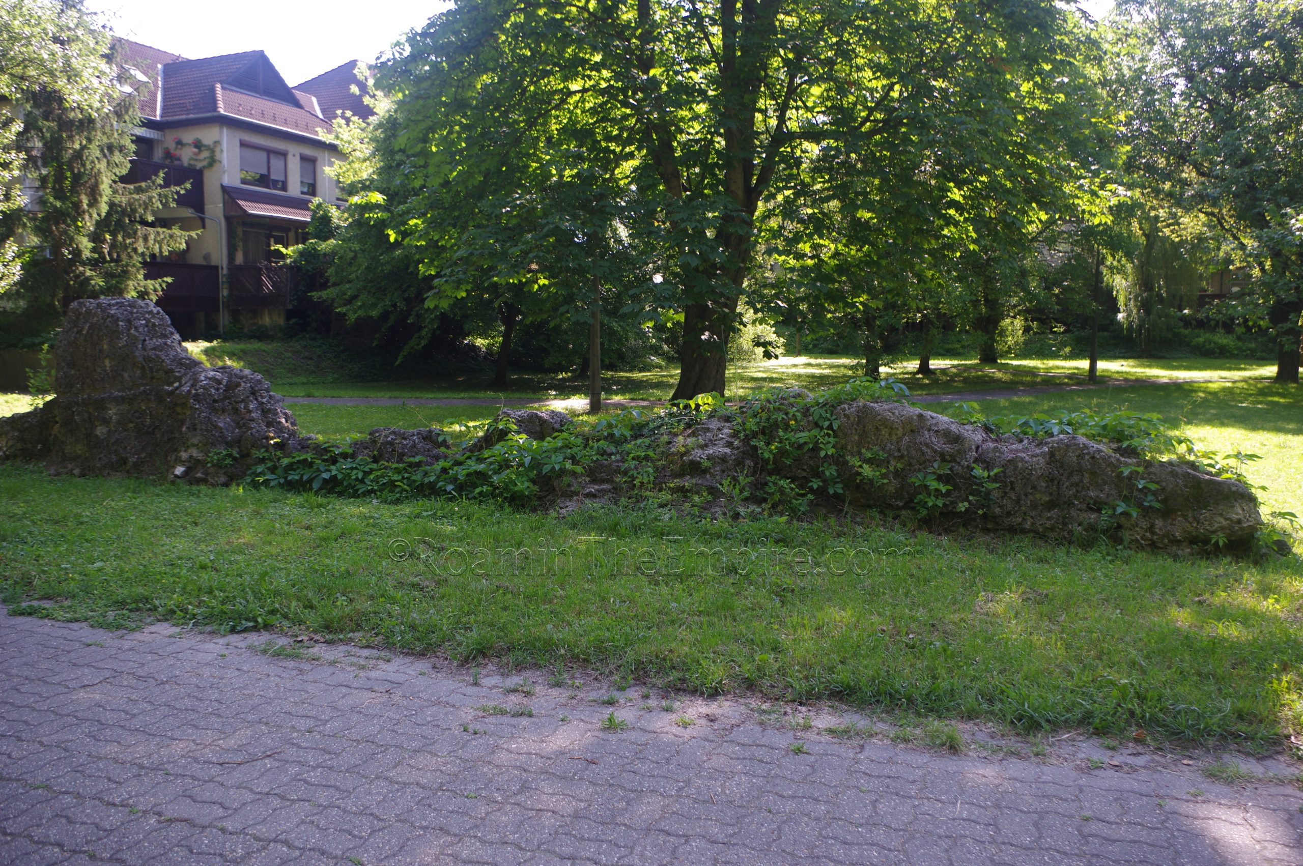
From this point where the aqueduct crosses over the walls of the civilian settlement, remains of the aqueduct can be observed running in both directions a short distance away. Just to the north is Adam Mickiewicz Park. Originating almost immediately in front of the Ókori Rom is the footpath Római stny. Along the right (east) side of the footpath are the remains of the aqueduct. The vestiges of the aqueduct are scattered and pretty sparse; most often being just a small pile of conglomerate building material that would have made up one of the piers of the aqueduct bridge. There are visible remains of the aqueduct fairly consistently along the path for the entire length of the park and through the adjacent neighborhood for about 675 meters, before the path intersects and terminates at Monostori út. Though the path doesn’t continue, about 200 meters in the continued direction is the Római Strandfürdő, a water park that is built in the area of the source of the aqueduct. There are apparently some remains of the basins and such that collected water at the source, but they are on the grounds of the water park and require a 3,200 to 3,600 Forint (depending on weekday or weekend) ticket to access, which was a bit steep for something that I may or may not have even been able to see (it is unclear whether the ancient remains of the source are accessible).
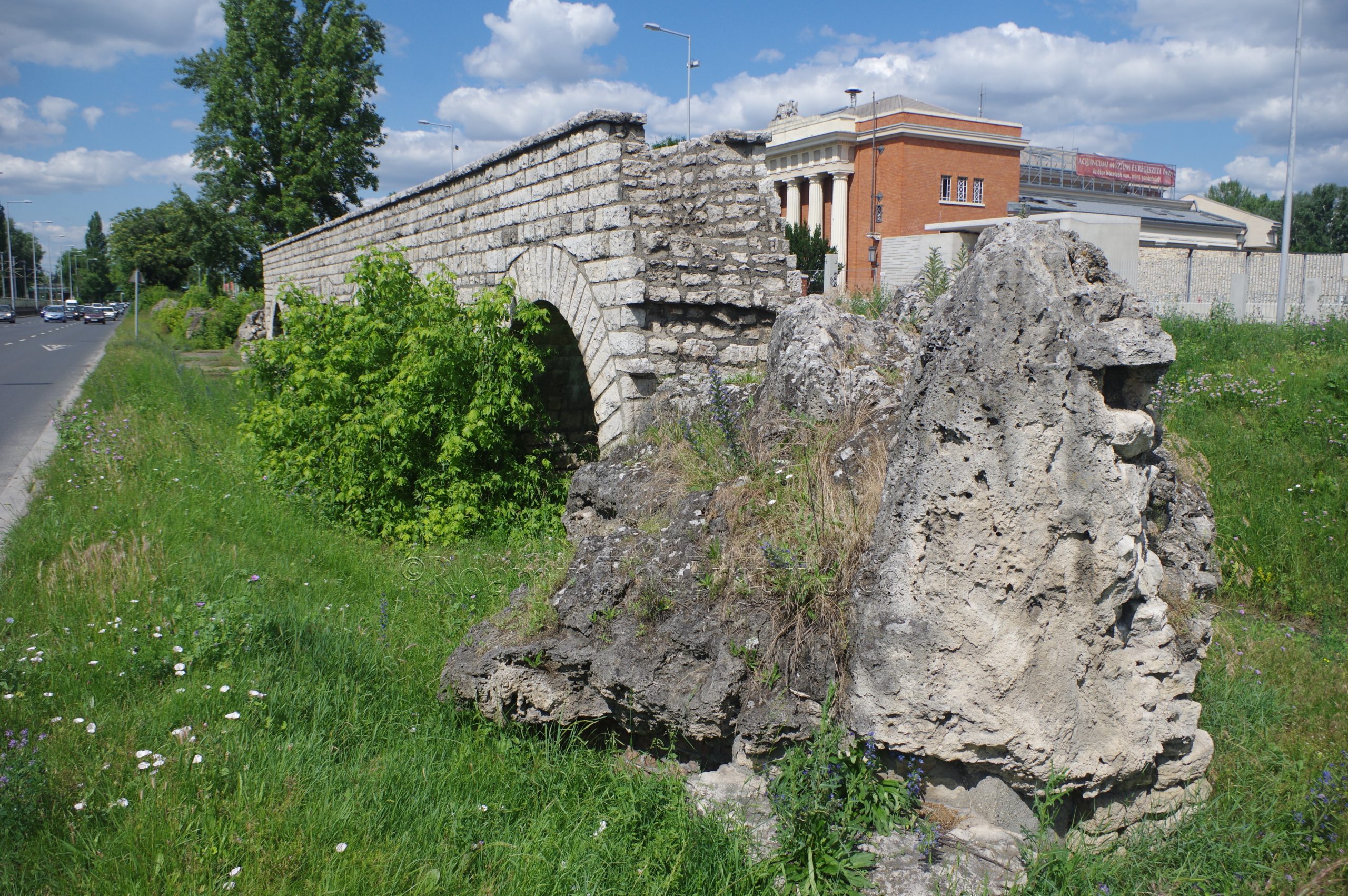
The remains and reconstructed parts of the aqueduct are also visible running south of the Ókori Rom, running parallel along the archaeological site in the median of Szentendrei út starting just past the railroad overpass, about 175 meters southwest. Unfortunately there is no very good access to this stretch of the aqueduct. It is visible, particularly from the southbound lanes of Szentendrei út, which are at a lower elevation than the northbound lanes; there is a sidewalk on the west side of the street opposite the aqueduct, but not along the aqueduct. The median is mostly overgrown, making walking through the median a less attractive option. The median is sort of accessible from the crosswalk at Záhony utca (the street at which this part of the aqueduct effectively stops), which runs a bit south of the archaeological park. Even then, I had to walk a bit in the street to see anything, and I wouldn’t necessarily recommend it. It works to try and see this part of the aqueduct after the archaeological park as well, which is what I did.
The Museum and Archaeological Park of Aquincum is located at Szentendrei út 135. Normally the entrance is reachable from this point, but there were renovations to this area and the entrance off Szentendrei út was inaccessible. In this case I actually had to go down to Záhony utca and access from the parking lot here. Unfortunately there aren’t really any signs that direct you here, so I had to wander for a bit to find a place to get in. The archaeological park is open in the summer (April 1 to October 31) Tuesday through Sunday from 9:00 to 18:00, though the museum and other buildings in the park such as exhibition hall, mithraeum, and baths do not open until 10:00. The rest of the year the hours are 9:00 to 16:00 from Tuesday to Sunday, again with the museum and other buildings not opening until 10:00. The site is closed on Mondays throughout the year. Standard admission in the summer is 2,200 Forint, and the rest of the year 1,600 Forint. Updated times and hours can be found here.
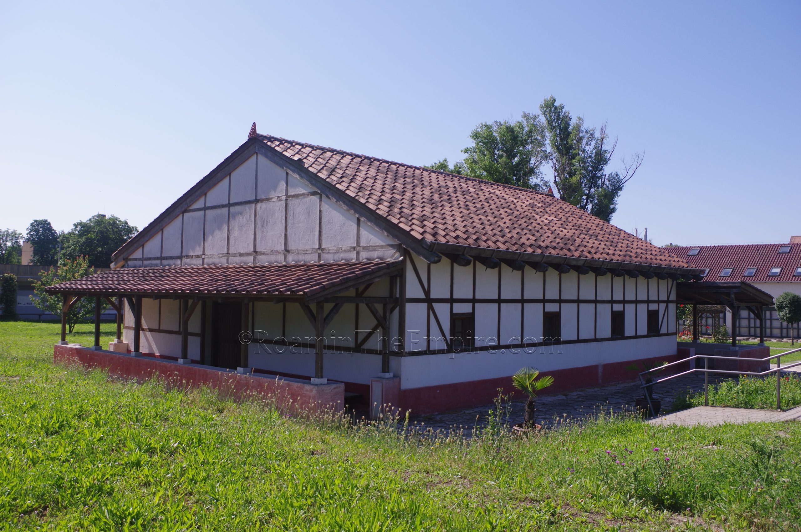
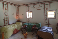
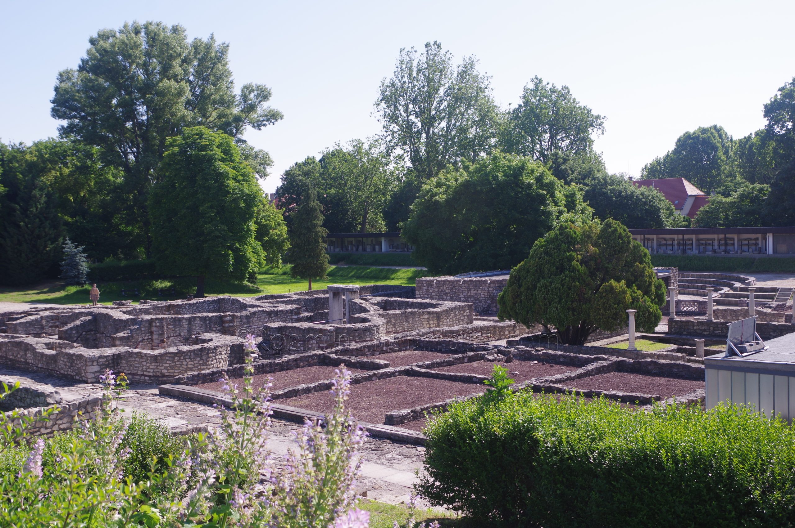
The Archaeological Park of Aquincum displays some of the core remains of the civilian settlement. Because of the staggered opening of the actual park and the buildings, it does make doing things in an orderly fashion a bit difficult if you arrive first thing in the morning, as I did. That being said, I’ll try and do the review to the site in a mostly linear way without taking that particular issue into account. Just to the right after entering the site area a pair of reconstructed buildings. The first of these is the so-called Painter’s House, a residence constructed in the 2nd century CE and subsequently subject to a number of renovations. Only the central part of the house is reconstructed (rooms around the atrium), while attached remains to the north and south are no longer visible. The interior of the house has been decorated with wall painting and replica objects to create some potential reconstructions of typical Roman rooms in a domestic dwelling.
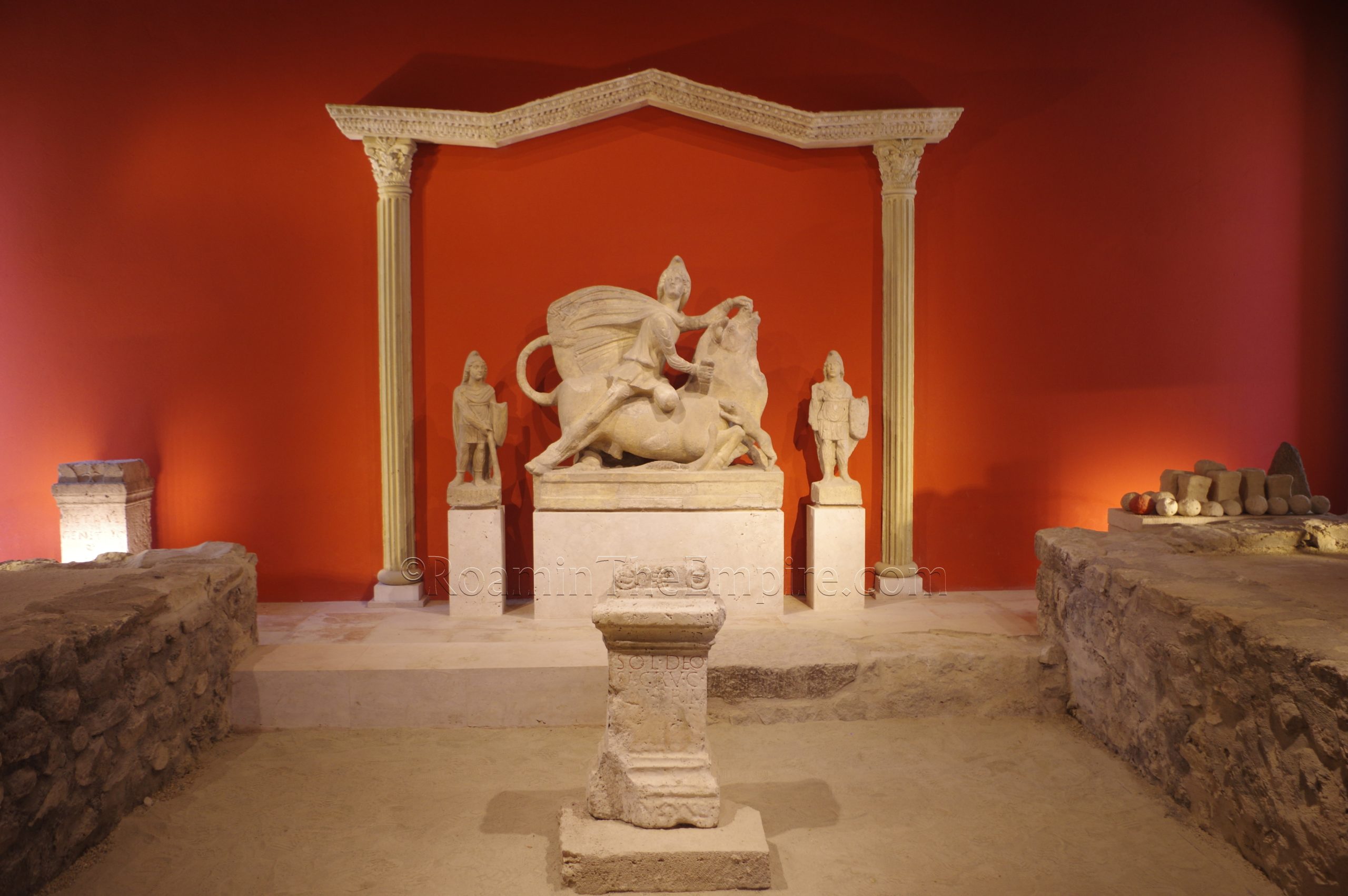
Just beyond this, to the east, is the Mithraeum of Symphorus and Marcus. When I first visited in 2013, this mithraeum was still open-air. Some of the walls had been reconstructed to some degree, but not any more than most of the buildings on-site. In 2018, work was done to completely reconstruct it and enclose it with a roof. An inscription found on the site notes that the donors of the cult image were Symphorus and Marcus, giving the building its name. This iteration of the mithraeum was already functioning by the end of the 3rd century CE, and possibly replaced an earlier mithreaum dating to 60-70 CE. It seems to have been in use until the early 4th century CE. The building is reconstructed with minimal wall decoration, but has a number of objects found here on display where they are theorized to have been placed in antiquity, including a (heavily reconstructed) tauroctony, statues of Cautes and Cautopates, and inscribed altars.
Continued In Aquincum, Pannonia Inferior – Part I
Sources:
Ammianus Marcellinus. Res Gestae, 30.5.
Grant, Michael. A Guide to the Ancient World: A Dictionary of Classical Place Names. New York: Barnes & Noble Books, 1997.
Kiss, Zsuzsanna Emília. “The Inscriptions of the Construction and Recovery Works of the Public Buildings and Utilities in Aquincum.” Periodica Polytechnica Architecture, Vol 51, No. 2 (2020), pp. 108-123.
Láng, Orsolya. “Functions and Phases: The ‘Peristyle-House’ in the Civil Town of Aquincum.” DOMUS: Das Haus in den Städten der römischen Donauprovinzen, Peter Scherrer, Österreichisches Archäologisches Institut Wien, 2008, pp. 271-284.
Láng, Orsolya. “Industry and Commerce in the City of Aquincum.” Urban Craftsmen and Traders in the Roman World, Andrew Wilson and Miko Flohr, Oxford University Press, 2016, pp. 352-376.
Láng, Orsolya. “Reconsidering the Aquincum Macellum.” Acta Archaeologica Academiae Scientarium Hungaricae. Vol. 54 (2003), pp. 165-204.
Nagy, Mihály. Roman Stones: A Guide to the Archaeological Exhibitions in the Hungarian National Museum. Budapest: Hungarian National Museum, 2012.
Smith, William. Dictionary of Greek and Roman Geography. Walton & Murray, 1870.
Stillwell, Richard, William L. MacDonald, and Marian Holland. McAllister. The Princeton Encyclopedia of Classical Sites. Princeton, NJ: Princeton U Press, 1976.
Szabó, Csaba. Sanctuaries in Roman Dacia: Materiality and Religious Experince. Oxford: Archeopress, 2018.


