


Continued From Augustodunum, Gallia Lugdunensis Part I
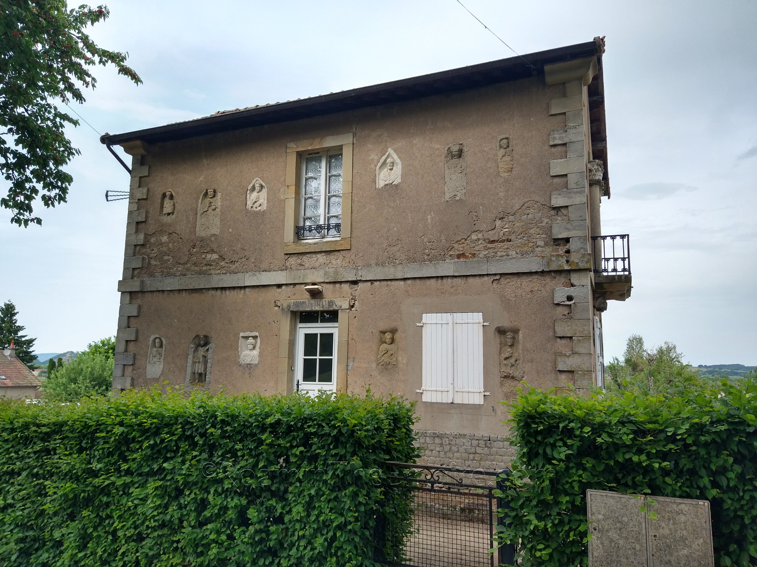
From the Porte Saint-André, it’s about a 10 minute, 700 meter walk to the next site located to the south; Les Maisons des Caves Joyaux. This building is located down the access road to the Roman theater off of Av. du 2 ème Dragon. Though there is no direct access to the building, it is visible from the public roads and paths. The 19th century building, which was apparently constructed as a guard house during the excavations of the adjacent theater, and later served as the first lapidarium for finds of Augustodunum. Built into the exterior façade of the building are a number of funerary stele from necropoli around the city, including the so-called Temple of Pluto, a mausoleum that was once standing outside the Porte d’Arroux, but has since been demolished.
Just to the south of Les Maisons des Caves Joyaux is the Roman theater of Augustodunum. The theater seems to have been constructed in the 1st century CE, probably sometime during the Flavian Dynasty; possibly during the reign of Vespasian. An inscription found dating to 105 CE seems to indicate a restoration of the theater occurred at this time. The theater is constructed using the natural slope of the hill to support the cavea, though there are robust retaining walls at either end. The three tiered seating structure is estimated to have held at least 12,000 spectators, though some estimates claim a capacity of 33,000. In either case, it is presently the largest theater discovered in Gaul, and among the largest found in the entirety of the empire with a cavea diameter of 148 meters. It seems to have been modified at some point with the construction of a podium around the orchestra, likely a change to accommodate gladiatorial spectacles, even though the site for a proper amphitheater has apparently been identified to the west.
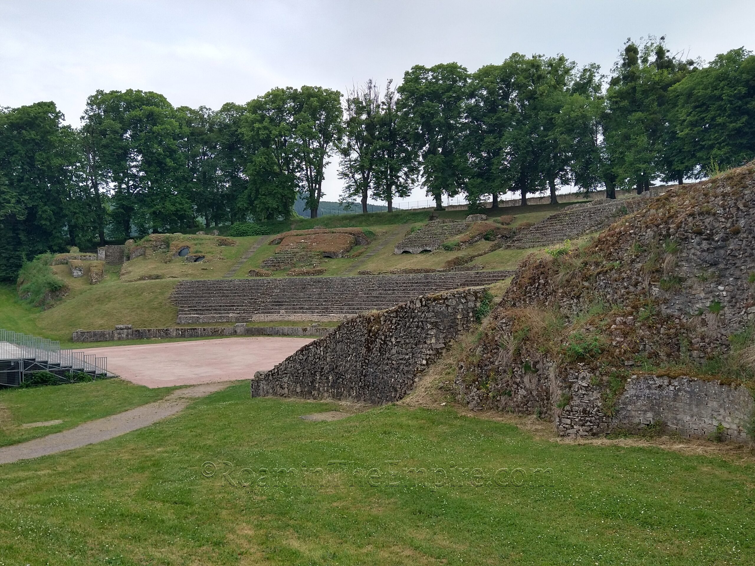
Mostly what is visible here are the supports for the cavea. The seating in the lower area is reconstructed, as are all the stairways. Some original seating remains along the northern side of the theater, but it has been covered. The remains of the scenae are also extant, but covered over with earth, so the stage area is just a grassy berm with a few bits of masonry poking out along the base. The foundations of an arcaded gallery were also apparently uncovered along the top of the cavea, but that too has been covered over for preservation. The theater is an open park area, so there is no admission and it is supposedly open without restriction. There are fences around it, though, so presumably it can be closed off. Performances are sometimes held here, so I imagine part of that is a mechanism for closing off the area when those are setting up.
The main road that runs to the east of the theater is Rue de la Maladière; taking that road a couple hundred meters to the south, on the west side of the road is the Cimetière d’Autun. The original circuit of walls ran for about 6 kilometers at a height of around 11 meters, and they’re visible, including in the Cimetière d’Autun. The cemetery is open from mid-February to mid-September from 8:30 to 19:00. The rest of the year the hours are 8:30 to 17:30. There are a few gated entrances, including at the north, south, and about midway down the east side. Along the back side (west side) of the cemetery are some remnants of the original circuit of walls that enclosed Augustodunum after the city’s foundation in the late 1st century BCE. The walls, of course, were rebuilt and repaired a number of times since the Roman period, but some elements of the Roman wall are visible, particularly in the north part of the cemetery. The remnants of a couple of towers in the fortifications are also visible in the northern section of the cemetery.
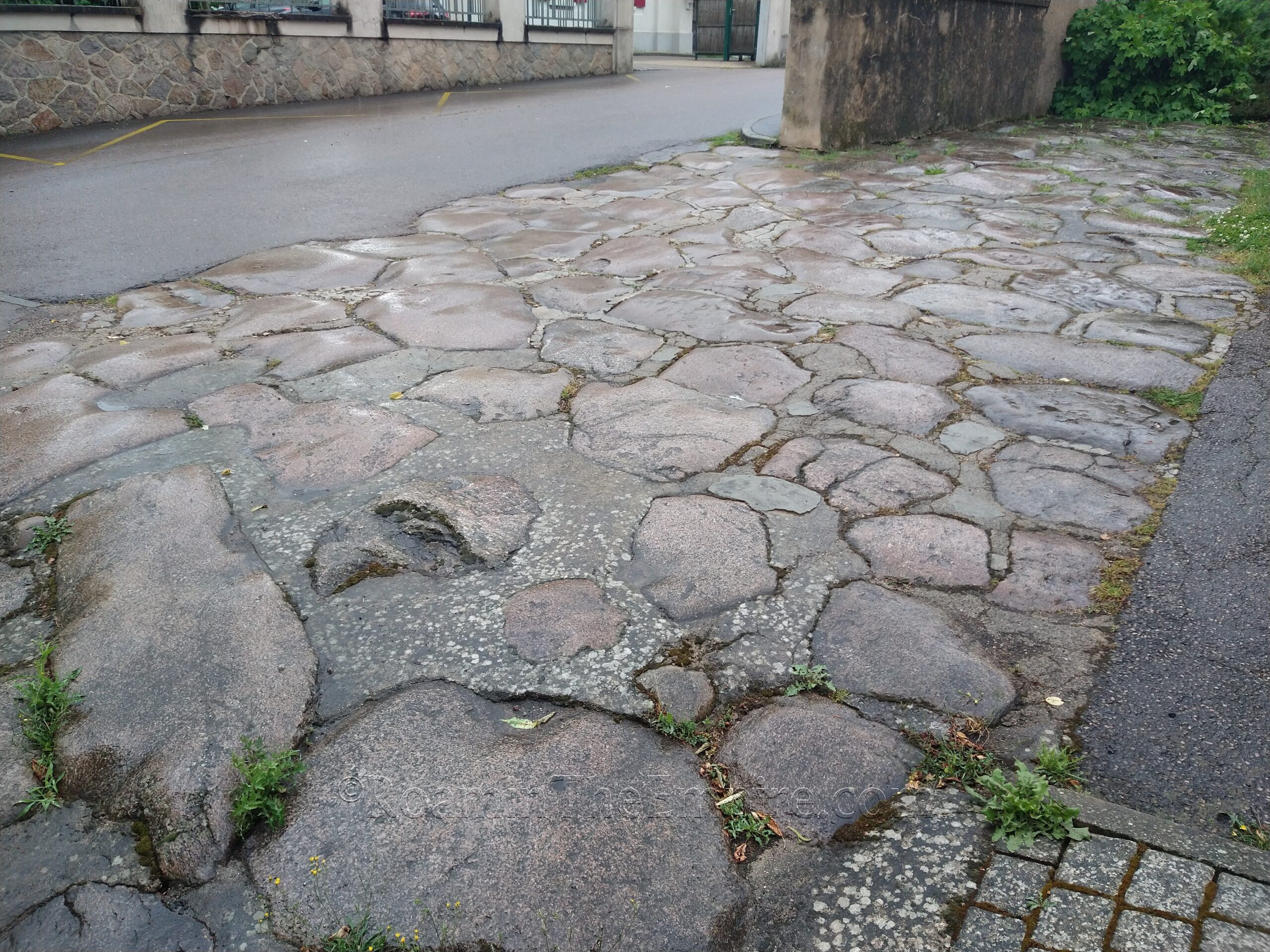
Exiting out the south side of the cemetery onto Rue Gaston Joliet, a few meters north is a cut over to the next street over to the south/west, Rue de la Jambe de Bois. About 150 meters north on this street, at the second intersection with the appropriately named Rés du Cardo (which loops around and intersects with Rue de la Jambe de Bois twice), are the remains of the cardo maximus of Augustodunum. The section of road runs parallel to the west of Rue de la Jambe de Bois, crossing Rés du Cardo and extending a few meters south of the road as well.
Another 135 meters or so north on Rue de la Jambe de Bois, the street reaches a multi-street roundabout intersection. At the southwest part of this intersection is a garden area between 2 and 4 Pl. Anatole de Charmasse, and visible across this garden, incorporated into the building opposite is a section of Roman wall. This is the so-called Temple of Apollo. Though it’s not really perceptible from the public road, the section of wall is slightly curved, indicating it was part of a circular monument. Despite the name, there is nothing to indicate that it was a temple dedicated to Apollo, or a temple at all. The size and location would suggest it was a public building of some sort, but so far no evidence has been found as to what it would have been used for. Additional remains are visible only from inside the courtyard. A sign with information in English and French is posted in front of the fence.
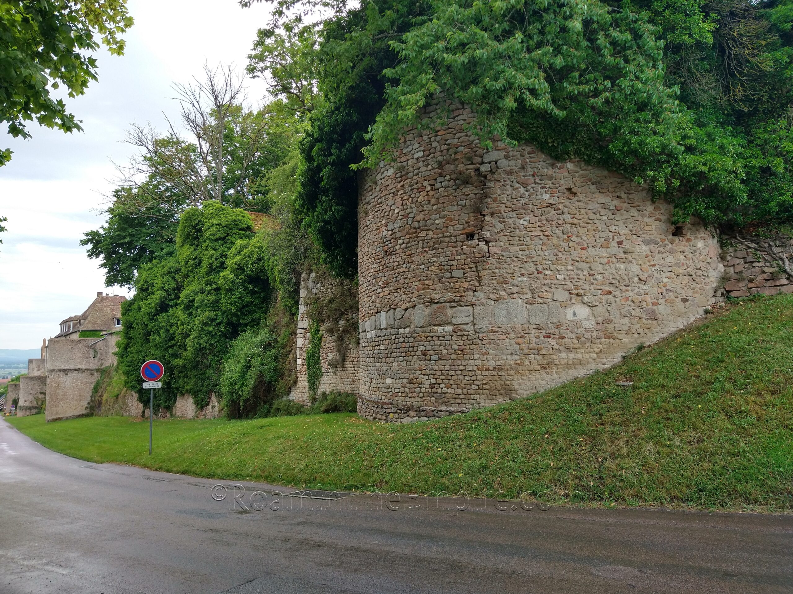
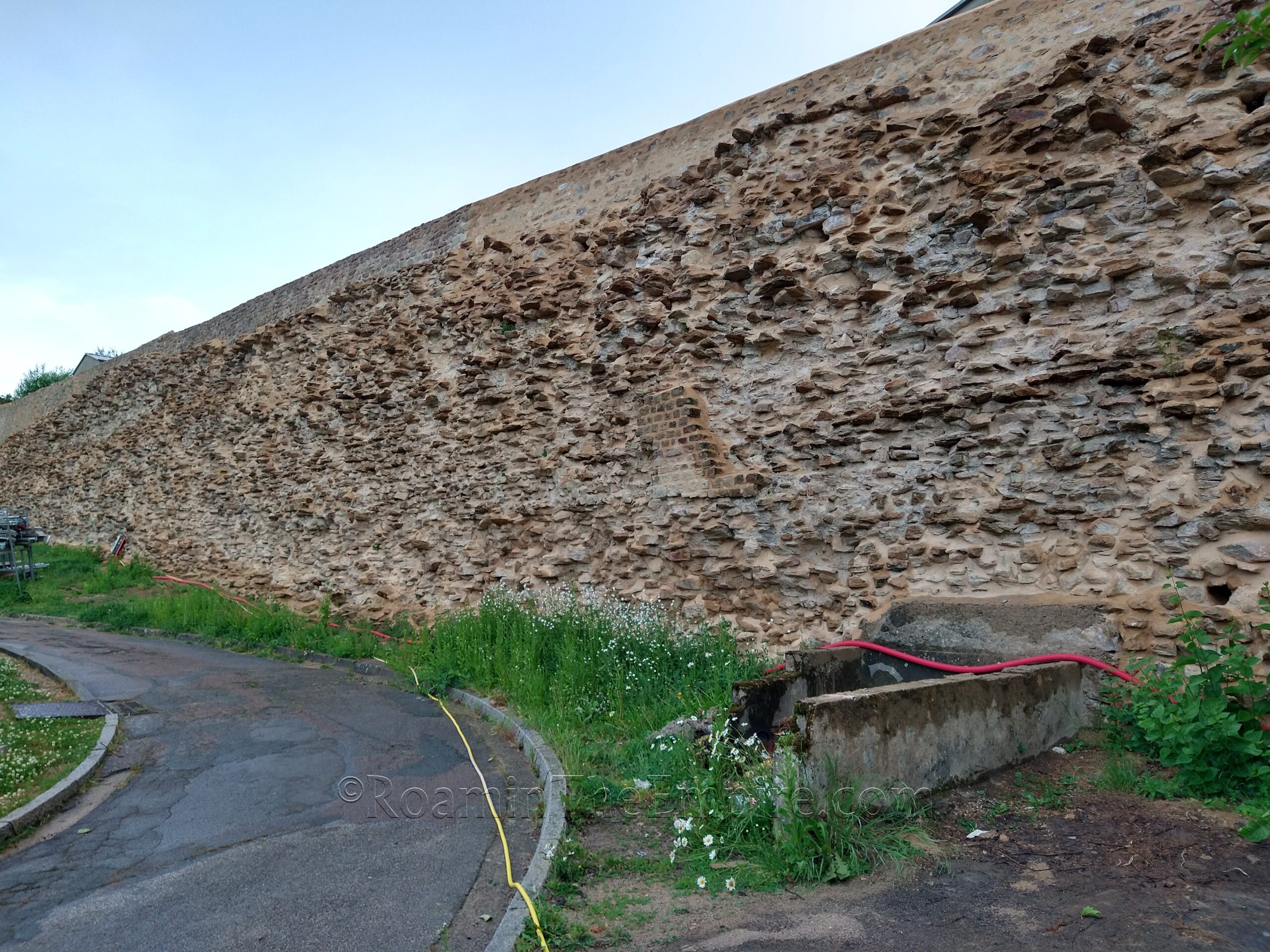
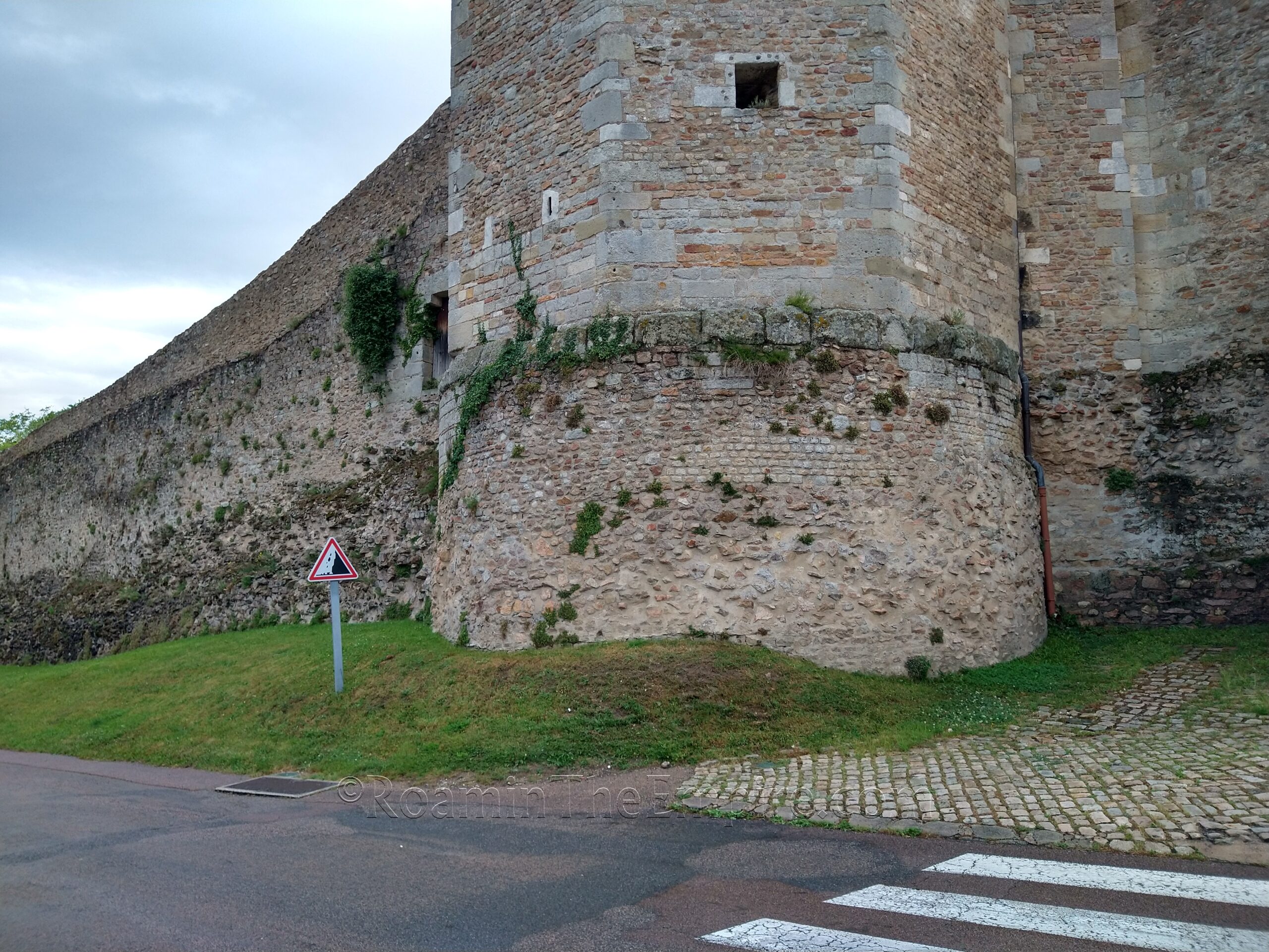
It’s about a 1 kilometer, 15 minute walk directly to the west (though the route is a number of twists and turns on streets, but the point is marked on the map) to the intersection of Avenue du Morvan and Boulevard des Résistants Fusillés. At this point, remnants of the circuit of the western fortifications of the city start. The first stretch of about 175 meters south of the intersection is almost entirely from the post-antique period. After the intersection of Boulevard des Résistants Fusillés and Rue du 19 Mars 1962, though, some elements of the Roman era walls of Augustodunum can be seen. At this point, some of the towers in the fortifications are visible as well. It is still primarily post-antique wall, but there are a few points where the more regular work of the Roman wall can be seen. The foundations of the first tower and a small stretch immediately south of the tower have Roman-era construction clearly visible. There are also some very clear Roman elements in the wall just past the intersection with Rue Georges Leyton.
The course of the walls of Augustodunum run more or less continuously for about a kilometer along this side of the city as Boulevard des Résistants Fusillés turns into Boulevard Mac Mahon. They run a bit uphill ultimately terminating (or more accurately, changing directions) at the Tour des Ursulines. The stretch of the last few towers before the Tour des Ursulines also have some well-preserved elements of the Roman wall both in the towers and in some of the walls between them. Most of the construction of the Tour des Ursulines dates to the 12th century CE or later, but it was built on a previously existing Roman tower, and the Roman stonework is visible in the first few meters of the base of the tower.
From the Tour des Ursulines, the walls of Augustodunum would have turned toward the east. The course of the walls runs through the rear areas of private properties, but there is a small section incorporated into a house that is visible from the road. This is just adjacent to the intersection of Rue du Faubourg Saint-Blaise/Rue Dufraigne and Rue Raquette. The course of the walls continues to run more or less parallel to Rue Raquette (which turns into Rue du Vieux Columbier after a distance), but they are not visible from the public roads. The shape of some of the towers are visible in satellite imagery, incorporated into the modern buildings, though. There is a small bit visible toward the end of Rue du Vieux Columbier, but again this is mostly later wall construction that followed the path of the Roman circuit.
The final point within the city is the Musée Rolin, located at 3 Rue des Bancs. As of September 30, 2022, the museum is closed for a ‘long period of work’ with no timetable for reopening. Outside of the closure, however, the museum is open daily except for Tuesday, when it is closed. In the summer (April through September) the museum is open 10:00 to 13:00 and 14:00 to 18:00. The rest of the year the hours are 10:00 to 13:00 and 14:00 to 17:00. Admission is 6.50 Euro, unless there is a special exhibition, which ups the entrance price to 7.50 Euro.
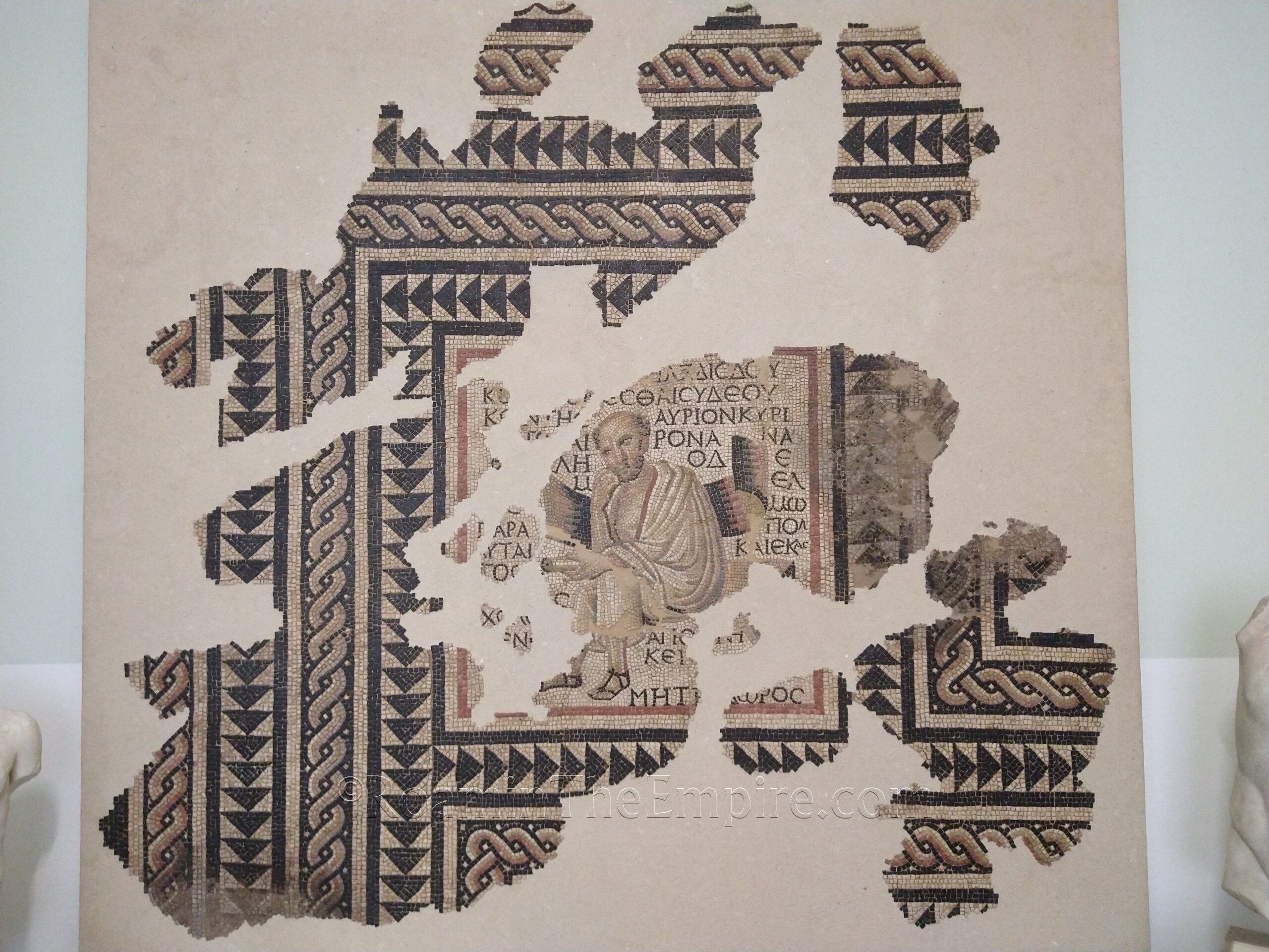
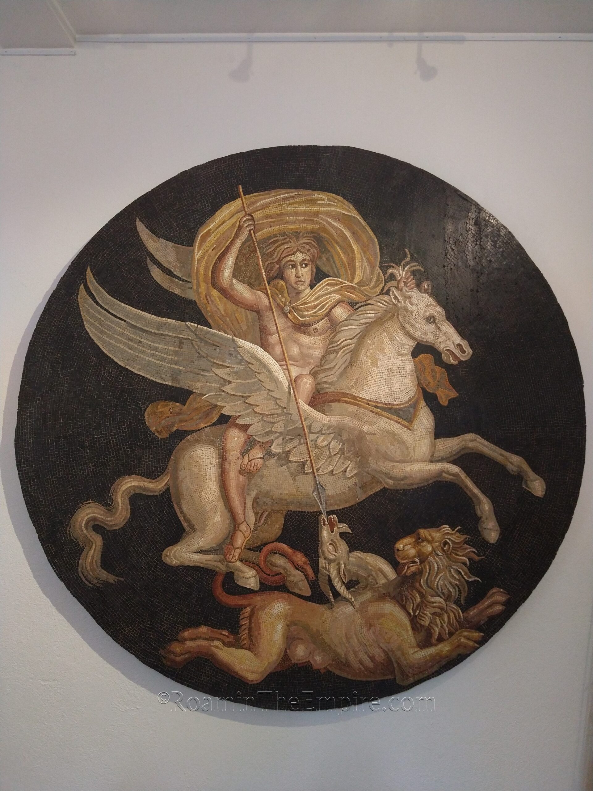
The museum is a general art museum, so it isn’t just archaeological works. There’s also a collection of paintings and other works here, which do include frequent portrayals of Classical material. The archaeological collection is quite nice. There are a number of mosaics, including a fantastic mosaic of Bellerophon slaying the Chimera (which is not with the rest of the archaeological collection) and mosaics depicting philosophers with quotes from their works. There’s a plentiful assemblage of smaller bronze statuettes and figures. One of the more interesting objects is a stone altar with a niche for an inscribed bronze statuette of a bull. Another interesting piece is a polychrome marble lararium. It’s rounded out by some funerary and votive reliefs and inscriptions, as well as other small finds and fragments of statuary.
It took me about an hour to get through the archaeological section and another hour to finish out the rest of the museum for a total of two hours there. Most of the objects in the archaeological collection have only French descriptions (English translations are more prevalent in the rest of the collection), as do some of the more detailed informational panels. Other informational panels include English translations.
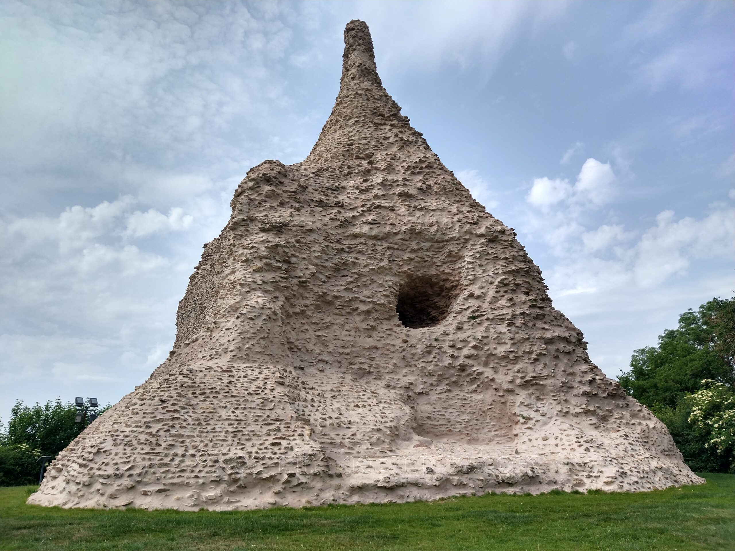
The last point of interest for ancient Augustodunum is a bit outside of town to the southeast in the small village of Couhard; the Pierre de Couhard, also called the Pyramide de Couhard. This 10 meter high pyramidal construction is the core of a funerary monument that would have overlooked the road running south to Cabillonum (modern Chalon-sur-Saône) and Lugdunum (modern Lyon). The monument dates to the 1st century CE. The Pierre de Couhard is in a public area that seems to have open access with no restriction on hours; there are no gates or fences to restrict access.
Though it technically took me parts of two days, the remains of Augustodunum can be pretty easily consolidated into a single day, provided the weather cooperates. Again, it’s tough to do without a personal car, just because of the lack of public transit connections to larger cities in the area. The two gates and the Temple of Janus are very much worth the trip to see, and the theater is good as well just because of the scale, though the state of preservation might be a little disappointing to some.


Sources:
Bromwich, James. The Roman Remains of Northern and Eastern France: A Guidebook. New York: Routlege, 2003.
Digeser, Elizabeth DePalma. “Crisis and Opportunity: Urban Renewal and Christianisation in Constantine’s Gaul.” Religion in the Roman Empire, Vol. 5, No. 1 (2019) pp 103-124
Grant, Michael. A Guide to the Ancient World: A Dictionary of Classical Place Names. New York: Barnes & Noble Books, 1997.
Smith, William. Dictionary of Greek and Roman Geography. Walton & Murray, 1870.
Stillwell, Richard, William L. MacDonald, and Marian Holland. McAllister. The Princeton Encyclopedia of Classical Sites. Princeton, NJ: Princeton U Press, 1976.