Continued From Apollonia, Macedonia – Part III
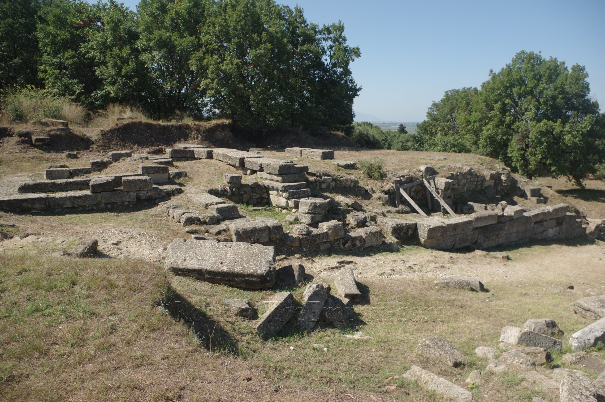
On the south side of the sacred way, above the north end of the stoa, was another set of retaining walls. On top of the plateau formed by these was a temple. The temple dates back to at least the 2nd century BCE and was then restored and probably reconfigured in the 2nd century CE. Though a secure attribution of the deity or deities to which the temple was dedicated has not been made, the tripartite division of the cella has led to the theory that it may have been dedicated to the Capitoline triad. The prominent position at the eastern end of the agora would seem to reinforce this supposition.
There is not a whole lot left of the agora itself. Though the approach and immediate area were very overgrown when I visited, there is a small bit of the northern stoa of the agora excavated about 50 meters north of the temple. This includes a few of the column bases for the portico of the stoa as well as an apsidal construction. Another 50 meters to the east of this, and closer and more accessible from the main path through the site, is the excavated northeast corner of the agora stoa. Again, a few column bases from the northern stoa can be seen as well as the transition to the eastern stoa of the agora. Other than these two points, however, there isn’t anything else visible of the agora.
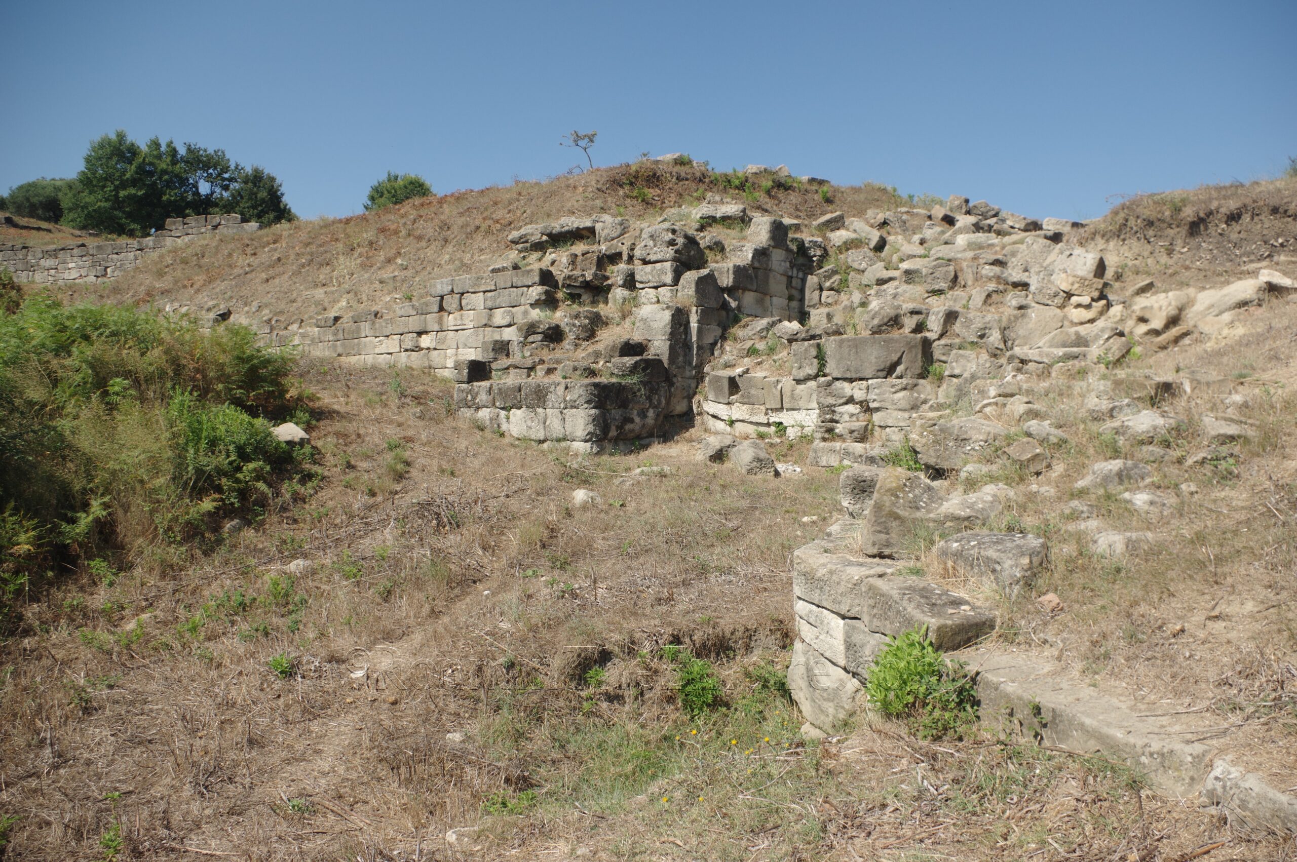
As the path cuts north along the east side of the agora, on the other side of the path are the excavated remains of one of the gates and a section of the eastern fortification walls of the city. Like the western walls, these date to probably the 4th century BCE. The total circuit of the walls around Apollonia was about 5 kilometers and reached about 10 meters in height. This section has some fairly well preserved fortifications. At least one tower is clearly discernable, though the form of the gate is a little difficult to envision with what remains. The course here is also fairly irregular, adjusting to the contour of the landscape and allowing for defensible sight lines.
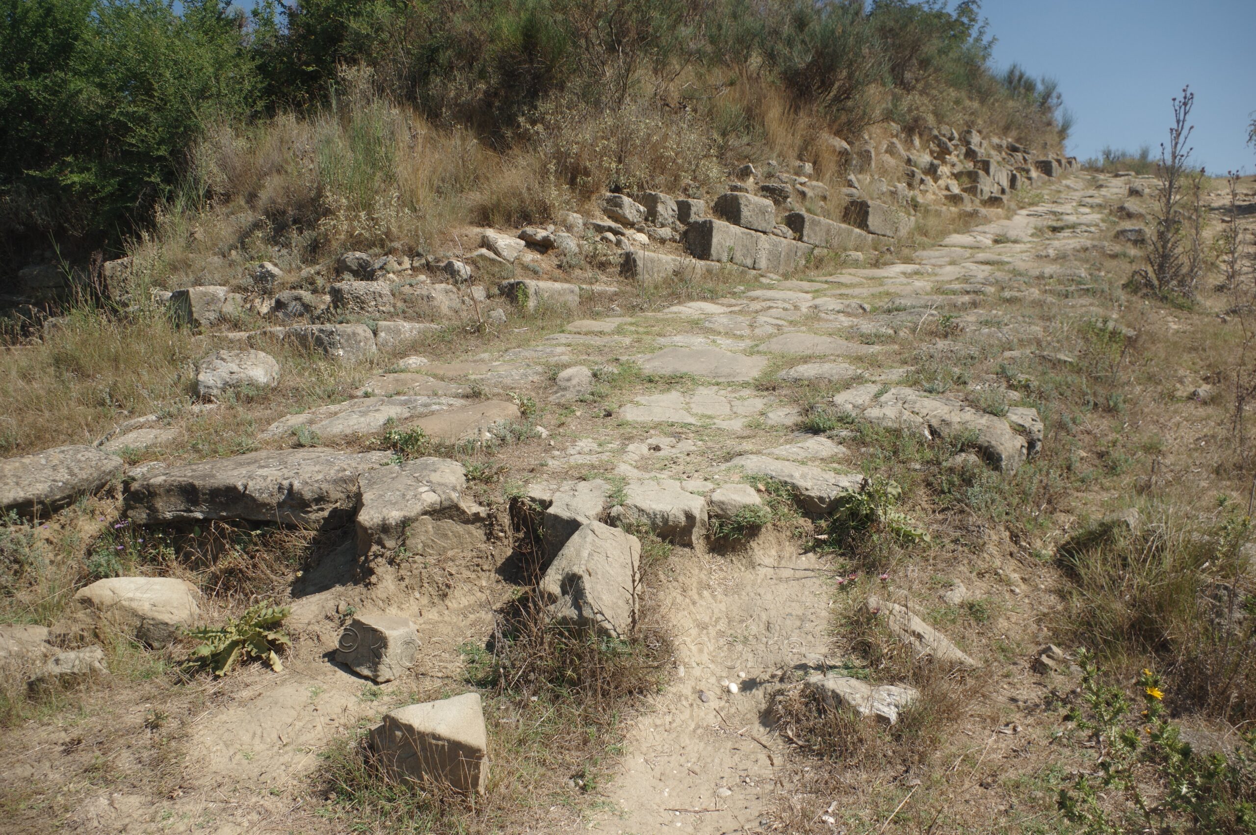
Lying just ahead on the path about 120 meters is a hill on which the acropolis was situated. The path leads up to the final stretch of the sacred way, which ran up the mountain and to the acropolis. A stretch of about 20-25 meters of the pavement of the sacred way and the retaining wall on the north side of the road has been preserved from the foot of the hill. The retaining wall and acropolis fortifications also continue along the south side of the base of the hill for several meters as well. Unfortunately, this is just about the only part of the acropolis that survives. In the 1960’s and 70’s, a network of bunkers was built throughout the top of the hill. They still remain today, but their construction seems to have wiped out all trace of the ancient remains of the acropolis at the top.
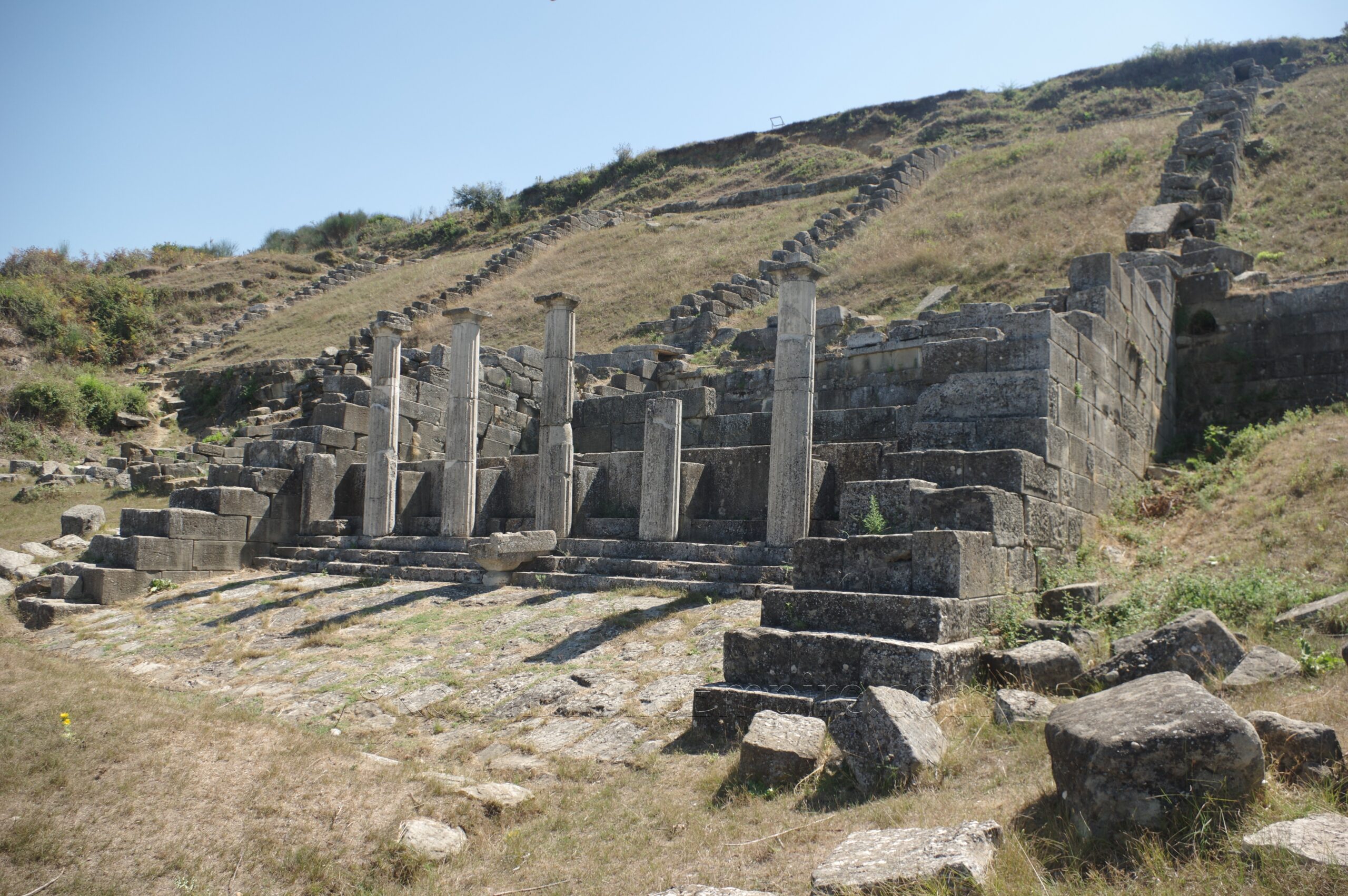
The next monument is a bit out of the way, but is absolutely worth the visit. Heading back down the trail to the intersection near the agora and city walls of Apollonia, there is a path that leads off to the west. About 160 meters on, take the first right (heading north) and another 210 meters from there, the trail splits off. Take the left (west) trail at the fork and walk for another 150 meters to reach the nymphaeum. The route is signposted and is not especially difficult to find. The trail ends at the top of the nymphaeum, which dates to the 4th to 3rd century BCE. Not to be confused with the oracular site of Nymphaeum (or Nymphaion), which was reported to be in the territory of Apollonia, this was simply an elaborate fountain house. The nymphaeum was fed by underground springs, but included a series of large catchment areas and canals at the top that fed water into the reservoir and basin. There is a path down to the bottom of the nymphaeum along the north side of the monument. From there, one can bet a better look at the basin, which is decorated in the front by five Doric columns. The area in front of the basin is laid with paving stones, and large retaining walls flank it in either direction.
Heading back to the intersection near the agora, there is a path that heads south and up a hill, parallel to the section of the fortifications. At the top of the hill, called Hill 104 (Kodra 104) is a restaurant and some very scant remains of what was apparently part of the road network atop the hill. This is located on the south side of the restaurant. Otherwise there doesn’t seem to be anything else uncovered, though it is on this hill that is a proposed location of a temple dedicated to Apollo.
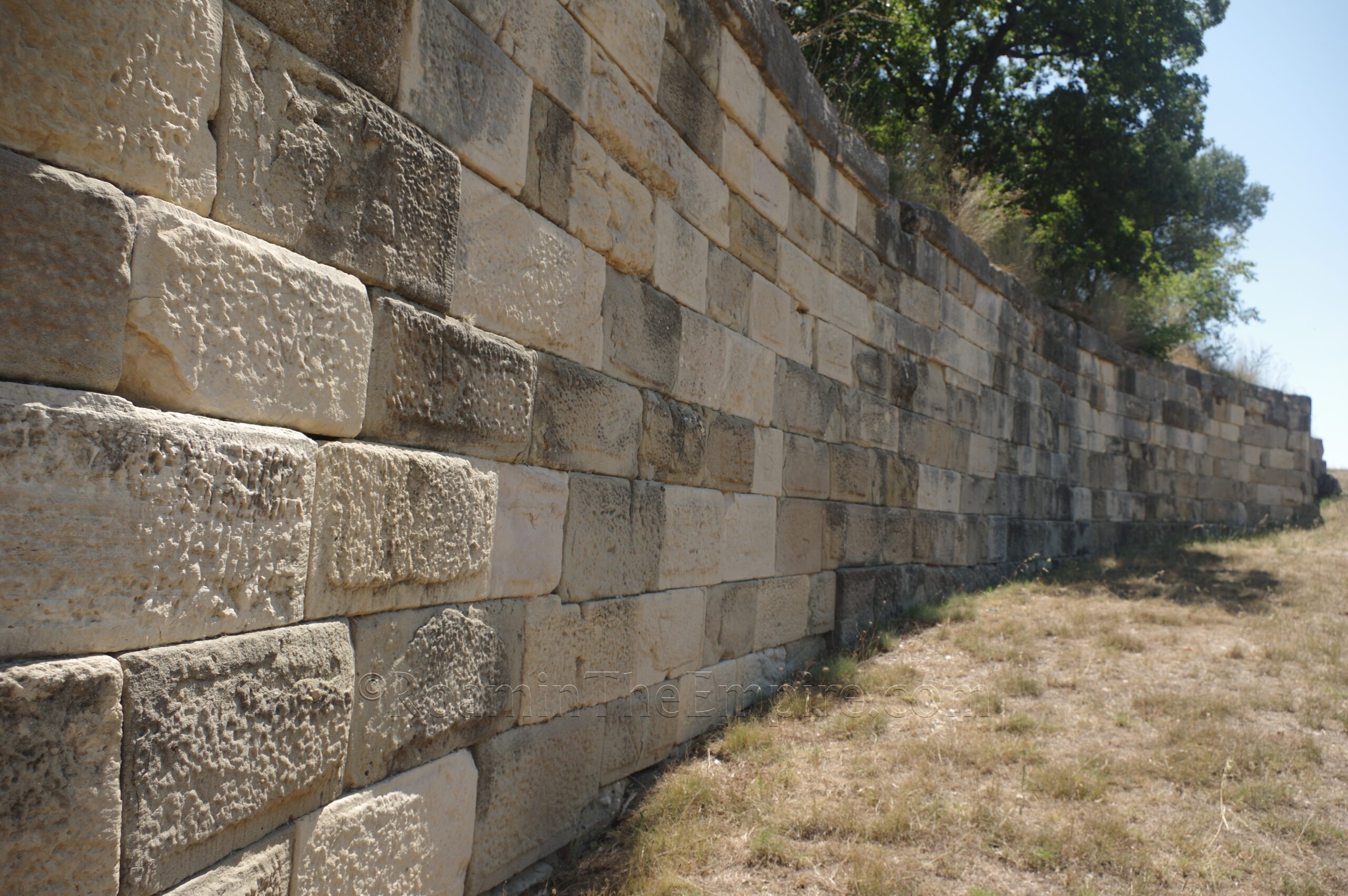
Another path leads down the south side of the hill and lets out about 65 meters to the east of the odeon. From just about this point, there is block wall that runs around the base of the hill to the west toward the odeon. This is referred to as the temnos wall, evidently enclosing the sacred precinct of the hill on which a temple to Apollo was located. The wall dates to the 5th century BCE. A number of mason’s marks, a combined delta and alpha that were used to indicate they were part of a public construction (damosios). A bit more than halfway along the wall toward the odeon is an ornately constructed arched gateway flanked by niches, which would have been the monumental entryway into the sacred precinct of the temple of Apollo. The archway appears to be newer than other parts of the wall, dating to the 3rd century CE.
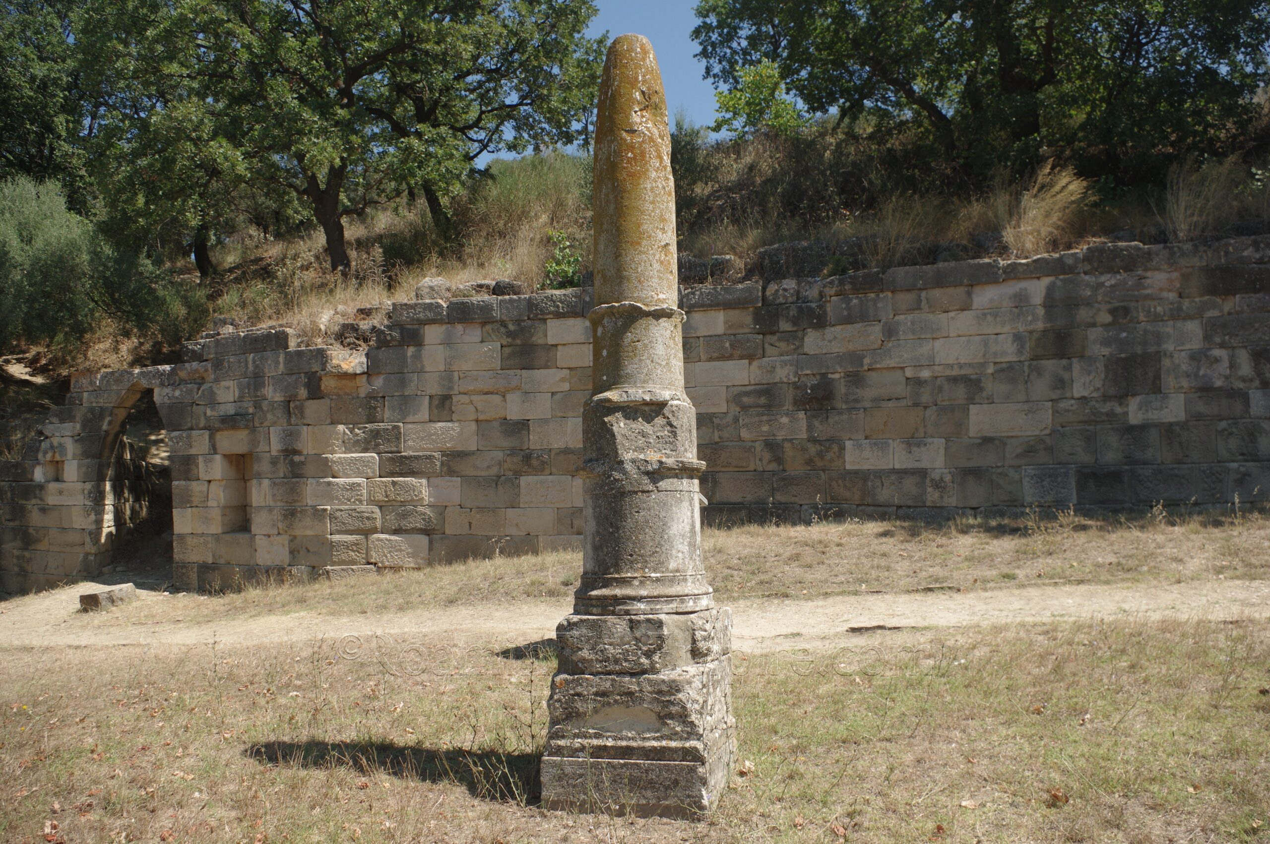
In front of the wall, a few meters to the east of the arched gateway is the so-called Apollo’s Obelisk. This conical limestone column, of which the form may have been meant to be reminiscent of the omphalos, and was associated with Apollo Agyieus, an aspect of the god associated with the protection of the streets within a city’s walls. Objects associated with Apollo, as well as his sister Artemis, would likely have been hung on the column, such as Apollo’s lyre or Artemis’ quiver, as is depicted in some images of similar objects. Though I couldn’t make out any visible inscription, the column is apparently inscribed with the word ‘Apolloniatan’ on two sides.
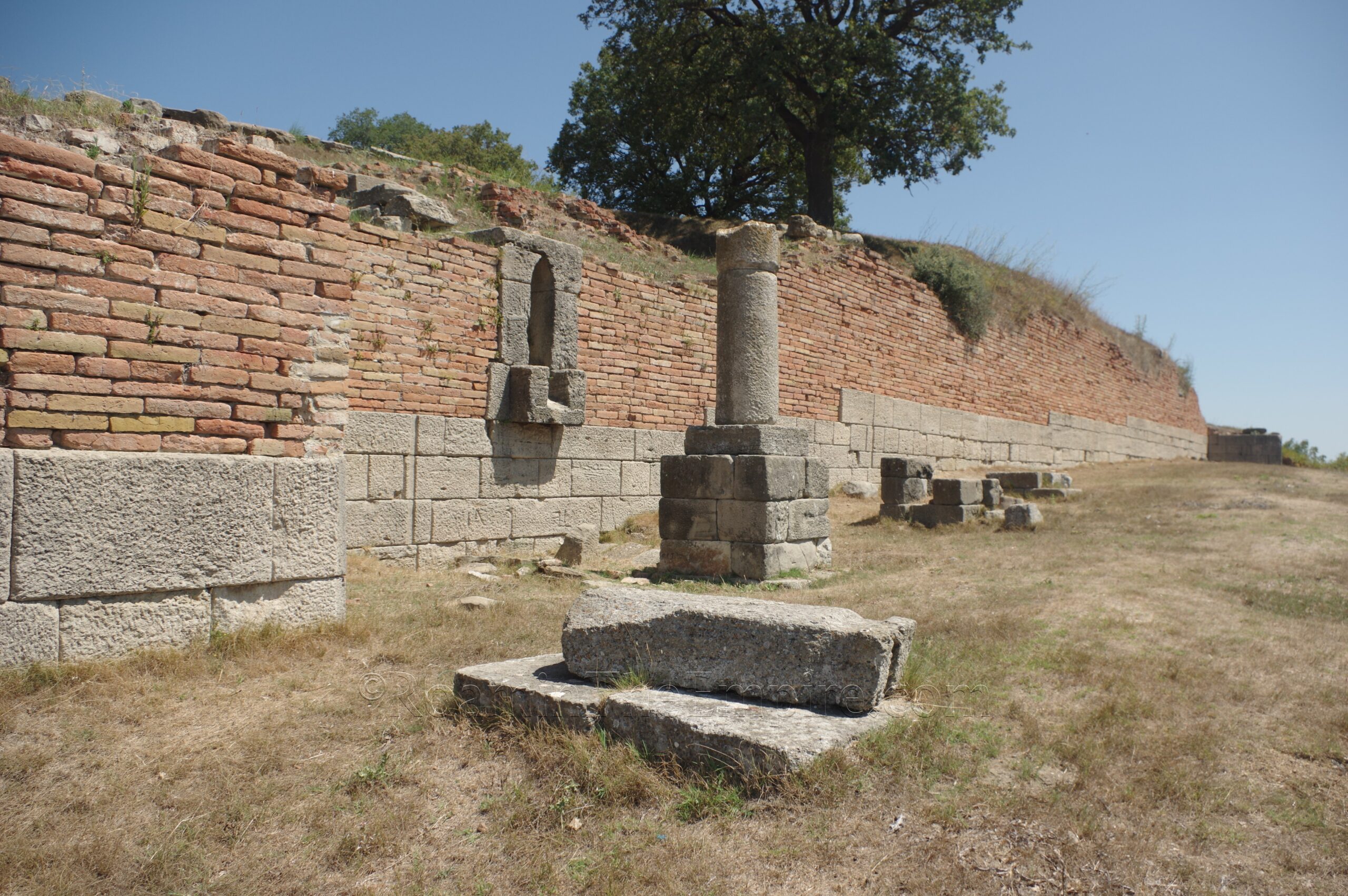
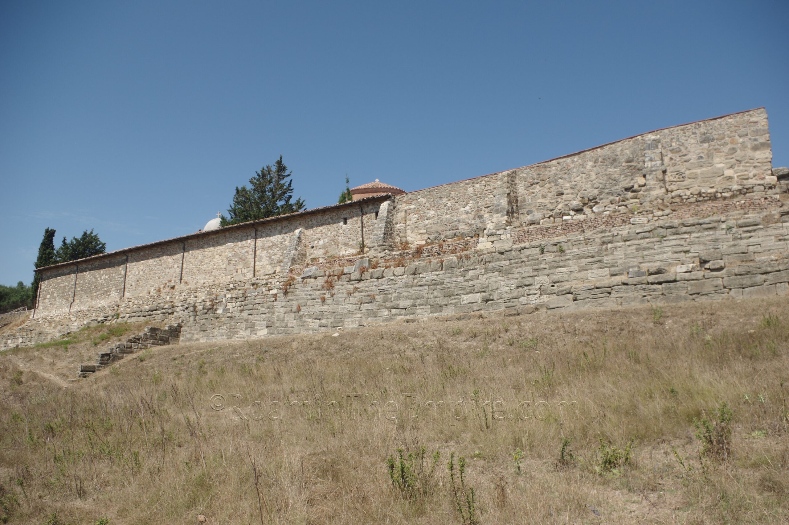
To the south of the column are two rectangular buildings that don’t seem to have any special, identifiable function. About 65 meters south of the column is another gate and the northern extent of a fairly large and well-preserved section of the southeastern fortifications of the city. The gate is located near the very start of the walls, which run several meters southeast into a large corner tower before changing direction and running southwest about 120 meters. A path leads down along the outside of the walls. About midway along this section there is a drainage channel built into the walls and some kind of column monument in front of it. At the end of this extent of the walls is another corner tower where the walls then change direction again for several meters before cutting back to the southwest. The walls and another tower running along the east side of the monastery are also visible from this position, though aren’t directly accessible.
The walls effectively wrap up the Archaeological Park of Apollonia. It is worth noting there are a couple of other points of interest outside the park, which I didn’t have the time to investigate, as I had the constraints of the last bus back to Fier. About 1.4 kilometers due southwest of the monastery is a single column, the so-called Shtyllas, from what is believed to be a temple dedicated to Artemis. The rest of the temple save for the single column was completely robbed out in the 18th century in order to build the nearby residence of a Turkish pasha. Access to this site is apparently questionable, and because of the river, it would have been over an hour of walking one-way from the site.
Slightly closer, but still pushing the envelope on the time constraints, about 500 meters west of the monastery are the remains of a bathing complex. From the World War II bunker near the cistern, I could get a line of sight on the baths, and frankly it didn’t look worth risking missing the bus back to Fier to go see. They’re definitely there, though, and seemingly mostly accessible. These baths date to the 1st or 2nd century CE.
All told, I used nearly all the time between the first bus from Fier and the last bus back to Fier; about 5 and a half hours, to explore Apollonia. Though I wasn’t especially pressed for time, it would have been nice to have maybe another bus maybe an hour later going back to Fier, which would have made visiting the baths a possibility without stressing out about that timeline. That being said, it’s an easy day trip from Fier. I’ve read that people attempt it as a day trip from Tirana, which with your own vehicle might be doable, but using public transport would be tough. Of course, for people that only spend a couple hours at the site, this might be a more workable option, but if you want to maximize your time there, it would probably be better to try and base oneself out of Fier rather than Tirana. The site is great and well presented. Most of the monuments have signs with information in English, French, and Albanian. Helpful pictures and diagrams help to further contextualize the remains of the city. Apollonia is a fantastic site and was one of the highlights on the back end of my trip, it is not to be missed.
Sources:
Amore, Maria Grazia. The Complex of Tumuli 9, 10 and 11 in the Necropolis of Apollonia (Albania). Vol. 1. Oxford: BAR Publishing, 2016.
Appian. Bella Civilia, 2.8-2.10.
Appian. Bellis Illyricis, 2.8.
Appian. Syriaca, 4.17.
Aristotle. Politika, 1290b.
Bereti Vasil, Quantin François, Cabanes Pierre. Histoire et épigraphie dans la région de Vlora (Albanie). Revue des Études Anciennes, Volume 113 (2011), No. 1, pp. 7-46.
Cassius Dio. Historia, 10.42, 10.141, 12.19, 18, 19.19.1, 41.45-47, 45.3.1, 45.9.3, 47.21-24, 55.29.3.
Değerlendirme, Yeniden. “The Athena Domus at Apollonia (Albania): A Reassessment.” Uludag University Journal of Mosaic Research, Volume 9 (2016), pp. 23-28.
Diodorus Siculus. Bibliotheca Historica, 18.15, 18.58, 19.19, 19.67-70, 19.78, 19.89.
Grant, Michael. A Guide to the Ancient World: A Dictionary of Classical Place Names. New York: Barnes & Noble Books, 1997.
Julius Caesar. Commentarii de Bello Civili, 3.
Livy. Ab Urbe Condita, 24.40, 26.25, 29.12, 31.18-40, 35.24, 37-38, 40.58, 42.18-55, 43.21, 44.30, 45.28-44.
Nicolaus of Damascus. Bios Kaisaris, 16-18.
Omari, Elda and Paolo Bonini. “The Athena Domus at Apollonia (Albania): A Reassessment”. Journal of Mosaic Research, no. 9, 2016, pp. 23-38.
Pausanias. Hellados Periegesis, 5.22.3-4, 6.14.13.
Pliny the Elder. Historia Naturalis, 3.26.2, 24.25.1, 35.51.1.
Plutarch. Brutus, 22, 25-26.
Plutarch. Caesar, 37-38.
Plutarch. Sulla, 27.1.
Polybius. Historiae, 2.9.6, 2.11, 5.109-110.
Sear, Frank. Roman Theaters: An Architectural Study. Oxford: Oxford university Press, 2006.
Smith, William. Dictionary of Greek and Roman Geography. Walton & Murray, 1870.
Stillwell, Richard, William L. MacDonald, and Marian Holland. McAllister. The Princeton Encyclopedia of Classical Sites. Princeton, NJ: Princeton U Press, 1976.
Suetonius. Augustus, 8, 95.
Thucydides. Historia, 1.26.
Vitruvius. De Architectura, 8.3.8, 10.16.9.
Wilkes, John. The Illyrians. Hoboken, NJ: Wiley-Blackwell, 1992.


