


Continued From Juliobriga Part I
There are a number of interesting and relevant smaller, ancillary sites to visit within about an hour of Juliobriga. I managed to see all of them along with Juliobriga in the same day (with the main archaeological site sandwiched right in the middle), so it makes for a nice full day of seeing ancient stuff. Depending on which direction you’re approaching from, this itinerary might work as is or in reverse. I was based out of Valladolid, so I went from south to north, but I think starting this itinerary from the north might make the most sense. A private vehicle is essential for most of the trip, other than perhaps the museum in Santandar, which has connections from other cities via bus and train.
So a natural starting place is the former site of the port of Juliobriga, Portus Victoriae Juliobrigensium; modern Santander. Unfortunately there were not any remains of the ancient port visible when I visited in 2022. Since then a small archaeological area of a Roman bathing complex and medieval necropolis has been opened in a cemetery near the airport. The main draw for Santander is the Museo de Prehistoria y Arqueología de Cantabria, which houses artifacts from Juliobriga and the wider region of Cantabria. The entrance to the museum is located at the intersection of Calle Bailén and Calle Ataulfo Argenta Músico. The museum is open in the summer (May 1 through September 30) Tuesday through Sunday from 10:00 to 14:00 and 17:00 to 20:00. The rest of the year it is open Tuesday through Sunday from 10:00 to 14:00 and 17:00 to 19:30. The museum is closed on Monday throughout the year. Admission is 5 Euros, but entrance is free on Sunday afternoons.
As the name of the museum would suggest, it’s not solely an archaeological museum, it also deals with prehistory. As such, a good chunk of the museum is devoted early human habitation (Paleolithic/Neolithic) in Cantabria. There are a number of important caves with prehistoric occupation in the region. This includes reconstructions of some of these caves as well as worked stone and bone objects as well as fossils of prehistoric flora and fauna.
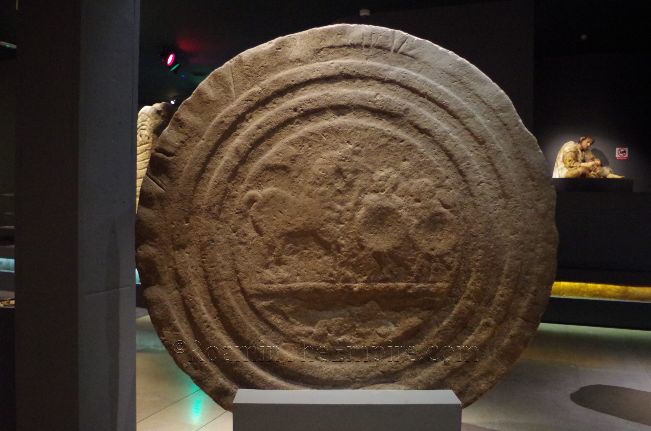
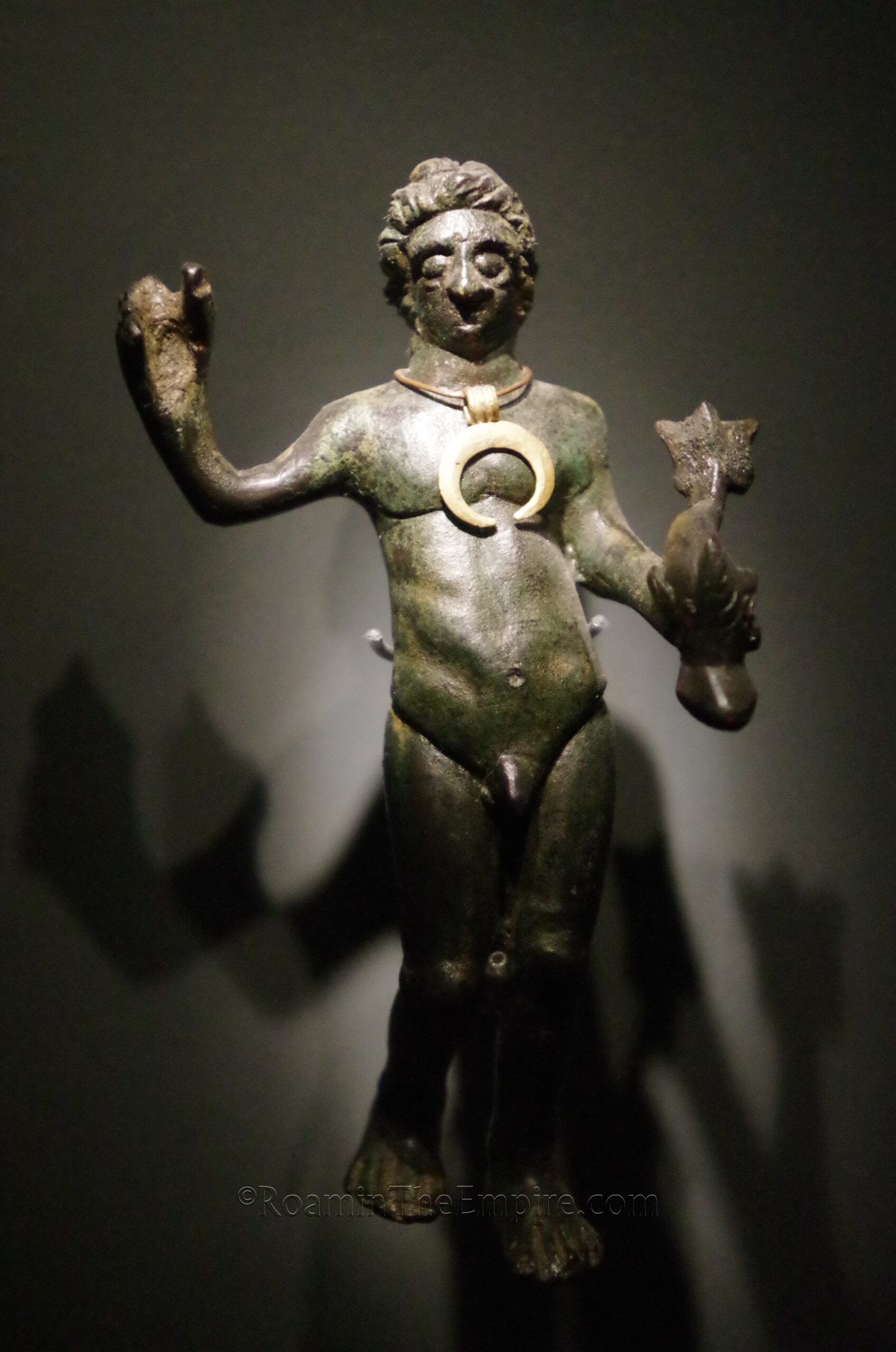
In the archaeological part of the museum, there is a nice collection of circular Romano-Cantabrian stele dating between the 1st century BCE and 3rd century CE. Some boundary stones marking the territory between Juliobriga and Legio IV Macedonica, and some altars dedicated in the Roman period to Cantabrian gods, and of course a collection of funerary stele. The museum has a decent numismatic collection as well as the more typical small finds of small bronze and household objects as well as terracotta and pottery. One noticeable absence is that there isn’t any ancient statuary. One of the highlights of the collection is a small bronze figure of Neptune with a crescent moon pendant. Most object descriptions and information is in English, French, and Spainish. It’s not a terribly large museum, it took me about an hour to go through. I was moving a little quickly as it was the end of the day and I still had quite a drive ahead to get back to where I was staying.
About 45 minutes south of Santandar toward Juliobriga, along the A67 is a building that, while modern, may be of interest to fans of the ancient world. Just outside the town of Arenas de Iguña is a church, the Iglesia de San Jorge. The late 19th century CE church is popularly known as El Partenón, the Parthenon. This is due to the fact that the church was constructed to resemble a hexastyle peripteral temple. There’s a small parking area on the east side of the church, and the church itself doesn’t seem to be frequently open. It’s the exterior that is the interesting part. But other than seeing a church built to look like a Greek temple, it’s just a quick stop.
In the mountains above Arenas de Iguña to the west is supposedly a stretch of pavement from a Roman road. I made it most of the way up, but last 3.5 kilometers is dirt road. I made it about halfway down the dirt road before it became too rough to go any farther.
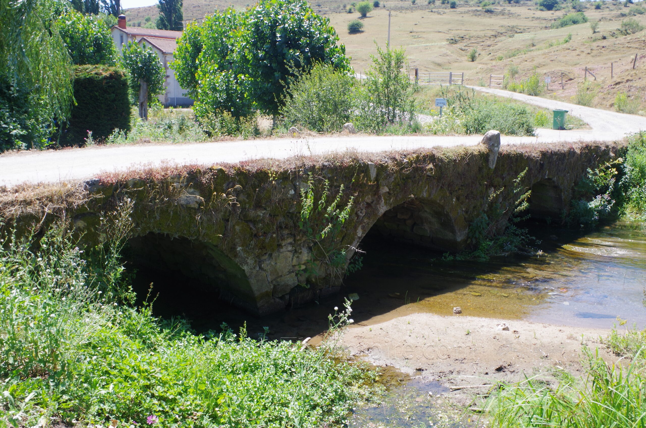
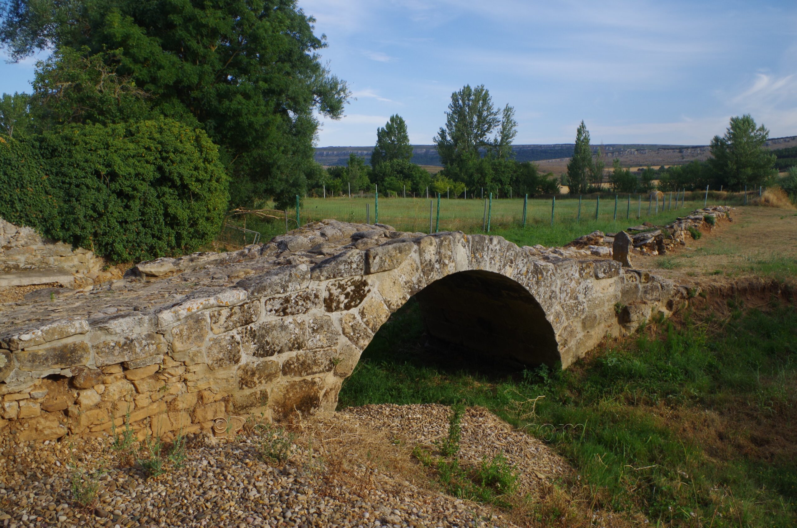
Another 27 kilometers down the A67 is Reinosa. Just to the east of Reinosa is Retortillo and the archaeological remains of Juliobriga. A few kilometers west of Reinosa is the town of Salces. On the northwest side of Salces is a bridge spanning the Iberus (modern Ebro, which originates less than 2 kilometers upstream in Fontibre) which is reportedly of Roman origin. Unfortunately I can’t find any specific information regarding the dating on the bridge. It looks like certain parts could potentially be Roman-era construction, but much of it looks to be later; or at the very least cobbled together/reconstructed with the building material from the Roman bridge. It still carries road traffic over the Iberus. It’s a quick trip from Juliobriga, so it is worth checking out. It’s also very close to the source of the Iberus, a hugely important river with regard, in particular, to the history of the Roman presence in Hispania.
A little farther south, about 16 kilometers from the bridge at Salces and 15 kilometers from Juliobriga, just to the north of Reinosilla, is the Puente La Vega. This is another bridge with uncertain dating. Several of the bridges in this region are typically claimed to be Roman due to their close alignment to the road that ran from Pisoraca (modern Herrera de Pisuerga) to Portus Blendium (modern Suances), which also ran through Juliobriga. While some of these bridges have definitively been dated to later periods, likely reconstructed at the same point a Roman bridge existed previously, others are less clear. This bridge is no longer in use and runs between two modern bridges, which give good views of the double arched bridge, which spans the Camesa River. There is a small sign in Spanish at the south end of the bridge.
A short trip down the road to Rebolledo is the Arqueositio Cántabro-Romano de Camesa-Rebolledo. It is believed that this may be the remains of the settlement of Octaviolca. Not much is known about the settlement, other than it is mentioned as being located about 10 Roman miles south of Juliobriga by Ptolomy. Like Juliobriga, the name suggests that it was established under Augustus, using his former name of Octavian as the basis.
The opening hours for the archaeological area are incredibly convoluted. For high season (June 15 through September 15), the site is open Tuesday to Saturday from 10:00 to 14:00 and 15:00 to 19:00, and on Sundays from 10:00 to 15:30. In mid season (March 1 through June 14 and September 16 through October 20) it is open Tuesday to Saturday from 9:30 to 14:00 and 15:00 to 18:30 and Sundays from 9:30 to 15:00. The rest of the year, low season, it is open Tuesday to Friday and Sunday from 9:30 to 15:30. On Saturdays, only from November 1 through December 6, it is open from 9:30 to 14;30 and 15:30 to 17:30; the rest of the Saturdays during this period are closed. The villa is closed on Mondays throughout the year. Admission is 3 Euros, but there is a 1 Euro discount if you have a same day ticket from Juliobriga. Tours are available at various points during the day, as detailed on the website.
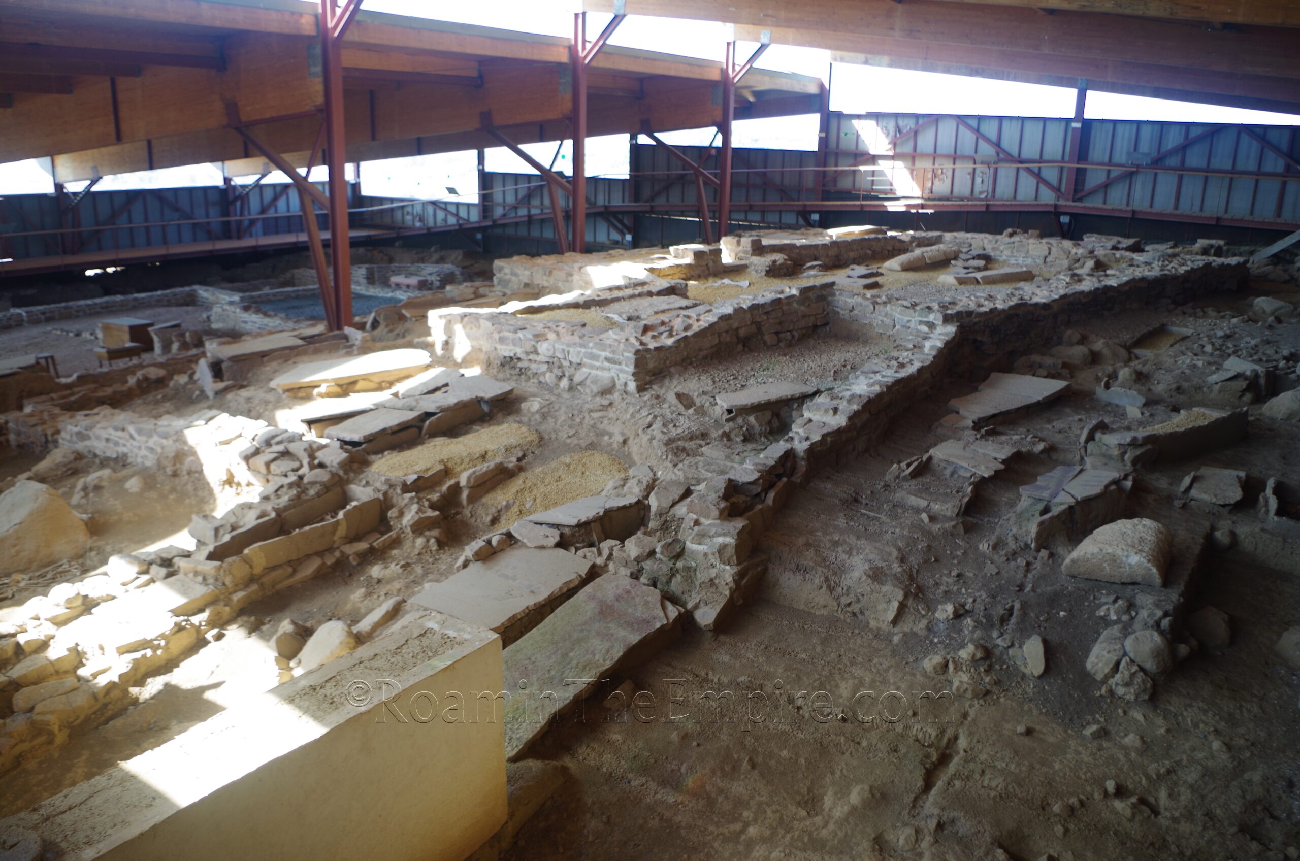
The entranced archaeological area mostly consists of a building of slightly uncertain function. It is almost certainly a residence of moderate comfort, but there is some question as to whether the remains of Octaviolca are military in nature or purely civilian. In the case of the former, it is believed that this may have been the residence of a commanding officer. It originally seems to have been constructed in the middle of the 1st century CE and functioned initially until the 3rd century CE. A secondary occupation occurred in the 4th and 5th century CE after which it was again abandoned until a small church and necropolis occupied the site in the Visigoth period. Graves from the Visigoth period can be seen to the right of the entrance and scattered throughout the archaeological area.
The dwelling is effectively built on three levels. The main floor of the museum more or less occupies the top level of the building that was also overlaid by the medieval church. There are a few ancient objects on display, including some boundary markers for the Juliobriga and Legio IV Macedonica territory, similar to those at the museum in Santander. Otherwise there are a lot of interpretive information boards for the area; all in Spanish only. The main archaeological area preserves the middle and lower levels of the dwelling. The rooms of the middle level are mostly nondescript, but include a likely atrium and triclinium. Again, the medieval graves are present throughout this level.
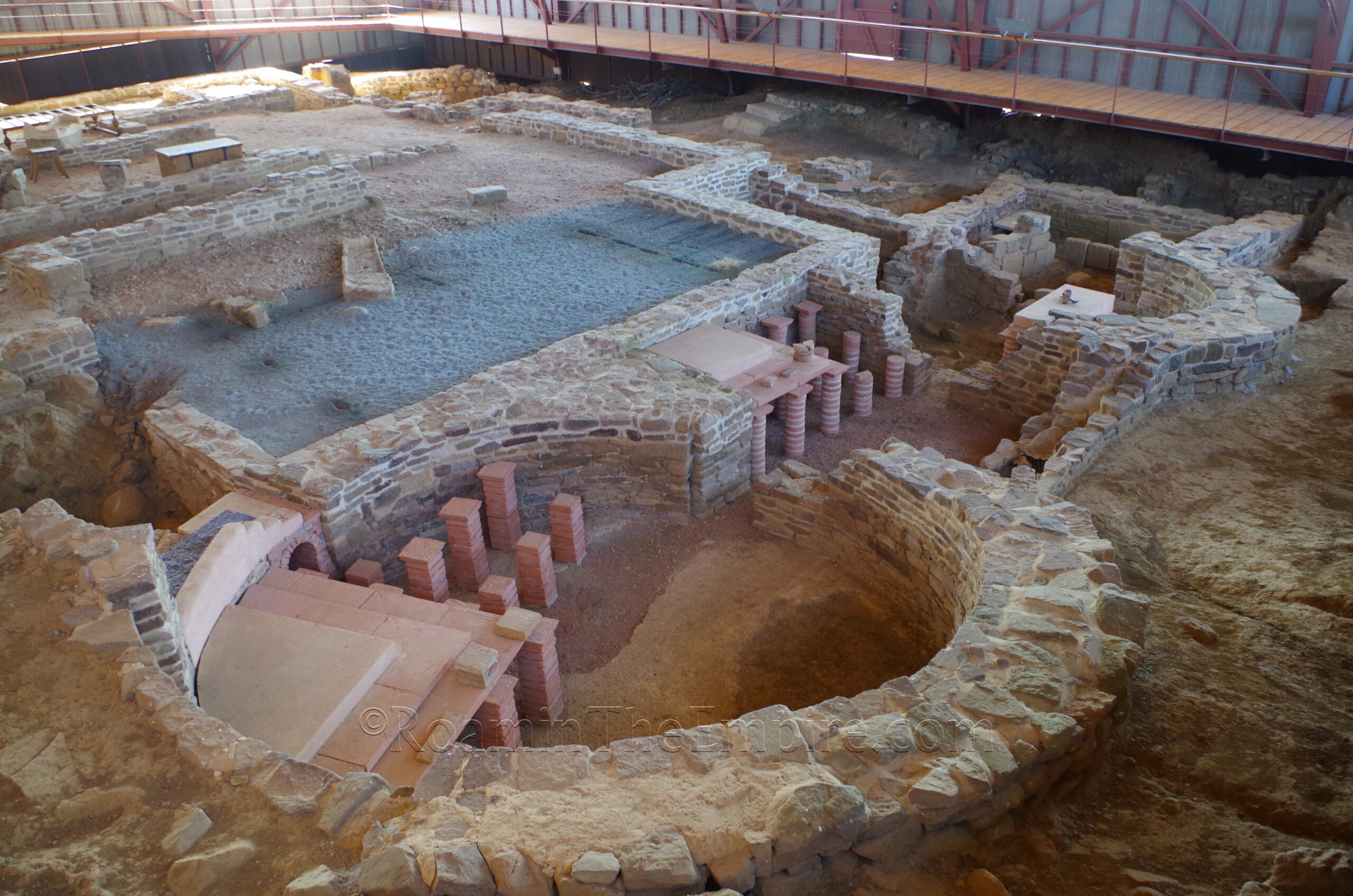
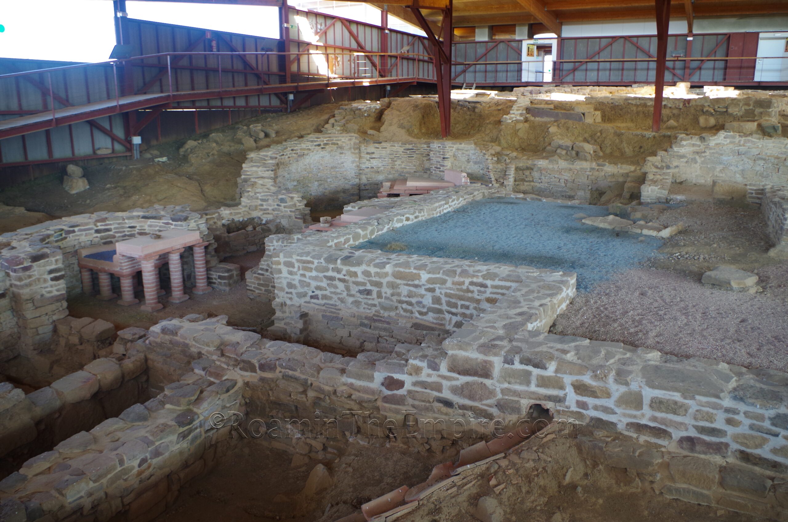
The lowest level of the building features a small, private bathing complex. On the west side of the complex are a series of three heated rooms; a circular room, a square room, and an apsidal room at the south. The circular room is likely the caldarium, with a praefurnium located off the east side of the room. The square room seems to be a heated apodyterium, and then the final apsidal room a tepidarium. To the south of the tepidarium is a latrine, with part of the toilets reconstructed. The small rectangular room off the east side of the tepidarium seems to have been the frigidarium. The large area to the east of these rooms is a courtyard area and further east are some rooms of uncertain function with modern furniture reconstructions.
There are a few structures preserved outside of the entranced archaeological area associated with Octaviolca. To the southwest is part of a building of uncertain use. It is theorized to perhaps be a public building of some sort or perhaps a small residential building. Along the east side of main building area a series of narrow rectangular structures stretching for about 60 meters. The northernmost of these structures, with a long narrow central area flanked by many small square/rectangular rooms is thought to perhaps be a modest atrium house with the southern structures being even smaller modest homes. The identification is by no means secure, and another theory suggests they might be part of a modest mansio. In all, I spent about 30-45 minutes at the Arqueositio Cántabro-Romano de Camesa-Rebolledo.
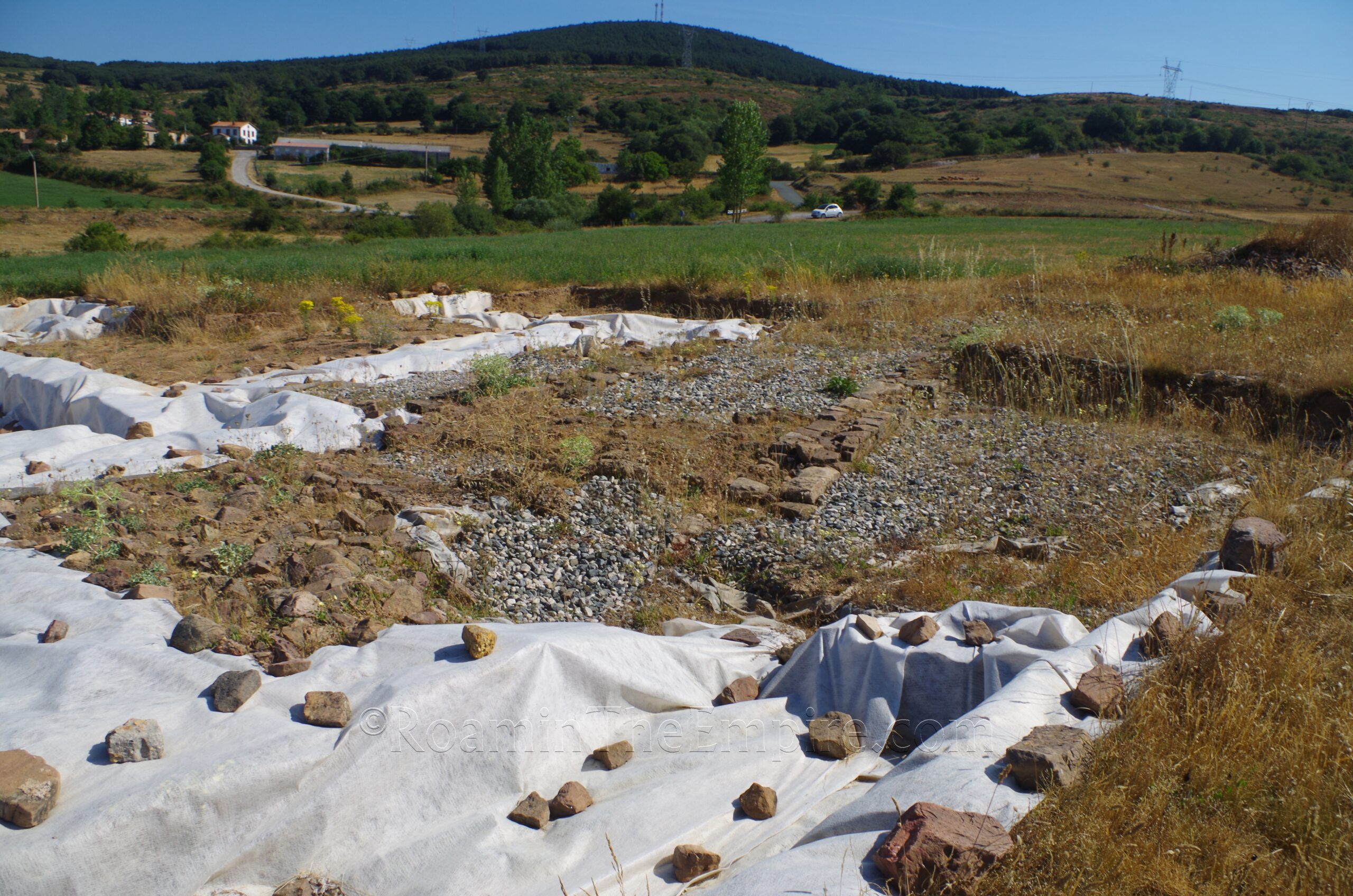
Less than a kilometer up the road to the north is another excavation associated with Octaviolca called La Cueva. It requires a short walk down a dirt road off the road to Camesa. Another long, narrow building has been found here, with just the western end of it currently excavated. This building is thought to have perhaps been a barracks, adding to the theory that the settlement may have had at least some military function. Unfortunately there was very little visible, as again most of the structure is not exposed, and that part which was exposed was mostly covered by tarps; at least during my visit. There were a few parts of walls that were visible, but not a whole lot. Honestly probably not worth the trouble for most people.
About 8 kilometers driving from the Camesa-Rebolledo site via the CA-284 and CA-834 is the village of La Quintana (not to be confused with La Quintanillas, the village just to the north). On the north side of La Quintana is a pasture area with a stretch of 1st century CE Roman road paving; part of the Pisoraca- Portus Blendium road network. The area is technically fenced, but there is a little step to get over the fence. The presence of fresh cow droppings would seem to indicate that the area is in use and could potentially be occupied; I had to pass through (with some difficulty) a sizable herd of cattle being moved on the road toward La Quintana about a kilometer to the south that I suspected could have been the occupants. Part of the road is overgrown, but there is a good stretch of about 20 meters visible, including some kind of channel at the south end. There is an informational sign in Spanish on-site.
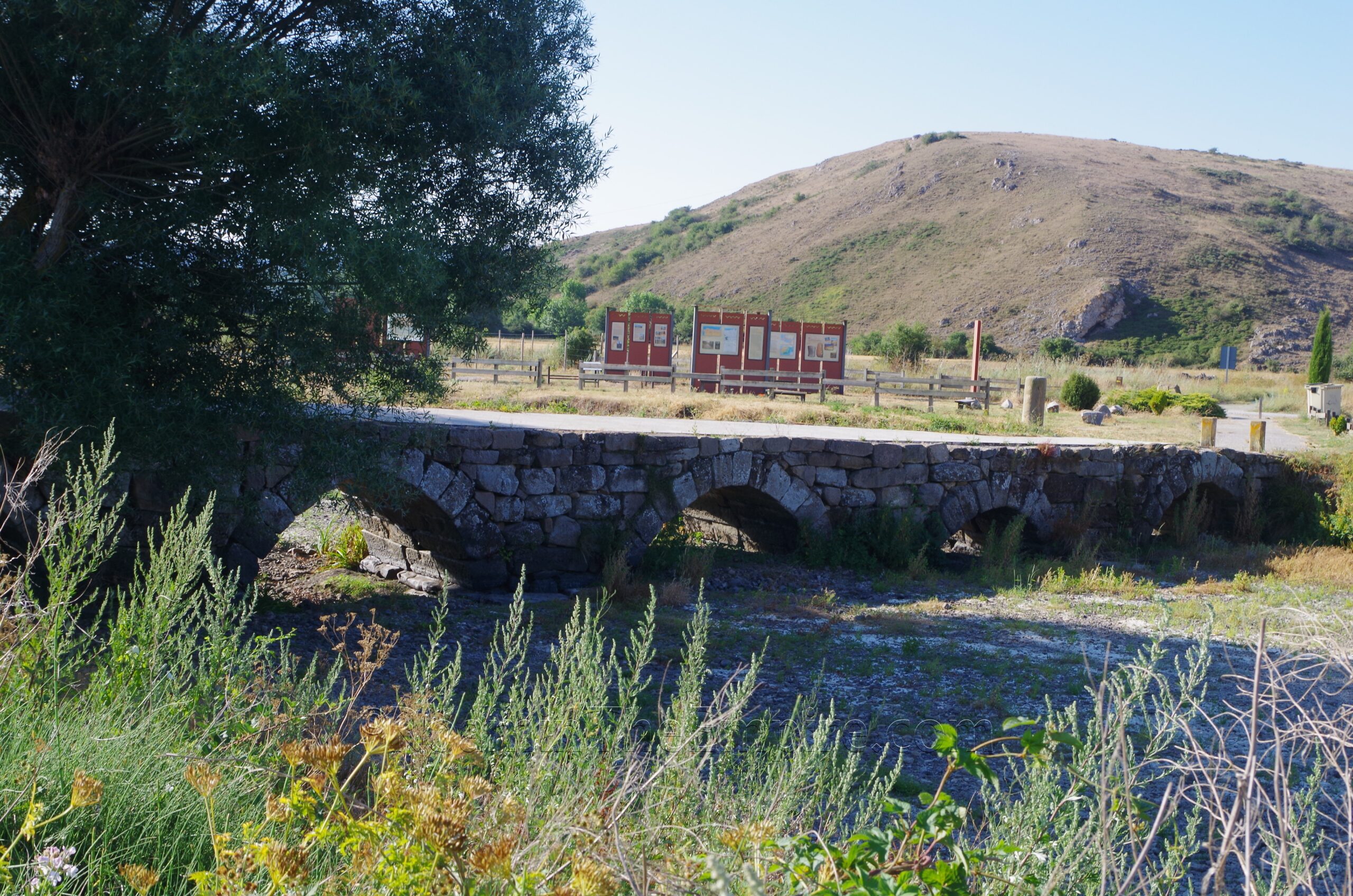
Another 7 kilometers to the south on the CA-834/PP-2208 is the town of Nestar. Outside the southeast side of town is the Puente de la Perdiz. The bridge, which spans Rubagón with five arches, seems to have been built toward the end of the 1st century BCE, perhaps following closely after the end the Cantabrian War. Like the other bridges, it was part of the network between Pisoraca and Portus Blendium. Though paved over the top, the road is closed to traffic. There’s an area with a bunch of informational signs on both the bridge and the wider area on the southern side of the bridge. All the information is in Spanish.
The final stop on the itinerary is a bit farther out, about 16.5 kilometers away in Puentetoma (a total of about 40 kilometers driving from Juliobriga). This is technically out of the valley and no longer along the Pisoraca-Portus Blendium road; but rather it is a short drive east of that axis. It is along the N-627 headed toward Burgos. On the south side of town, of which the name is derived from the presence of the bridge, is the Puente Romano de Puentetoma. The single arch bridge over what was the Rio Lucio, which has now shifted about 80 meters to the south, was apparently reconstructed to some degree in the medieval period, using the existing Roman bridge and materials from the Roman bridge. A stretch of stones forming a line of pavement on the south side of the bridge is often described as being part of a Roman road that led to the bridge, but in reality seems to be the remains of a pre-Roman bridge over the Lucio.
I paired all these sites along with Juliobriga, and while it was a long day with quite a bit of driving, it can certainly all be done in a single day.


Sources:
Curchin, Leonard A. Roman Spain: Conquest and Assimilation. New York: Routledge, 1991.
Gil, José Manuel Iglesias. Juliobriga in its Historical Setting. Cuadernos de Campoo, No. 4 (June 1996).
Gomez, Jose Maria Robles. From Juliobriga to Octavioca. Cuadernos de Campoo, No. 10 (December 1997).
Luis-Ruiz, Julio Manuel de, et. al. Optimization of Photogrammetric Flights with UAVs for the Metric Virtualization of Archaeological Sites. Application to Juliobriga (Cantabria, Spain). Applied Sciences, Vol. 11, No. 1204 (2021).
Pliny the Elder. Naturalis Historiae, 3.4.4-8, 4.34.1.
Ptolemy. Geographia, 2.60.50.
Smith, William. Dictionary of Greek and Roman Geography. Walton & Murray, 1870.
Stillwell, Richard, William L. MacDonald, and Marian Holland. McAllister. The Princeton Encyclopedia of Classical Sites. Princeton, NJ: Princeton U Press, 1976.