


Most Recent Visit: May 2024
Though the area was inhabited since prehistoric times, the ancient city of Edessa seems to have been continuously occupied by the late 8th or early 7th century BCE. It is thought that the earliest inhabitants were the Bryges, a Thracian people from which the Phrygians seem to have originated. The name Edessa is believed to have been derived from the Phrygian word for water, vedu. The Bryges inhabiting Edessa were then subsequently conquered by the Macedonians by the 6th century BCE. According to Macedonian legend, however, Edessa was founded as the first capital of the Macedonian Kingdom by Karanos, the mytho-historical progenitor of the Macedonian people and the founder of the Argead Dynasty in the late 9th century BCE.
The location of Edessa allowed for control of an important pass that permitted movement between the Adriatic coast and Upper Macedonia. The centralized location was also a natural choice for a capital city and served as an easy mustering point for Macedonian armies. Edessa’s position as capital of the Macedonian Kingdom was short-lived, as it was moved to Aigai sometime in the first half of the 5th century BCE. The city’s central location allowed it to continue being a logical point to gather Macedonian armies, though.
When Pyrrhus launched his campaign against Demetrius I Poliorcetes through Thessaly, it is noted that he advanced unopposed as far as Edessa before Demetrius set out against him, forcing Pyrrhus to withdraw. Following the arrival of Roman hegemony in Macedonia, the Via Egnatia was constructed and exited the Pindos mountains at Edessa, replicating the earlier important route which was controlled by the city. Edessa remained relevant for this reason, but otherwise was seldom mentioned in the historical record other than to state its existence.
Getting There: The modern town of Edessa is not particularly large, but is a relatively big tourist draw in the region with its famous waterfalls (which may or may not have existed in antiquity). There are relatively frequent busses between Thessaloniki and Edessa; one every hour to hour and a half each way. The journey itself is about an hour and a half. The schedule can be found on the KTEL Pellas website. Presently ticket prices are 9.70 Euro each way or 18.00 Euro for a return trip. The main archaeological area for Edessa is in a rural area about 3 kilometers walking from the Edessa bus station, and there doesn’t seem to be local public transport that goes out or near it. Walking seems to be the option. Going to the site is downhill, but going back is a pretty steep grade uphill. So while possible to do Edessa as a day trip by public transit, it may involve quite a bit of walking. Otherwise there is parking at the site for private transportation.
In antiquity, the city spanned both the plateau on which the modern town is now located as well as the valley below. Because of the continuous habitation of the upper part, almost nothing remains of the acropolis of the ancient city, and what does is not accessible. The archaeological area of Edessa is part of the so-called Longos, the lower section of the city. This area was abandoned in the 6th or 7th century CE while habitation continued in the upper town. It is located along an unnamed road right next to the Agia Triada Monastery. The site is open from 8:30 to 15:30 and closed on Tuesdays. Admission is free.

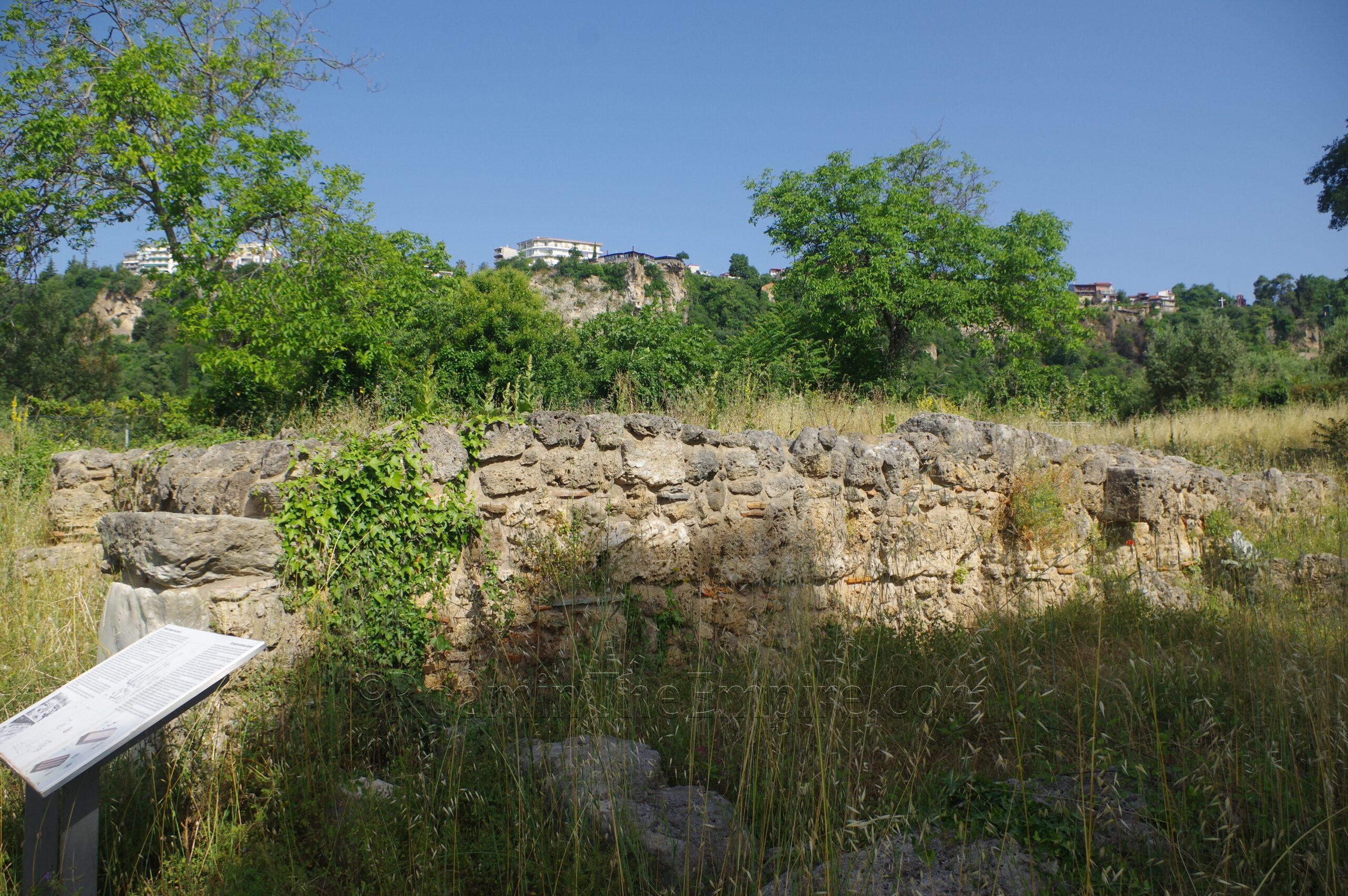
One enters the site from the southeast side of the excavated part of the city and walks along the fortification walls to the southern gate. The walls that enclosed the lower city ran a circuit of about 1.2 kilometers and are preserved in this part of the city to a fairly significant. The walls were originally constructed in the 4th century BCE and were again repaired and bolstered in the 3rd century CE when Gothic incursions again required their use. The famous pig tombstone was found among the spolia of the 3rd century CE restorations of the wall. A plaster copy is on display at the site, though I’ve yet to figure out where the original is. I was told by the custodian that it was in the Polycentric Museum of Aigai, but it is not there (or at least is not on display).
The wall continues along to the southern gate of the city, which like the rest of the walls in this area is preserved to some height. The gate opens up onto the colonnaded cardo maximus of the city. On a block at the eastern corner of the exterior façade of the south gate is a small human figure carved into one of the corner blocks. I was told by the site custodian that this is an ancient carving, and it definitely looks like it could be.
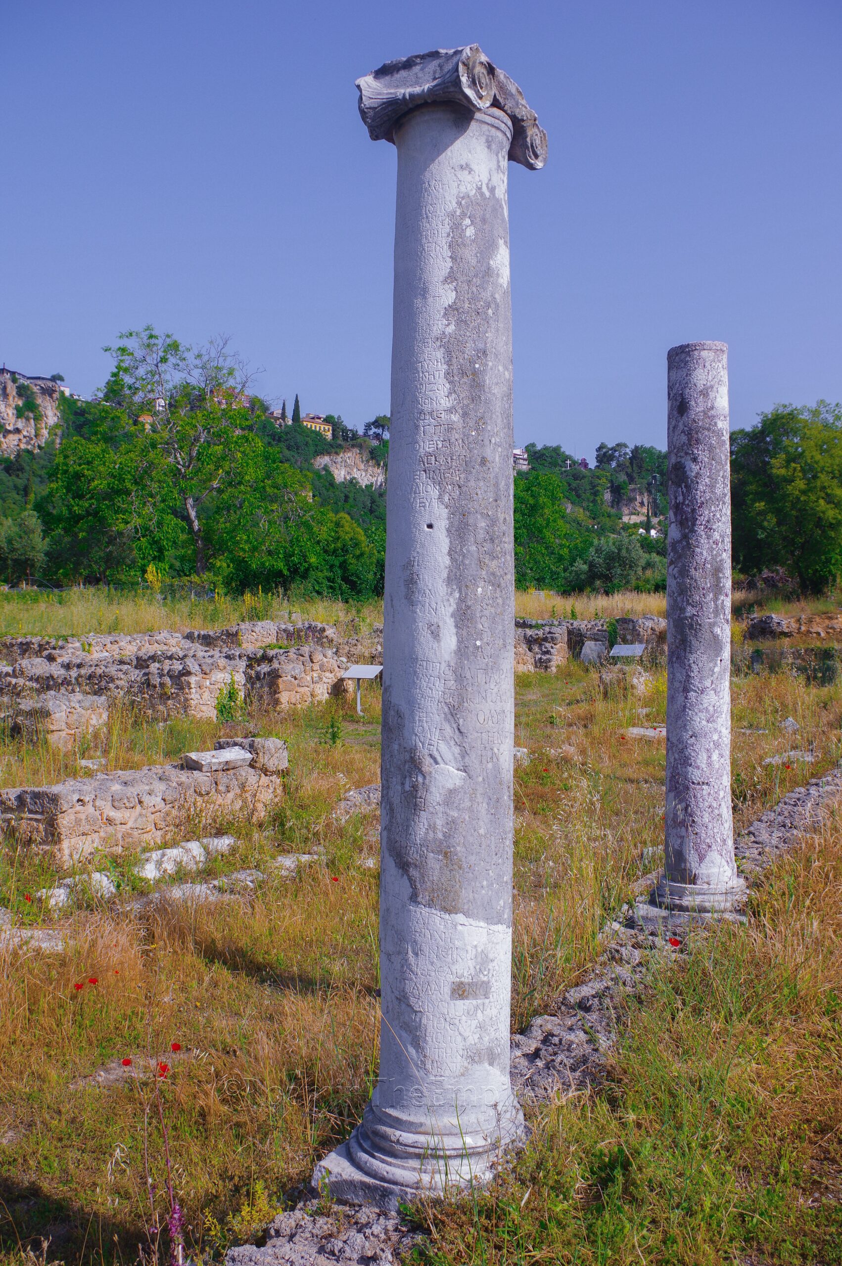
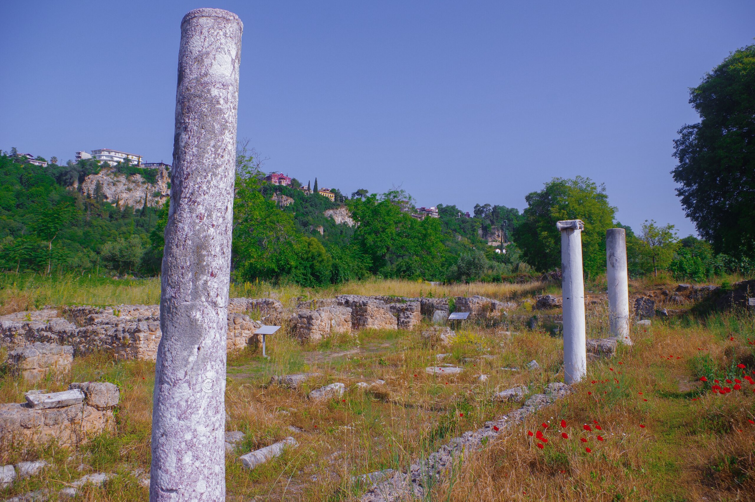
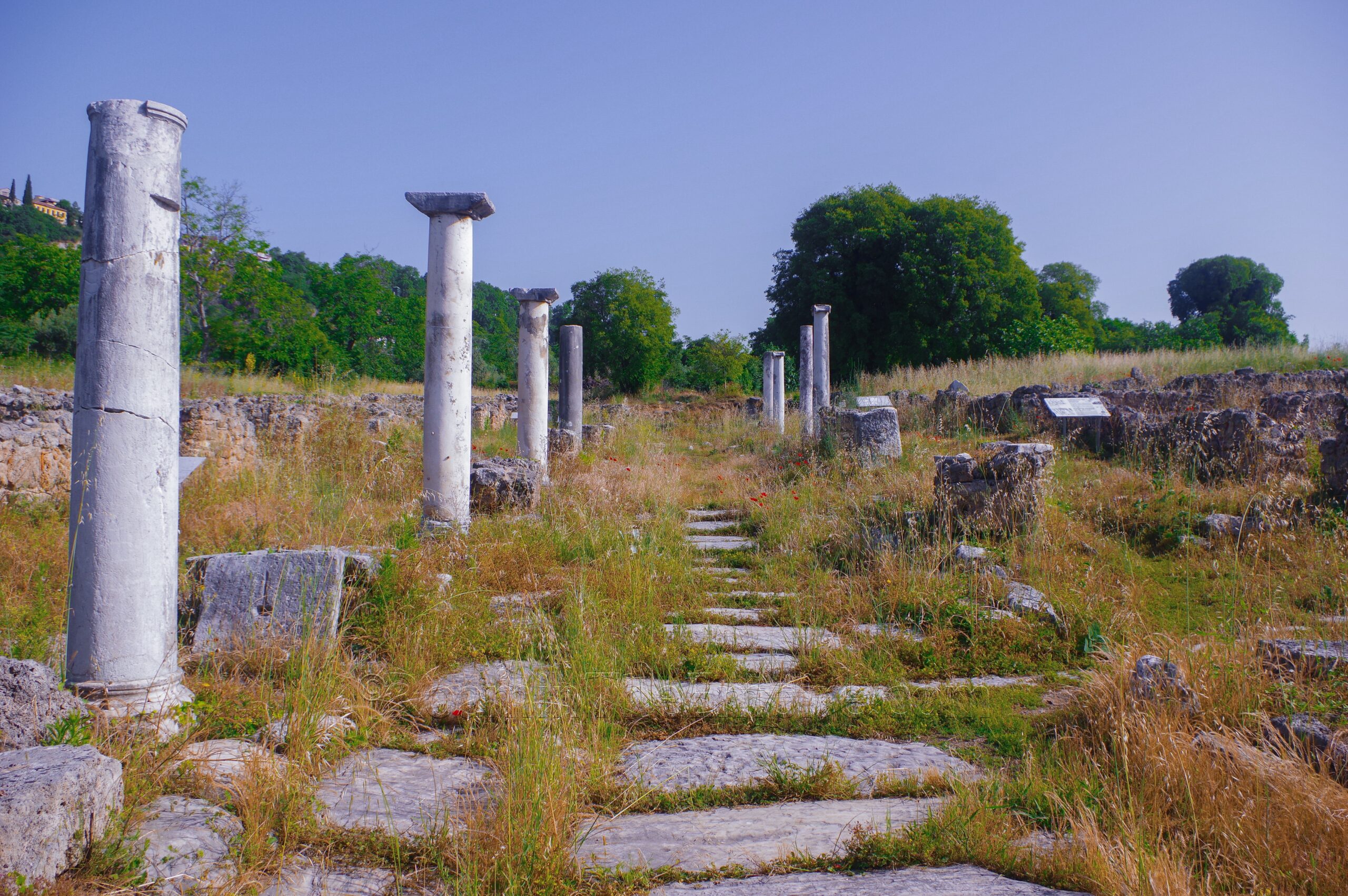
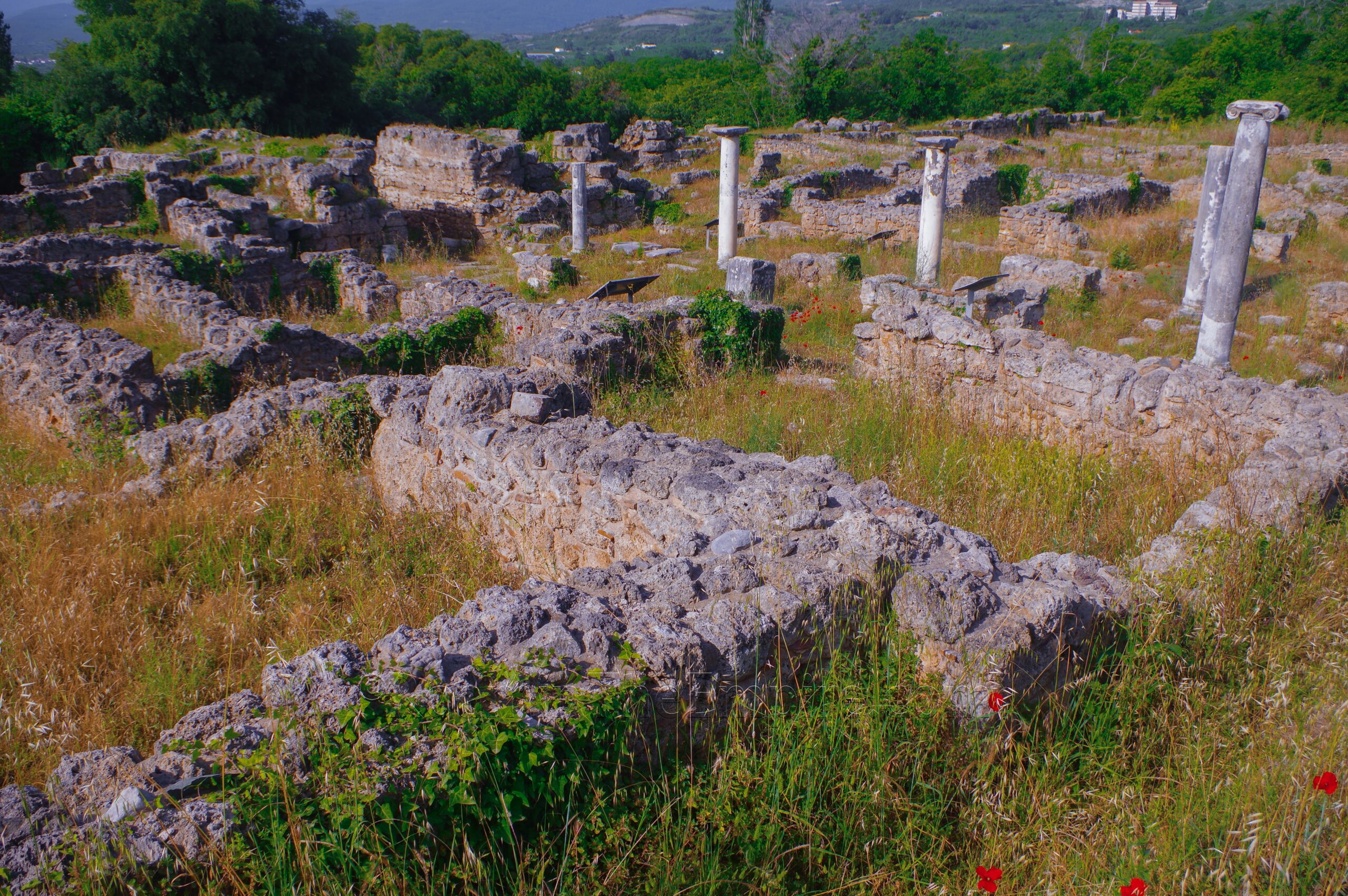
Passing through the south gate, the cardo maximus is excavated for about 65 meters stretching to the north. Some columns are remaining/reconstructed on either side of the street, with slightly raised stoas on either side. The construction of this has been dated to sometime shortly after a destruction that occurred due to a Gothic raid about 268 CE, based on the usage of spolia in its construction. The first column on the east side is particularly interesting as it was taken from a temple dedicated to the goddess Ma, likely destroyed in the 268 CE raid. It has a number of visible Greek inscriptions, predominately slave manumissions through dedication to Ma. These seem to date from about 211 CE through 267 CE.
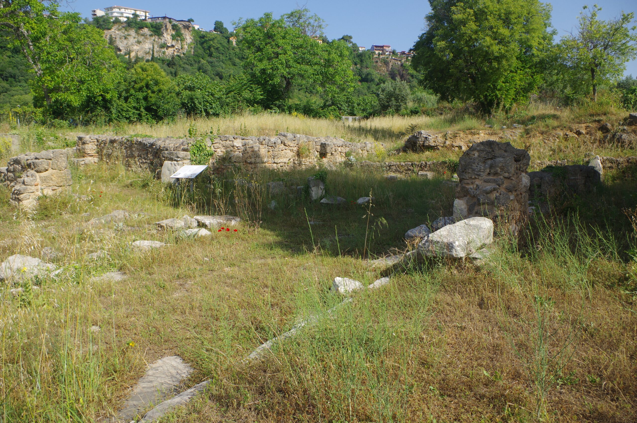
Immediately to the right (east) side of the south gate is a three room construction abutting the fortifications that has been identified as possibly being a military lodging. The room closest to the street, which now is barely distinguishable, served as a latrine and dated generally to the early Christian period. The two further rooms were living quarters. A staircase leading up to the walls is visible in the middle of these rooms.
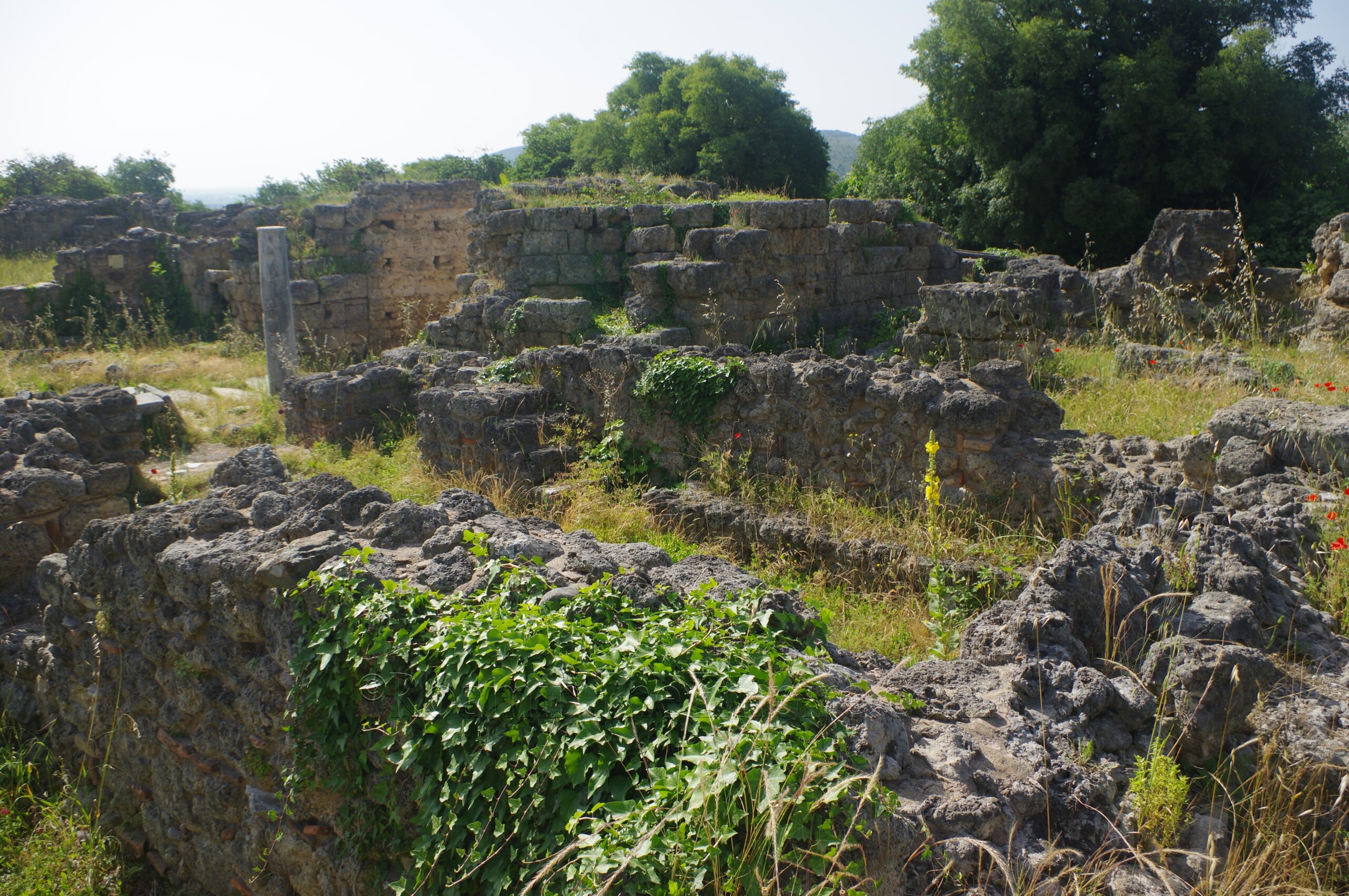
Two small roads lead off to the east and the west a few meters inside the southern gate. To the west, a couple of shops are located on the corner of the intersection with the cardo maximus. Heading along the western street leads into a residential district dating to the 4th to 6th centuries CE. The buildings are largely nondescript, and also fairly overgrown, obscuring what few distinguishing features outside the wall foundations might remain. The area to the north is another such neighborhood, but is more sparsely excavated. Fronting the cardo maximus were street level commercial areas that had residential spaces located on the second floor.
Located at the northernmost excavations on the west side of the cardo maximus was the so-called tripartite warehouse; a triple-hall horreum somewhat reminiscent of basilica layout. As is the case with much of this part of the site, the building construction dates to the period following the 268 CE destruction. The entrance is located on the south side of the building and evidence of storage jars have been found inside. The horreum had an upper gallery level of unclear usage, but probably associated with some trade or commercial activity. Next to this, to the east, is an area identified as part of an early Christian complex of unknown use. Below the remains of the early Christian level are some traces of a previously existing bathing complex from the pre-268 CE Roman period. There honestly isn’t much to look at here in the way of visible remains, though, just a few scattered bits of masonry.
The area immediately adjacent to the cardo maximus on the east side of the street is not particularly well excavated aside from a small block at the corner of the cardo maximus and the street running inside the north gate. Once again, it’s a mostly residential area dating to the 4th-6th centuries. Remains of earlier Roman or Hellenistic workshop have been found below. The most interesting feature of this area is that the two rooms on the corner of the intersection have been identified as a glass blowing shop based on furnaces found there. Due to either the removal or the overgrowth in the area, the remains of the furnaces don’t seem to be visible, or at least were not when I visited.
The eastern road continues to the east past this residential area. Another area along the walls has been excavated about 20 meters to the east, but this was completely overgrown and nothing was visible at the time of my visit. The path then continues north to an area that is also accessible via the north end of the excavated cardo maximus. A complex located here has been identified as some sort of public building dating to the 5th to 6th centuries CE. A structure with a paved courtyard is the most visible area of the complex. An apsidal building sits to the north of this, but it was neither accessible nor visible.
The northern public building complex essentially wraps up the main part of the site. The custodian offered to let me into a gated area that continues along the walls up from the site office to the eastern gate of the city. The walls are pretty well preserved along here, and some significant elements of the east gate have been preserved as well. I was politely requested to stop at the east gate and not continue on beyond that as it was ‘not safe’ with no further explanation of why it wasn’t safe. But the walls do continue. I’m also not sure how regularly accessible this part of the site is, as it was locked even with the custodians around. There’s also one funerary stele with a relief on display at the site offices.
In all I spent around an hour visiting the Longos archaeological area. There were plenty of informational signs located around the site with explanations in both Greek and English. The site custodian was very friendly. The one drawback is the vegetation isn’t very well maintained as can be seen in the pictures. It’s also worth mentioning that the Agia Triada Monastery, about 75 meters down the road to the east, supposedly contains another inscribed column from the sanctuary dedicated to Ma. Unfortunately the monastery was closed when I visited (despite being within the posted opening hours of 6:00 to 9:00 and 11:30 to 15:00). Spoliated funerary inscriptions also appear to be used in the western façade of the main building based on pictures.


Sources:
Evangelidis, Vassilis. The Archaeology of Roman Macedonia. Oxford: Oxbow Books, 2022.
Grant, Michael. A Guide to the Ancient World: A Dictionary of Classical Place Names. New York: Barnes & Noble Books, 1997.
Hammond, N.G.L. A History of Macedonia Volume 1. London: Oxford University Press, 1972.
Justin. Liber Historiarum Philippicarum, 7.1.
Livy. Ab Urbe Condita, 42.51, 45.29-30.
Plutarch. Demetrius, 43.1.
Plutarch. Pyrrhus, 10.2, 12.6.
Polybius, Historiai, 5.97.
Smith, William. Dictionary of Greek and Roman Geography. Walton & Murray, 1870.
Stillwell, Richard, William L. MacDonald, and Marian Holland. McAllister. The Princeton Encyclopedia of Classical Sites. Princeton, NJ: Princeton U Press, 1976.