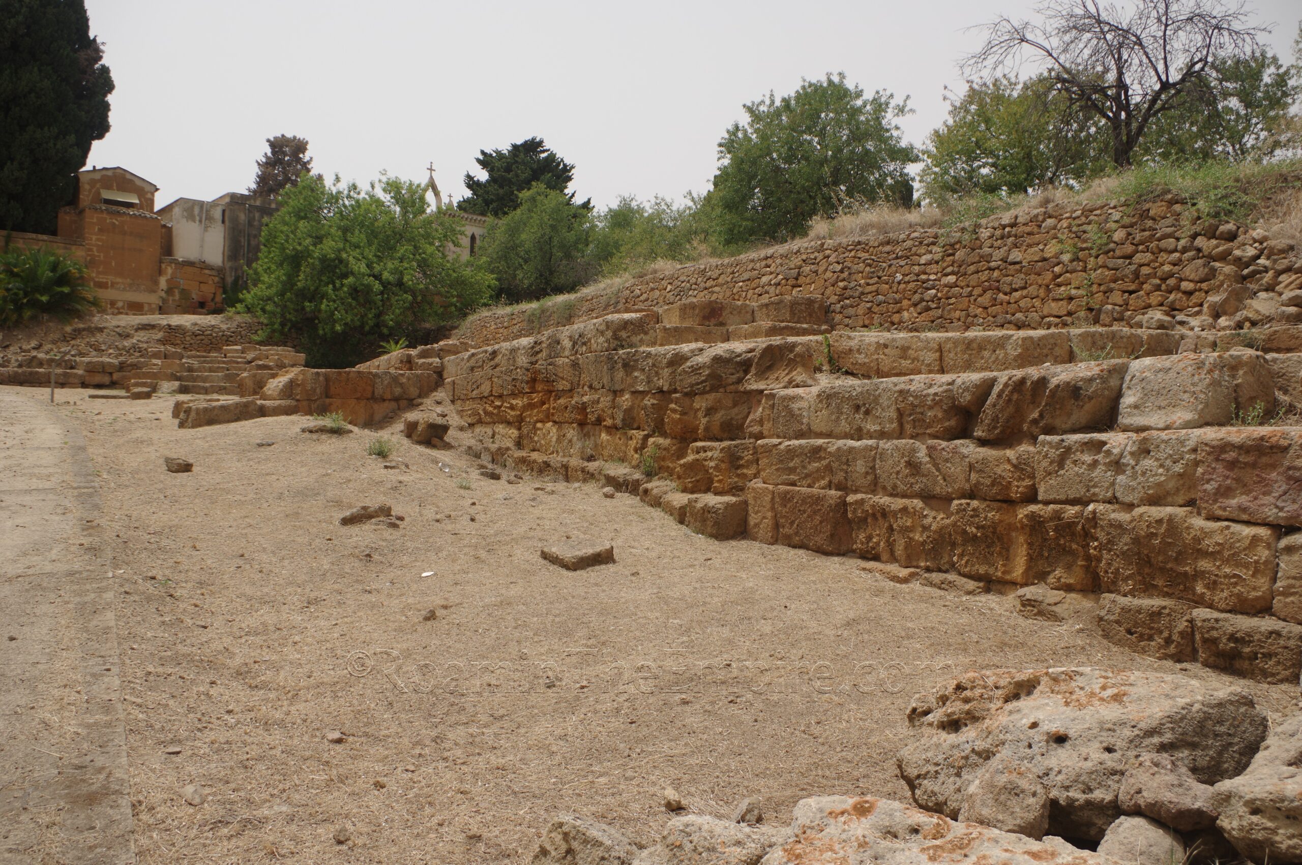
Continued From Agrigentum, Sicilia Part II
The first time I visited Agrigento in June 2017, I was just a few months on from officially starting this project. It was one of the first sites I visited after I had actually started working this. Though I had gone into summer 2016 travels with the idea, I was still sort of playing it by ear. But with the travels in 2017, I had already started the writing and working on sites, but was still very much figuring things out as I went along. I hadn’t quite honed my strategies for finding all the things I needed or wanted to see in places, and so I missed a few things my first visit to Agrigento (and a few others have since become accessible). In the intervening years, I’ve wanted to revisit and see the things I missed the first time around (and just to visit the site again). I was able to do that in the summer of 2024 and these posts are meant as sort of addenda to the previous series on Agrigentum.
The first site we’ll visit is up in the main part of the modern city of Agrigento in the historical center. The ridge upon which the modern city is constructed was, in antiquity, the acropolis of Agrigentum. Located near the western apex of the ridge is the Chiesa di Santa Maria dei Greci at about 31 Via Santa Maria dei Greci. The church is open for tourist visits Monday through Sunday from 10:00 to 19:00. Admission just to this church is 3 Euros, but there is a combo ticket available that also gives access to the cathedral and the Diocesan Museum for 7 Euros.
The Greek-Byzantine Chiesa di Santa Maria dei Greci was built upon the ruins of a Doric temple circa 1200 CE. It incorporated elements of the temple in the subsequent construction. The Doric temple was constructed in the 5th century BCE and is believed to have been dedicated to Athena Lindia and/or Zeus Atabyrios, both of whom are mentioned by Polybius as either having temples or sharing a temple on the acropolis of Agrigentum. These gods are also both associated with the ancestral homeland of the founders of Agrigentum, Rhodes. The dedication of the later church to Mary would seem to indicate that Athena might be the stronger candidate for the temple, and it is often cited specifically as the goddess to whom it was dedicated.
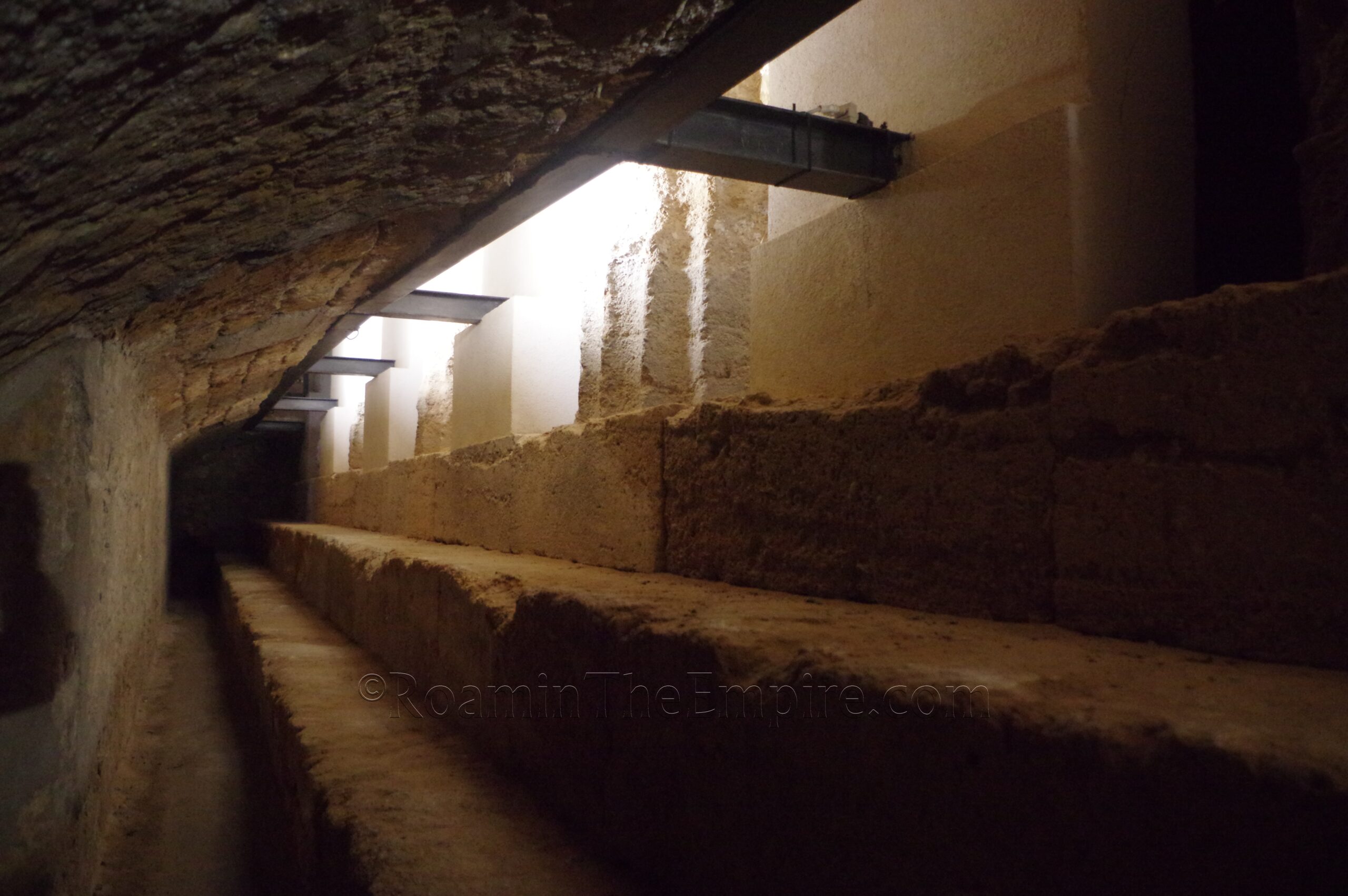
Upon entering the church area, a tunnel to the right allows access along the northern crepidoma of the temple. Some of the exterior sides of the bases of the columns area also visible from here. One can then go up and into the interior of the later church, where several sections of glass floor allow views onto the foundations of the Greek temple as well as some vestiges from earlier versions of the church, namely a colatoio. On the north and south sides of the church, the remains of columns are visible, incorporated into the walls of the church. The church’s apse also appears to preserve some elements of the floor of the original temple.
A bit of a walk down the hill, about 1.5 kilometers from the Chiesa di Santa Maria dei Greci, near the intersection of Via Alessandro Manzoni and Via Giuseppe Toniolo, are the remains of one of the ancient gates of the city. The gate, designated Gate IX; one of two gates identified on the north side of the city. There is a large undeveloped plot of land here, and the gate seems to be at the west end of this. Unfortunately it is also very overgrown (or at least was when I visited) and there isn’t a whole lot to see. Some cuts in the rock are visible on what would seem to be the western side of the gate, but even this wasn’t really exposed when I visited. This gate belongs to the system of walls constructed around Agrigentum in the 6th and 5th centuries BCE. The area is fenced off, but has lots of improvised points of ingress were one to want to venture in.
Just to the northeast of the main archaeological area is the Casa San Felippo, the main administrative offices for the archaeological park. About 150 meters north of the offices is a gated parking lot off the east side of Strada Provinciale 4 in an old quarry. Most of the quarrying activity around the parking lot looks decidedly modern (or at least not ancient) to my eye, but I couldn’t find any definitive information one way or another. In any case, I checked with the park office to make sure that parking in that parking lot was ok and was assured that it was, but that the office closed and the gate was locked at 17:00 whether my car was in there or not. So it’s not always open. Typically an alternative to visit the things in this area would be the parking lot on the north side of the cemetery, but when I visited, the road there was being worked on (hopefully to allow better access to these sites) and I was not allowed even pedestrian access through this way.
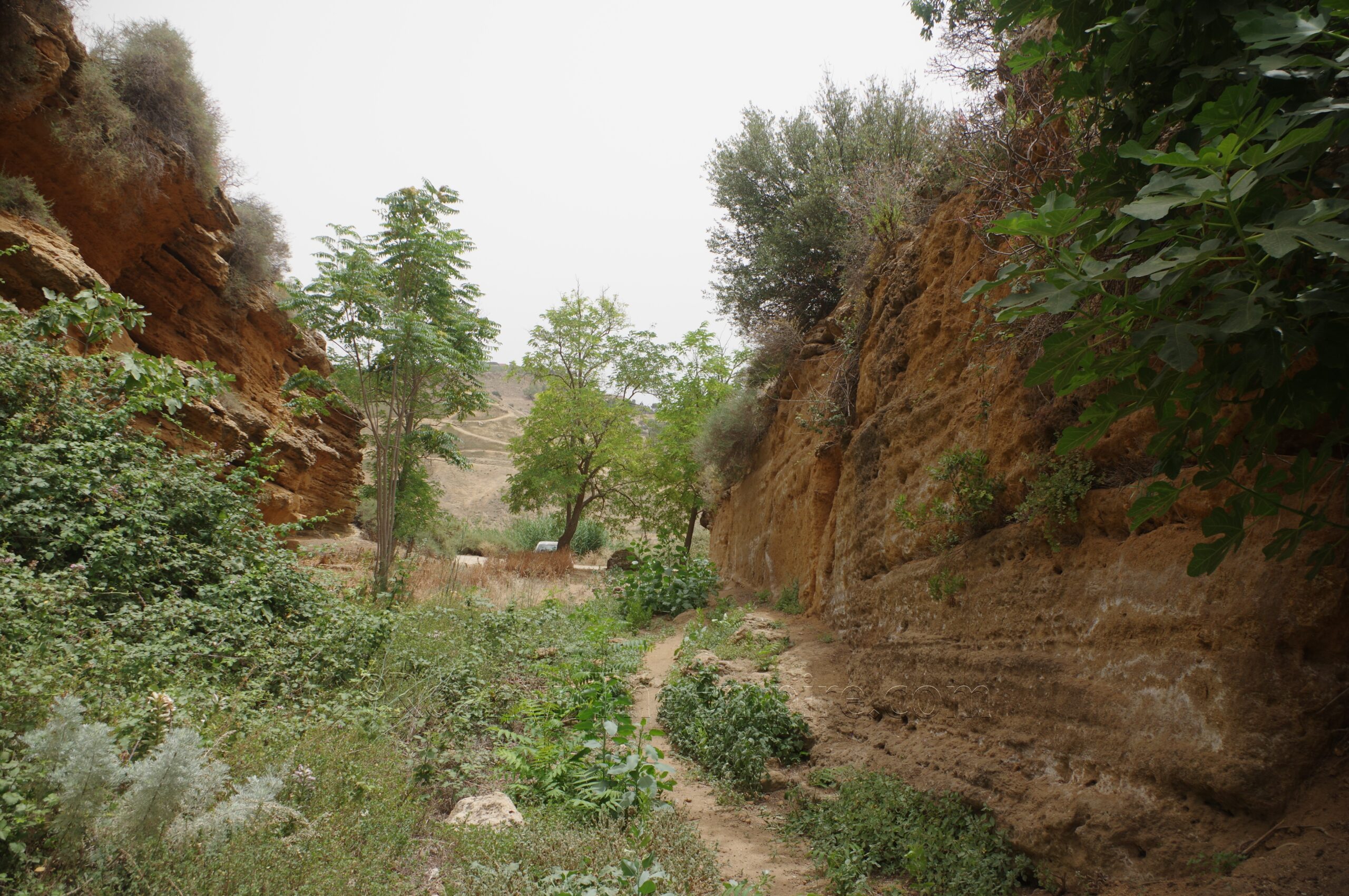
From the parking lot there is a path that leads off to the southeast. This path leads to Gate II, also called the Gela Gate as the road from here lead from Agrigentum to Gela. Like Gate IX, this one is predominately built by carving out of existing rock, rather than the construction of freestanding masonry. Although there was a masonry element added to enhance the height of the fortifications starting in the 6th century BCE. None of the masonry survives, so most of what is here is just a sloping cut in the rock starting out about 4 meters and widening to 8 meters. There is a split in the path, with one leading down and through the gate, and the other leading to a viewpoint overlooking the gate. The area is quite overgrown, but the path down is traversable. Although there isn’t much to see other than cut rock walls, though there is a cut stairway near the interior entrance that leads up to some cut terraces on the south side of the gate.
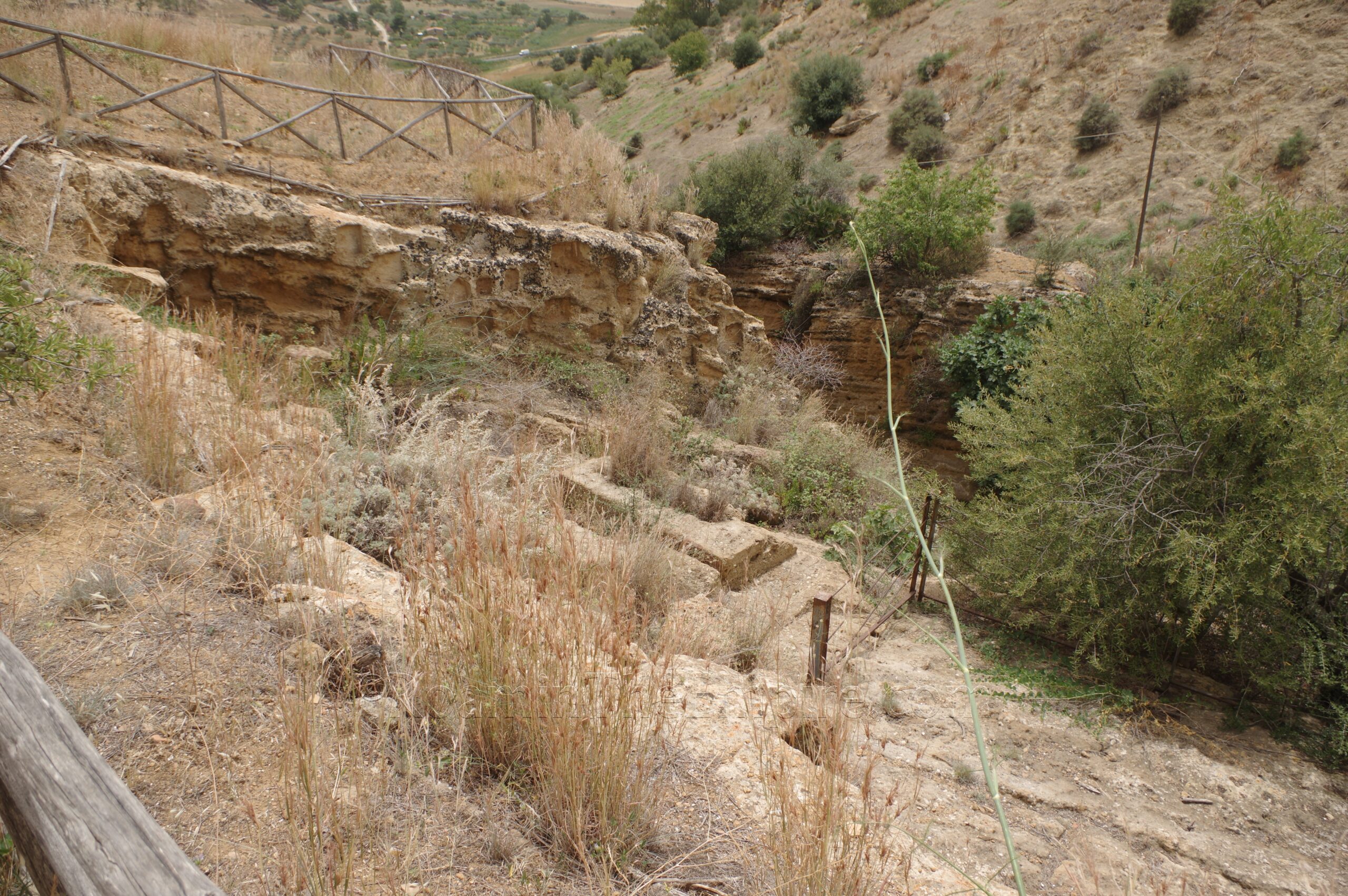
For the upper path, it overlooks an interesting rock-cut platform area above the midpoint on the north side of the gate. Along the south wall of this area, a number of niches are cut into the rock. Although it was a bit overgrown and they weren’t very visible, there are also hearths cut into the rock here. This area was used for consecration rituals during the construction of the walls, with the niches having provided for the placement of votives. Unfortunately there is no direct access to the area, though the presence of a small fence seems to indicate that there once was. There is a sign off the main path near here that explains the gate with a diagram and information in English, French, and Italian.
Heading back to the parking lot, there is another path that heads off to the northwest before doubling back and essentially leading to the area above the parking lot quarry. Located here is the so-called Punic Quarter. The area was first built up in the late 5th or early 6th century BCE, but was destroyed in the Carthaginian conquest of Agrigentum in 406 BCE. It was then rebuilt in the 4th century BCE, using the distinctive opus africanum building style, only to be destroyed once again during the First Punic War. Following this final destructive event, the area was effectively abandoned. The Punic construction of the 4th century BCE is what remains visible today, giving the neighborhood its name.
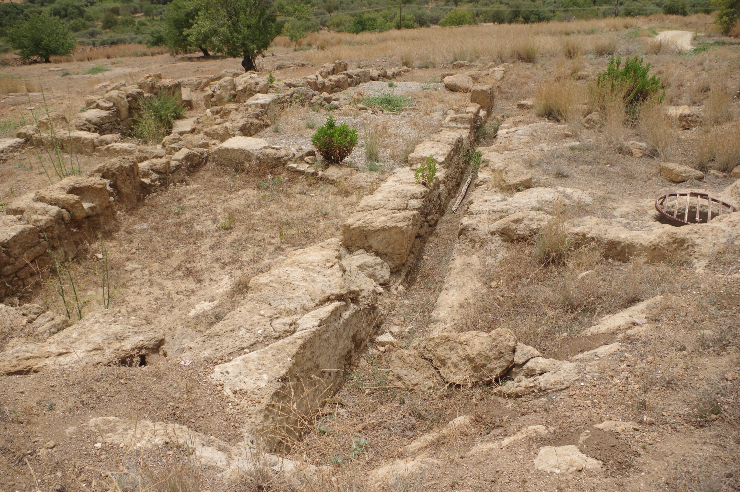
The remains of three houses situated between two secondary north-south roads (stenopoi) are visible on this terrace. The northernmost, House A, is the best preserved. The form of the house, with rooms situated around a central courtyard is more or less visible. This is followed by House E to the south of that, and House C at the southernmost of the excavated area. The distinct form of rooms are visible in each of the houses. A few of these have some extant plaster on the walls. There are a few cisterns dug into the rock. The road running along the east side of these buildings is very visible and has the presence of cart ruts worn into the rock. The western road, which is a good 15 meters from the west side of House A is not as easy to discern. A drainage canal also runs along the east side of House A. The area is not extremely well taken care of and is a bit overgrown in places. But the area is not fenced off and is open access. A sign in English, French, and Italian is located along the main path giving information and a diagram of the Punic Quarter.
The path continues east and then around a house and back along the apsidal wall of the cemetery and then to the southeastern corner. Starting at this location are the remains of a series of fortifications associated with Gate I of Agrigentum. The walls can be seen forming a corner at this point, at which was located a tower. This corner mirrors the actual gate, which was located about 155 meters to the northeast. The walls between the tower and the gate were identified as being a particularly weak point in the defensive fortifications. The tower and the fortifications of the actual gate thereby formed a pincer on either side of these weak fortifications, allowing the area to be better defended by creating a situation in which attacking soldiers would be particularly vulnerable to defenders. The robust foundations of the tower are visible as well as the fortification walls on either side. A water channel exits through the walls about midway along the remains of the walls to the west of the tower. This area of Agrigentum was destroyed by the Carthaginians in 406 BCE and residential buildings were built over it.
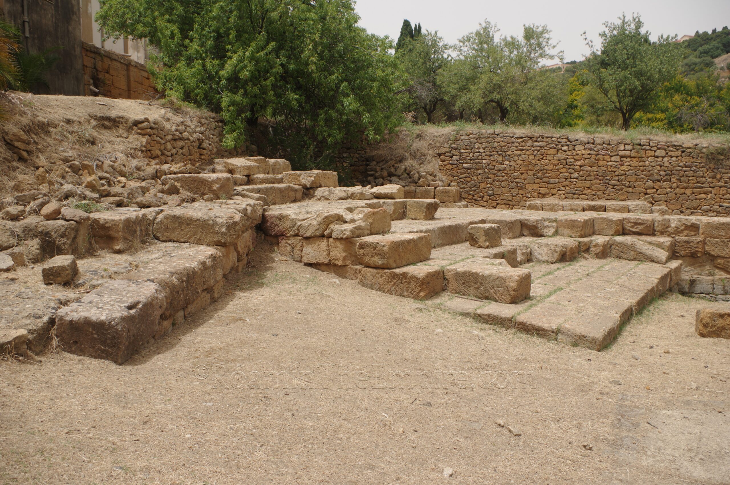
About 60 meters east along the path past the last remains of the walls is a gate. Now, this gate may or may not be closed. There are a few ways around it. It happened to be open when I visited, I think because they were working on the Casa Morello. There’s nothing explicitly stating that access is not permitted in this area. The trail splits and one path leads southeast and one northeast. The northeast leads to Gate I. Some remains of the walls pick up again and are visible on the north side of the path. About 50 meters from the fork in the path is the spot where Gate I was located. Nothing really distinguishable remains of the gate itself, it’s more or less just an opening in the walls, with the vague presence of the southern part of this opening visible.
Just inside the gate is an excavated area covered by a low protective roof. This roof protects two sacred buildings, constructed at slightly different levels. The lower and western of these two seems to have been constructed in the late 6th century BCE. Several course of limestone blocks are preserved on the east side of the building. The eastern building was constructed in the early 5th century BCE. Far less of the structure of this building survives. The exact function of the buildings is unclear, but they were perhaps associated with the other two identified sanctuaries in the area. This part of the site appears to have stopped functioning by about 480 BCE.
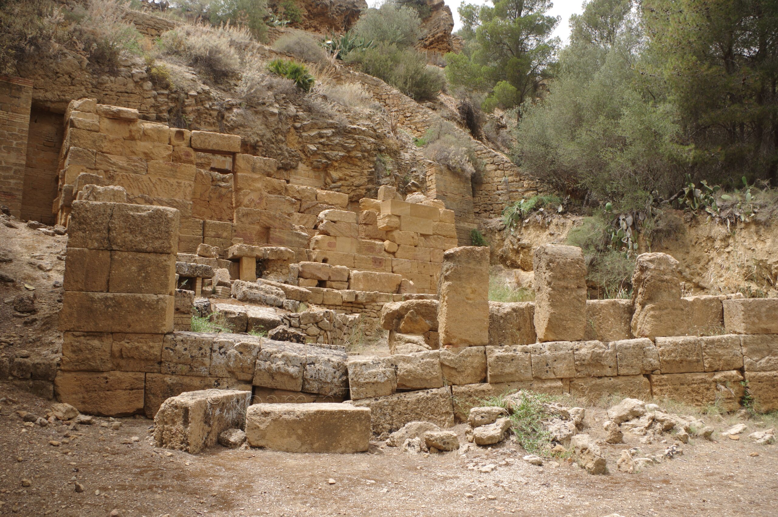
About 25 meters east of these small buildings is a staircase that leads down to the rock-cut sanctuary, which was situated outside the walls of Agrigentum. This sanctuary is traditionally identified as being dedicated to Demeter and Persephone based on some of the finds made here. Subsequent analysis suggests that it may have been a sanctuary dedicated to the nymphs, though. A series of three tunnels are carved into the rock of the Rupe Atenae, as this hill is known. The far north of these tapped into a natural spring, which brought water to this sanctuary. In the late 5th or 4th century BCE, a fountain house was constructed in front of the entrance of these tunnels, with a paved court and both large constructed basins for water as well as smaller portable basins. This replaced what was probably originally a wooden construction, and later in the Hellenistic period the water distribution system was altered significantly. Votive niches are present on some of the rock around the sanctuary.
The final point of interest in this part of Agrigentum is reached by doubling back to the Gate I sanctuary. A path leads toward the northwest from the two buildings near the gate, and after about 115 meters will switchback up the hill. About 25 meters from the switchback, there is a stretch of ancient road and wheel ruts cut into the rock to the left of the path. This road is visible for about 30 meters up the hill. Following this road and then a short dirt path will intersect with the main path continuing up the hill. This path terminates at the Chiesa di San Biagio.
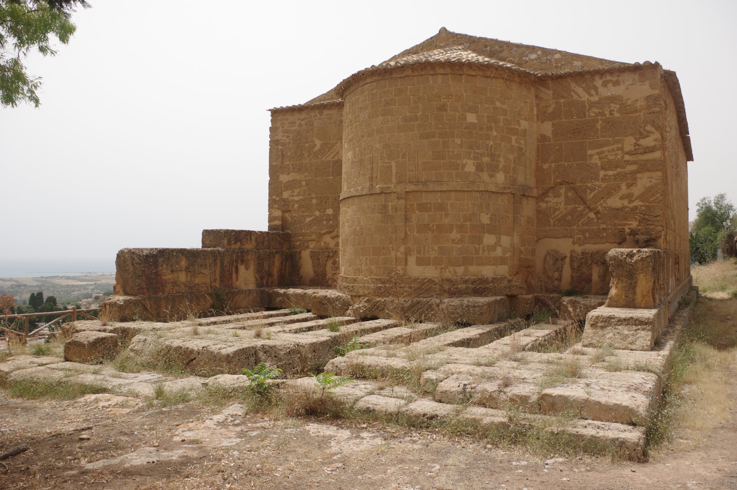
The Chiesa di San Biagio was constructed in the 12th century CE upon the foundations of a Doric temple dated to about 470 BCE. Based on votives found in the vicinity, it is believed that the temple was dedicated to Demeter. The church is more or less built upon the dimensions of the temple, with the foundations of the temple visible around pretty much the entirety of the church. The exception being the rear of the church (east side), where about 9 meters of the foundations of the temple are left exposed. Wells and altars are located along the north side of the chuch/temple. The interior of the church is not accessible, but can be seen through the door. There doesn’t appear to be anything ancient visible inside. There is also an ancient retaining wall along the south side of the temple, but the area was too overgrown to really discern anything.
Continued In Agrigentum, Sicilia Part IV
Sources:
Barresi, P., M. Liuzzo, and M. Scialfa. “Per una lettura socio economica dei contesti abitativi: la casa I E/F nell’insula I del Quartiere ellenistico-romano di Agrigento.” Agrigento: Archeology of an Ancient City. Urban Form, Sacred and Civil Spaces, Productions, Territory, Giuseppe Lepore and Luigi Maria Caliò (eds.), Heidelberg: Propylaeum, 2021.
Merola, Marco. “Sicily’s Lost Theater.” Archaeology, March/April 2019.
Niccoli, Chiara and Mauro Serio. The Valley of the Temples of Agrigento and Heraclea Minoa, Milan: Skira, 2018.
Pecoraro, Anna Rita. “La casa II D del quartiere ellenistico-romano di Agrigento.” Paesaggi Urbani Tardoantichi: Casi a Confronto, Maria Concetta Parello and Maria Serena Risso (eds.), Bari: Edipuglia, 2016.
Polybius. Historia, 9.27.


